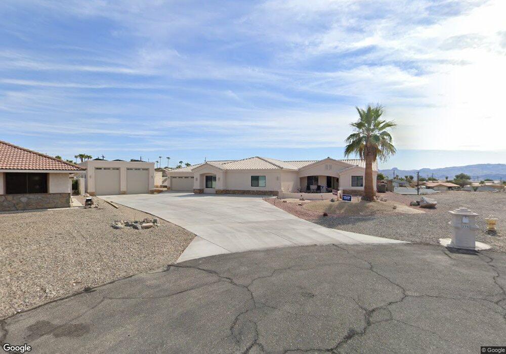
739 Satellite Ct Lake Havasu City, AZ 86404
Estimated Value: $800,000 - $1,154,433
3
Beds
2
Baths
1,976
Sq Ft
$496/Sq Ft
Est. Value
About This Home
This home is located at 739 Satellite Ct, Lake Havasu City, AZ 86404 and is currently estimated at $980,608, approximately $496 per square foot. 739 Satellite Ct is a home located in Mohave County with nearby schools including Havasupai Elementary School, Thunderbolt Middle School, and Lake Havasu High School.
Ownership History
Date
Name
Owned For
Owner Type
Purchase Details
Closed on
Apr 13, 2005
Sold by
Hansen Leland J and Hansen Cynthia J
Bought by
Manteuffel Wade and Manteuffel Cynthia
Current Estimated Value
Home Financials for this Owner
Home Financials are based on the most recent Mortgage that was taken out on this home.
Original Mortgage
$317,600
Outstanding Balance
$111,978
Interest Rate
1%
Mortgage Type
Fannie Mae Freddie Mac
Estimated Equity
$868,630
Purchase Details
Closed on
May 16, 2000
Sold by
Thomas Terry Robert and Thomas Marilyn E
Bought by
Hansen Leland J and Hansen Cynthia J
Create a Home Valuation Report for This Property
The Home Valuation Report is an in-depth analysis detailing your home's value as well as a comparison with similar homes in the area
Home Values in the Area
Average Home Value in this Area
Purchase History
| Date | Buyer | Sale Price | Title Company |
|---|---|---|---|
| Manteuffel Wade | $397,000 | State Title Agency Inc | |
| Hansen Leland J | $16,000 | Transnation Title Ins Co |
Source: Public Records
Mortgage History
| Date | Status | Borrower | Loan Amount |
|---|---|---|---|
| Open | Manteuffel Wade | $317,600 |
Source: Public Records
Tax History Compared to Growth
Tax History
| Year | Tax Paid | Tax Assessment Tax Assessment Total Assessment is a certain percentage of the fair market value that is determined by local assessors to be the total taxable value of land and additions on the property. | Land | Improvement |
|---|---|---|---|---|
| 2026 | -- | -- | -- | -- |
| 2025 | $2,493 | $95,288 | $0 | $0 |
| 2024 | $2,493 | $75,311 | $0 | $0 |
| 2023 | $2,493 | $65,837 | $0 | $0 |
| 2022 | $2,401 | $49,194 | $0 | $0 |
| 2021 | $2,329 | $36,429 | $0 | $0 |
| 2019 | $2,328 | $27,560 | $0 | $0 |
| 2018 | $2,252 | $26,115 | $0 | $0 |
| 2017 | $2,231 | $24,822 | $0 | $0 |
| 2016 | $2,031 | $22,029 | $0 | $0 |
| 2015 | $1,950 | $19,590 | $0 | $0 |
Source: Public Records
Map
Nearby Homes
- 2875 Swirl Dr
- 2880 Sombrero Dr
- 2735 Poseidon Dr
- 710 Meadows Dr
- 2699 Poseidon Dr
- 2825 Pepperwood Dr
- 2815 Pepperwood Dr
- 3000 Applewood Dr
- 2775 Briarcrest Dr
- 3030 Green Acres Dr
- 600 Stone Acre Dr
- 3056 Ironwood Dr
- 2953 Canyon Oak Dr
- 2820 Briarcrest Dr
- 2774 Hidden Valley Dr
- 3070 Dogwood Dr
- 2528 Tanglewood Dr
- 2740 Arcadia Dr
- 2980 Kiowa Blvd N
- 3040 Gatewood Dr
- 737 Satellite Ct
- 2815 Papeete Dr
- 741 Satellite Ct
- 2825 Papeete Dr
- 2805 Papeete Dr
- 715 Satellite Dr
- 719 Satellite Dr
- 735 Satellite Ct
- 2770 Empress Ln
- 743 Satellite Ct
- 2795 Papeete Dr
- 725 Satellite Dr
- 725 Satellite Dr
- 731 Satellite Dr
- 745 Satellite Dr
- 745 Satellite Ct
- 745 Satellite Dr
- 705 Satellite Dr
- 2765 Empress Ln
- 749 Satellite Dr