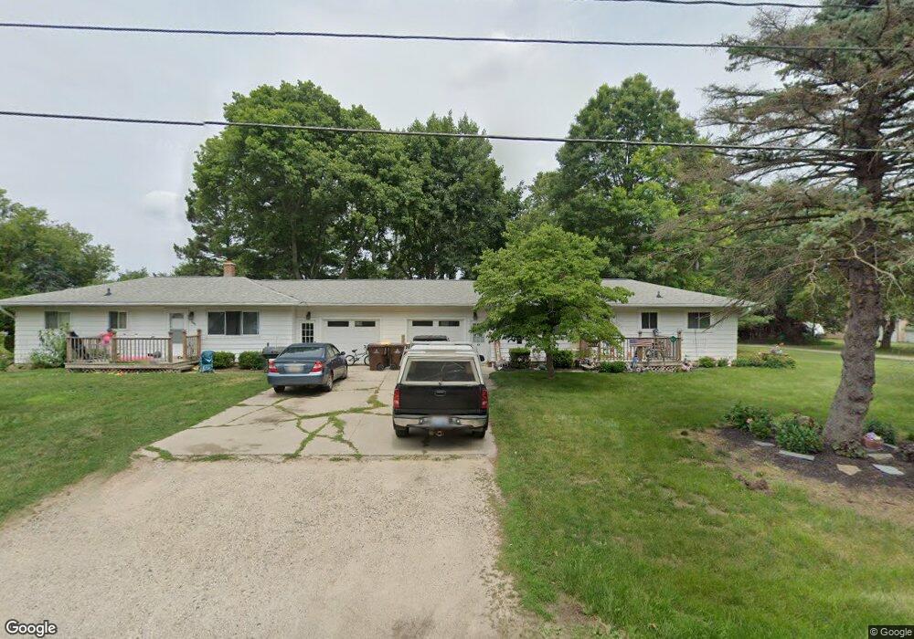
7395 Coleman Rd East Lansing, MI 48823
Estimated Value: $193,000 - $298,282
--
Bed
2
Baths
1,824
Sq Ft
$135/Sq Ft
Est. Value
About This Home
This home is located at 7395 Coleman Rd, East Lansing, MI 48823 and is currently estimated at $246,821, approximately $135 per square foot. 7395 Coleman Rd is a home located in Clinton County with nearby schools including Haslett High School and St Thomas Aquinas School.
Ownership History
Date
Name
Owned For
Owner Type
Purchase Details
Closed on
Jan 15, 2021
Sold by
Organek Gary E
Bought by
Mahmoud Maher A
Current Estimated Value
Home Financials for this Owner
Home Financials are based on the most recent Mortgage that was taken out on this home.
Original Mortgage
$109,685
Outstanding Balance
$80,132
Interest Rate
2.67%
Mortgage Type
New Conventional
Estimated Equity
$166,689
Create a Home Valuation Report for This Property
The Home Valuation Report is an in-depth analysis detailing your home's value as well as a comparison with similar homes in the area
Home Values in the Area
Average Home Value in this Area
Purchase History
| Date | Buyer | Sale Price | Title Company |
|---|---|---|---|
| Mahmoud Maher A | $175,000 | None Available |
Source: Public Records
Mortgage History
| Date | Status | Borrower | Loan Amount |
|---|---|---|---|
| Open | Mahmoud Maher A | $109,685 |
Source: Public Records
Tax History Compared to Growth
Tax History
| Year | Tax Paid | Tax Assessment Tax Assessment Total Assessment is a certain percentage of the fair market value that is determined by local assessors to be the total taxable value of land and additions on the property. | Land | Improvement |
|---|---|---|---|---|
| 2025 | $6,723 | $142,300 | $20,900 | $121,400 |
| 2024 | $4,037 | $130,800 | $20,900 | $109,900 |
| 2023 | $3,839 | $116,100 | $0 | $0 |
| 2022 | $5,998 | $102,000 | $18,000 | $84,000 |
| 2021 | $5,811 | $97,700 | $18,000 | $79,700 |
| 2020 | $4,540 | $97,900 | $17,500 | $80,400 |
| 2019 | $4,390 | $93,800 | $17,500 | $76,300 |
| 2018 | $4,247 | $95,400 | $17,500 | $77,900 |
| 2017 | $4,129 | $97,100 | $17,500 | $79,600 |
| 2016 | $4,106 | $97,200 | $17,500 | $79,700 |
| 2015 | -- | $81,200 | $0 | $0 |
| 2011 | -- | $86,700 | $0 | $0 |
Source: Public Records
Map
Nearby Homes
- 16925 Willowbrook Dr
- 6910 Coleman Rd
- 7822 Forestview Dr
- 16092 Center Rd
- 1695 S Crystal Cove Dr Unit 22
- 16460 Sanctuary Cir
- 1827 Towner Rd
- 6370 Royal Oak Dr
- 0 English Oak Dr
- 16930 Broadview Dr
- 16931 Black Walnut Ln
- 1779 Baker St
- 16673 Sundew Cir
- 6427 W Reynolds Rd
- 6248 W Reynolds Rd
- 6708 English Oak Dr
- 6403 E Reynolds Rd
- 6285 Heathfield Dr
- 6120 Fresno Ln
- 6119 Fresno Ln
- 7381 Coleman Rd
- 7300 Stanke Dr
- 7388 Coleman Rd
- 7286 Coleman Rd
- 7286 Stanke Dr
- 7403 Coleman Rd
- 7262 Coleman Rd
- 7249 Coleman Rd
- 7390 Coleman Rd
- 7250 Coleman Rd
- 16646 Eunice St
- 7445 Coleman Rd
- 7226 Coleman Rd
- 16658 Eunice St
- 16678 Eunice St
- 7295 Stanke Dr
- 7199 Coleman Rd
- 7241 Stanke Dr
- 16680 Eunice St
- 7448 Coleman Rd