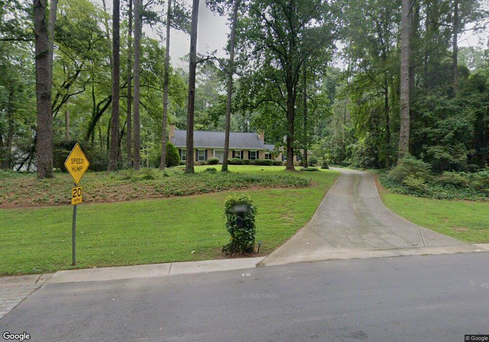
7399 Twin Branch Rd NE Unit 2 Atlanta, GA 30328
The Branches NeighborhoodEstimated Value: $734,000 - $913,062
4
Beds
4
Baths
2,378
Sq Ft
$354/Sq Ft
Est. Value
About This Home
This home is located at 7399 Twin Branch Rd NE Unit 2, Atlanta, GA 30328 and is currently estimated at $841,516, approximately $353 per square foot. 7399 Twin Branch Rd NE Unit 2 is a home located in Fulton County with nearby schools including Woodland Elementary School, Sandy Springs Middle School, and North Springs High School.
Ownership History
Date
Name
Owned For
Owner Type
Purchase Details
Closed on
Jun 26, 1998
Sold by
Lockhart Louis C and Lockhart Hilda
Bought by
Galotti Edgardo-Etal
Current Estimated Value
Home Financials for this Owner
Home Financials are based on the most recent Mortgage that was taken out on this home.
Original Mortgage
$230,000
Outstanding Balance
$48,586
Interest Rate
7.37%
Mortgage Type
New Conventional
Estimated Equity
$792,930
Purchase Details
Closed on
Dec 1, 1993
Sold by
Trust Co Bank Exec
Bought by
Lockhart Louis C Hilda L
Home Financials for this Owner
Home Financials are based on the most recent Mortgage that was taken out on this home.
Original Mortgage
$202,500
Interest Rate
7.09%
Create a Home Valuation Report for This Property
The Home Valuation Report is an in-depth analysis detailing your home's value as well as a comparison with similar homes in the area
Home Values in the Area
Average Home Value in this Area
Purchase History
| Date | Buyer | Sale Price | Title Company |
|---|---|---|---|
| Galotti Edgardo-Etal | $287,500 | -- | |
| Lockhart Louis C Hilda L | $225,000 | -- |
Source: Public Records
Mortgage History
| Date | Status | Borrower | Loan Amount |
|---|---|---|---|
| Open | Galotti Edgardo-Etal | $230,000 | |
| Previous Owner | Lockhart Louis C Hilda L | $202,500 |
Source: Public Records
Tax History Compared to Growth
Tax History
| Year | Tax Paid | Tax Assessment Tax Assessment Total Assessment is a certain percentage of the fair market value that is determined by local assessors to be the total taxable value of land and additions on the property. | Land | Improvement |
|---|---|---|---|---|
| 2025 | $4,513 | $269,680 | $121,720 | $147,960 |
| 2023 | $6,605 | $234,000 | $108,560 | $125,440 |
| 2022 | $4,406 | $208,520 | $82,840 | $125,680 |
| 2021 | $4,363 | $190,200 | $60,240 | $129,960 |
| 2020 | $4,381 | $172,720 | $51,040 | $121,680 |
| 2019 | $4,308 | $177,320 | $50,160 | $127,160 |
| 2018 | $4,540 | $173,160 | $48,960 | $124,200 |
| 2017 | $4,093 | $141,320 | $40,040 | $101,280 |
| 2016 | $4,091 | $141,320 | $40,040 | $101,280 |
| 2015 | $4,089 | $140,800 | $40,040 | $100,760 |
| 2014 | $4,520 | $140,800 | $40,040 | $100,760 |
Source: Public Records
Map
Nearby Homes
- 7330 Hunters Branch Dr NE
- 1172 Redfield Ridge
- 5816 Chamblee Dunwoody Rd
- 5379 Harris Cir
- 7632 Auden Trail
- 915 Dumaine Trace
- 7445 Talbot Colony NE
- 1412 Huntingdon Chase
- 1912 Huntingdon Chase
- 2712 Huntingdon Chase
- 2401 Huntingdon Chase
- 1201 Old Hammond Chase
- 37 Westfair Ct
- 1106 Aurora Ct
- 1208 Dunbrooke Ln
- 5302 Fairfield N
- 1128 Aurora Ct
- 1275 Fairfield E
- 4006 Wingate Way
- 1015 Wingate Way
- 7415 Twin Branch Rd NE
- 7385 Twin Branch Rd
- 5360 Redfield Cir
- 5354 Redfield Cir Unit 1
- 7435 Twin Branch Rd NE
- 5342 Redfield Dr Unit 1
- 7369 Twin Branch Rd NE
- 5348 Redfield Dr
- 5368 Redfield Cir
- 5357 Redfield Cir
- 5336 Redfield Dr
- 5356 Redfield Dr
- 5376 Refield Cir
- 5376 Redfield Cir
- 5361 Redfield Cir Unit 1
- 7355 Twin Branch Rd NE
- 7390 Twin Branch Rd NE Unit 2
- 7420 Twin Branch Rd Unit 1
- 7400 Twin Branch Rd NE Unit 1
- 5330 Redfield Dr