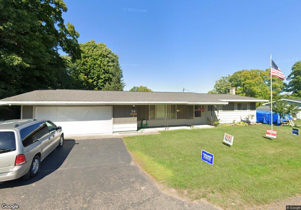
74 4th St South Range, MI 49963
Estimated Value: $194,713 - $244,000
3
Beds
1
Bath
1,152
Sq Ft
$185/Sq Ft
Est. Value
About This Home
This home is located at 74 4th St, South Range, MI 49963 and is currently estimated at $213,428, approximately $185 per square foot. 74 4th St is a home with nearby schools including South Range Elementary School and Jeffers High School.
Create a Home Valuation Report for This Property
The Home Valuation Report is an in-depth analysis detailing your home's value as well as a comparison with similar homes in the area
Tax History
| Year | Tax Paid | Tax Assessment Tax Assessment Total Assessment is a certain percentage of the fair market value that is determined by local assessors to be the total taxable value of land and additions on the property. | Land | Improvement |
|---|---|---|---|---|
| 2025 | $2,818 | $98,750 | $0 | $0 |
| 2024 | $27 | $83,695 | $0 | $0 |
| 2023 | $2,616 | $76,365 | $0 | $0 |
| 2022 | $2,678 | $67,051 | $0 | $0 |
| 2021 | $2,622 | $55,316 | $0 | $0 |
| 2020 | $2,600 | $54,162 | $0 | $0 |
| 2019 | $2,552 | $54,107 | $0 | $0 |
| 2018 | $2,490 | $56,073 | $0 | $0 |
| 2017 | $2,426 | $53,686 | $0 | $0 |
| 2016 | -- | $51,978 | $0 | $0 |
| 2015 | -- | $51,774 | $0 | $0 |
| 2014 | -- | $48,615 | $0 | $0 |
Source: Public Records
Map
Nearby Homes
- 46 Stanton Ave
- 0 Tbd Baltic Onkalos Corner Rd
- TBD Baltic-Onkalo's Corner Rd
- TBD Huron St
- 52275 N Superior Rd
- 47302 Janovosky Rd
- 42936 Superior Rd
- 1800 Middle Pointe Ln
- 1906 White Oak Ln
- 15710 Coles Creek Rd
- 1506 Sugar Maple Ln
- 1504 Sugar Maple Ln
- TBD Razorback Dr Unit Part of Lot 22, Enti
- 47212 Main St
- 48454 Lincoln St
- TBD A B C Navy Stream
- 19336 W Edwards Ave
- 19990 Henry St
- 46750 Paradise Rd
- 503 W Baraga Ave
Your Personal Tour Guide
Ask me questions while you tour the home.