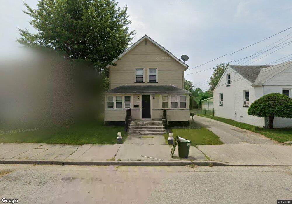
74-74 E Harmony St Penns Grove, NJ 08069
Estimated Value: $161,227 - $241,000
--
Bed
--
Bath
1,968
Sq Ft
$103/Sq Ft
Est. Value
About This Home
This home is located at 74-74 E Harmony St, Penns Grove, NJ 08069 and is currently estimated at $201,807, approximately $102 per square foot. 74-74 E Harmony St is a home located in Salem County with nearby schools including Mannington Township School.
Ownership History
Date
Name
Owned For
Owner Type
Purchase Details
Closed on
Aug 25, 2005
Sold by
Bradley Valerie
Bought by
Still Dionne
Current Estimated Value
Home Financials for this Owner
Home Financials are based on the most recent Mortgage that was taken out on this home.
Original Mortgage
$118,500
Outstanding Balance
$63,159
Interest Rate
5.79%
Mortgage Type
Fannie Mae Freddie Mac
Estimated Equity
$138,648
Create a Home Valuation Report for This Property
The Home Valuation Report is an in-depth analysis detailing your home's value as well as a comparison with similar homes in the area
Home Values in the Area
Average Home Value in this Area
Purchase History
| Date | Buyer | Sale Price | Title Company |
|---|---|---|---|
| Still Dionne | $118,500 | -- |
Source: Public Records
Mortgage History
| Date | Status | Borrower | Loan Amount |
|---|---|---|---|
| Open | Still Dionne | $118,500 |
Source: Public Records
Tax History Compared to Growth
Tax History
| Year | Tax Paid | Tax Assessment Tax Assessment Total Assessment is a certain percentage of the fair market value that is determined by local assessors to be the total taxable value of land and additions on the property. | Land | Improvement |
|---|---|---|---|---|
| 2025 | $5,618 | $101,300 | $13,100 | $88,200 |
| 2024 | $5,430 | $101,300 | $13,100 | $88,200 |
| 2023 | $5,430 | $101,300 | $13,100 | $88,200 |
| 2022 | $5,234 | $101,300 | $13,100 | $88,200 |
| 2021 | $5,008 | $101,300 | $13,100 | $88,200 |
| 2020 | $5,074 | $101,300 | $13,100 | $88,200 |
| 2019 | $5,095 | $101,300 | $13,100 | $88,200 |
| 2018 | $4,768 | $118,200 | $21,100 | $97,100 |
| 2017 | $4,785 | $118,200 | $21,100 | $97,100 |
| 2016 | $4,604 | $118,200 | $21,100 | $97,100 |
| 2015 | $4,410 | $118,200 | $21,100 | $97,100 |
| 2014 | $4,362 | $118,200 | $21,100 | $97,100 |
Source: Public Records
Map
Nearby Homes
- 12 Hawks Bridge Rd
- 824 Hawks Bridge Rd
- 367 (01) Highway 40 W
- 17 Sportsman Rd
- 588 Harding Hwy
- 1007 Harding Hwy
- 1045 Route 40
- 3 Lakeside Ln
- 371 40 Route
- 371 Route 40
- 79 E Quillytown Rd
- 613 Hawks Bridge Rd
- 16 Waters Way
- 609 Hawks Bridge Rd
- 604 Hawks Bridge Rd
- 613 Soders Rd
- 1 Victory Ave Unit 84
- 1 Victory Ave Unit 82
- 1 Victory Ave Unit 74
- 1 Victory Ave Unit 72
- Lot 18 Straughens Ln
- L:1.01 Florence Ave
- L:1.02 N Broad St
- 201 / 2 S Norman Ave
- 121/2 Del a Vue Ave Unit 1 / 2
- LOT 1&4 Iona Ave
- 00 Route 130
- 0 Undisclosed Street Address Unit 384479
- 951 Walnut St
- 641 S Miller Ave
- 121/2 Del a Vue Ave
- 0 Smith Ave Unit 1003309426
- 1 01 Florence Ave
- 1 02 N Broad St
- L:6 Shell Rd
- 195 Haines Neck Rd
- 199 Haines Neck Rd
- 205 Haines Neck Rd
- 186 Haines Neck Rd
- 182 Haines Neck Rd