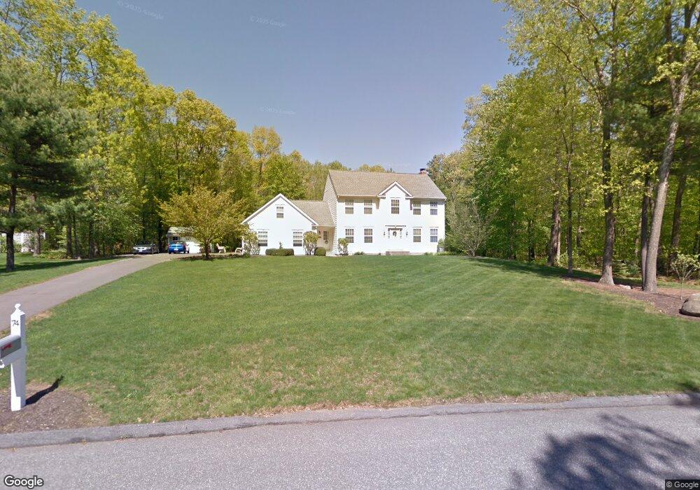
74 Avebury Ln Tolland, CT 06084
Estimated Value: $550,000 - $637,000
4
Beds
3
Baths
2,124
Sq Ft
$272/Sq Ft
Est. Value
About This Home
This home is located at 74 Avebury Ln, Tolland, CT 06084 and is currently estimated at $578,190, approximately $272 per square foot. 74 Avebury Ln is a home located in Tolland County with nearby schools including Birch Grove Primary School, Tolland Intermediate School, and Tolland Middle School.
Ownership History
Date
Name
Owned For
Owner Type
Purchase Details
Closed on
Nov 3, 1999
Sold by
Crossen Bldrs Inc
Bought by
Gray William and Gray Rebecca
Current Estimated Value
Home Financials for this Owner
Home Financials are based on the most recent Mortgage that was taken out on this home.
Original Mortgage
$257,548
Interest Rate
7.73%
Create a Home Valuation Report for This Property
The Home Valuation Report is an in-depth analysis detailing your home's value as well as a comparison with similar homes in the area
Home Values in the Area
Average Home Value in this Area
Purchase History
| Date | Buyer | Sale Price | Title Company |
|---|---|---|---|
| Gray William | $254,900 | -- | |
| Gray William | $254,900 | -- |
Source: Public Records
Mortgage History
| Date | Status | Borrower | Loan Amount |
|---|---|---|---|
| Open | Gray William | $205,900 | |
| Closed | Gray William | $217,700 | |
| Closed | Gray William | $228,000 | |
| Closed | Gray William | $257,548 |
Source: Public Records
Tax History Compared to Growth
Tax History
| Year | Tax Paid | Tax Assessment Tax Assessment Total Assessment is a certain percentage of the fair market value that is determined by local assessors to be the total taxable value of land and additions on the property. | Land | Improvement |
|---|---|---|---|---|
| 2025 | $8,864 | $326,000 | $88,900 | $237,100 |
| 2024 | $8,464 | $224,100 | $85,000 | $139,100 |
| 2023 | $8,366 | $224,100 | $85,000 | $139,100 |
| 2022 | $8,198 | $224,100 | $85,000 | $139,100 |
| 2021 | $8,316 | $224,100 | $85,000 | $139,100 |
| 2020 | $8,079 | $224,100 | $85,000 | $139,100 |
| 2019 | $8,385 | $232,600 | $87,600 | $145,000 |
| 2018 | $8,141 | $232,600 | $87,600 | $145,000 |
| 2017 | $7,953 | $232,600 | $87,600 | $145,000 |
| 2016 | $7,953 | $232,600 | $87,600 | $145,000 |
| 2015 | $7,760 | $232,600 | $87,600 | $145,000 |
| 2014 | $7,539 | $242,800 | $96,900 | $145,900 |
Source: Public Records
Map
Nearby Homes
- 0 Tolland Stage Rd Unit 24101836
- 0 Tolland Turnpike Unit 24107059
- 152 Buff Cap Rd
- 95 Derek Dr
- 120 Derek Dr
- 257 Torry Rd
- 322 Buff Cap Rd
- 88 Anthony Rd
- 128 Slater Rd
- 368 Buff Cap Rd
- 10 Depot Rd Unit 25
- 10 Summit Dr
- 25 Josephine Way
- 18 Stone Pond Rd
- 395 Old Stafford Rd
- 284 Merrow Rd
- 248 Merrow Rd
- 312 Merrow Rd
- 461 Old Stafford Rd
- 476 Old Stafford Rd
- 84 Avebury Ln
- 73 Avebury Ln
- 87 Avebury Ln
- 66 Avebury Ln
- 92 Avebury Ln
- 63 Avebury Ln
- 55 Avebury Ln
- 54 Avebury Ln
- 96 Avebury Ln
- 178 Woodhenge Dr
- 188 Woodhenge Dr
- 189 Woodhenge Dr
- 43 Avebury Ln
- 179 Woodhenge Dr
- 168 Woodhenge Dr
- 106 Avebury Ln
- 42 Avebury Ln
- 160 Woodhenge Dr
- 24 Winterbourne View
- 169 Woodhenge Dr