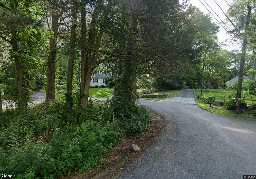
74 Briarwood Ln Stamford, CT 06903
North Stamford NeighborhoodEstimated Value: $1,131,000 - $1,317,000
4
Beds
3
Baths
2,394
Sq Ft
$501/Sq Ft
Est. Value
About This Home
This home is located at 74 Briarwood Ln, Stamford, CT 06903 and is currently estimated at $1,200,035, approximately $501 per square foot. 74 Briarwood Ln is a home located in Fairfield County with nearby schools including Davenport Ridge Elementary School, Rippowam Middle School, and Stamford High School.
Ownership History
Date
Name
Owned For
Owner Type
Purchase Details
Closed on
May 8, 2025
Sold by
Hirshfield David
Bought by
David Hirshfield Lt and Hirshfield
Current Estimated Value
Purchase Details
Closed on
Dec 29, 2000
Sold by
Zales Steven C and Zales Cathy B
Bought by
Hirshfield David and Hirshfield Jayne
Purchase Details
Closed on
Aug 16, 1990
Sold by
Woodward Claude
Bought by
Zoles Steven
Create a Home Valuation Report for This Property
The Home Valuation Report is an in-depth analysis detailing your home's value as well as a comparison with similar homes in the area
Home Values in the Area
Average Home Value in this Area
Purchase History
| Date | Buyer | Sale Price | Title Company |
|---|---|---|---|
| David Hirshfield Lt | -- | -- | |
| Hirshfield David | $591,000 | -- | |
| Hirshfield David | $591,000 | -- | |
| Zoles Steven | $413,000 | -- |
Source: Public Records
Mortgage History
| Date | Status | Borrower | Loan Amount |
|---|---|---|---|
| Previous Owner | Zoles Steven | $300,700 | |
| Previous Owner | Zoles Steven | $300,700 |
Source: Public Records
Tax History Compared to Growth
Tax History
| Year | Tax Paid | Tax Assessment Tax Assessment Total Assessment is a certain percentage of the fair market value that is determined by local assessors to be the total taxable value of land and additions on the property. | Land | Improvement |
|---|---|---|---|---|
| 2025 | $12,915 | $555,010 | $291,410 | $263,600 |
| 2024 | $12,506 | $549,470 | $291,410 | $258,060 |
| 2023 | $13,440 | $549,470 | $291,410 | $258,060 |
| 2022 | $11,562 | $439,110 | $220,360 | $218,750 |
| 2021 | $11,404 | $439,110 | $220,360 | $218,750 |
| 2020 | $11,123 | $439,110 | $220,360 | $218,750 |
| 2019 | $11,123 | $439,110 | $220,360 | $218,750 |
| 2018 | $10,736 | $439,110 | $220,360 | $218,750 |
| 2017 | $10,414 | $406,960 | $201,990 | $204,970 |
| 2016 | $10,101 | $406,960 | $201,990 | $204,970 |
| 2015 | $9,824 | $406,960 | $201,990 | $204,970 |
| 2014 | $9,486 | $406,960 | $201,990 | $204,970 |
Source: Public Records
Map
Nearby Homes
- 160 Wire Mill Rd
- 88 Rockridge Ln
- 400 Wire Mill Rd
- 38 Lancaster Place
- 56 Bradley Place
- 210 Red Fox Rd
- 34 Bradley Place
- 368 Den Rd
- 7 the Reserve at Sterling Ridge
- 506 Roxbury Rd
- 60 Redmont Rd
- 107 Deepwood Rd
- 164 Janes Ln
- 14 Barmore Dr
- 27 Emma Rd
- 180 Riverbank Rd
- 65 Malibu Rd
- 21 Nichols Ave
- 113 Wood Ridge Dr
- 12 Old Mill Ln
- 80 Briarwood Ln
- 66 Briarwood Ln
- 58 Briarwood Ln
- 75 Briarwood Ln
- 48 Briarwood Ln
- 35 Briarwood Ln
- 52 Briarwood Ln
- 44 Four Brooks Rd
- 59 Briarwood Ln
- 56 Four Brooks Rd
- 40 Four Brooks Rd
- 240 Wire Mill Rd
- 60 Pheasant Ln
- 0 Briarwood Ln Unit 2 170246423
- 0 Briarwood Ln Unit 2
- 71 Briarwood Ln
- 30 Briarwood Ln
- 67 Briarwood Ln
- 36 Pheasant Ln