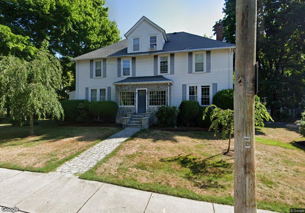
74 Clark St Newton Center, MA 02459
Thompsonville NeighborhoodEstimated Value: $1,819,000 - $2,091,868
8
Beds
3
Baths
3,077
Sq Ft
$639/Sq Ft
Est. Value
About This Home
This home is located at 74 Clark St, Newton Center, MA 02459 and is currently estimated at $1,966,217, approximately $639 per square foot. 74 Clark St is a home located in Middlesex County with nearby schools including Bowen School, Oak Hill Middle School, and Newton South High School.
Ownership History
Date
Name
Owned For
Owner Type
Purchase Details
Closed on
Nov 18, 2005
Sold by
Clark Llc
Bought by
Tsivkin Barak and Tsivkin Kira
Current Estimated Value
Home Financials for this Owner
Home Financials are based on the most recent Mortgage that was taken out on this home.
Original Mortgage
$720,000
Outstanding Balance
$395,224
Interest Rate
6.07%
Mortgage Type
Purchase Money Mortgage
Estimated Equity
$1,570,993
Create a Home Valuation Report for This Property
The Home Valuation Report is an in-depth analysis detailing your home's value as well as a comparison with similar homes in the area
Home Values in the Area
Average Home Value in this Area
Purchase History
| Date | Buyer | Sale Price | Title Company |
|---|---|---|---|
| Tsivkin Barak | $900,000 | -- | |
| Tsivkin Barak | $900,000 | -- |
Source: Public Records
Mortgage History
| Date | Status | Borrower | Loan Amount |
|---|---|---|---|
| Open | Tsivkin Barak | $720,000 | |
| Closed | Tsivkin Barak | $720,000 |
Source: Public Records
Tax History Compared to Growth
Tax History
| Year | Tax Paid | Tax Assessment Tax Assessment Total Assessment is a certain percentage of the fair market value that is determined by local assessors to be the total taxable value of land and additions on the property. | Land | Improvement |
|---|---|---|---|---|
| 2025 | $15,584 | $1,590,200 | $957,800 | $632,400 |
| 2024 | $15,068 | $1,543,900 | $929,900 | $614,000 |
| 2023 | $14,711 | $1,445,100 | $761,000 | $684,100 |
| 2022 | $14,077 | $1,338,100 | $704,600 | $633,500 |
| 2021 | $13,209 | $1,227,600 | $646,400 | $581,200 |
| 2020 | $12,816 | $1,227,600 | $646,400 | $581,200 |
| 2019 | $11,989 | $1,147,300 | $604,100 | $543,200 |
| 2018 | $12,182 | $1,125,900 | $564,800 | $561,100 |
| 2017 | $11,486 | $1,032,900 | $518,200 | $514,700 |
| 2016 | $10,784 | $947,600 | $475,400 | $472,200 |
| 2015 | $10,282 | $885,600 | $444,300 | $441,300 |
Source: Public Records
Map
Nearby Homes
- 671 Boylston St
- 42 Sunhill Ln
- 125 Oakdale Rd
- 625 Boylston St
- 5 Halcyon Rd
- 628 Boylston St
- 1597 Centre St Unit 1597
- 1597 Centre St
- 1292 Walnut St
- 1308 Walnut St
- 1623-1625 Centre St
- 1629 Centre St
- 21 Philbrick Rd
- 19 Selwyn Rd
- 1151 Walnut St Unit 205
- 1151 Walnut St Unit 405
- 1151 Walnut St Unit 207
- 42 Bow Rd
- 35 Haynes Rd
- 250 Woodcliff Rd
- 76 Clark St
- 106 Athelstane Rd Unit 108
- 106 Athelstane Rd Unit 1
- 108 Athelstane Rd Unit 2
- 108 Athelstane Rd
- 106 Athelstane Rd Unit B
- 106 Athelstane Rd Unit 106
- 106 Athelstane Rd
- 91 Halcyon Rd Unit 1
- 91 Halcyon Rd Unit 93
- 73 Clark St
- 73 Clark St Unit 2
- 71 Clark St Unit 73
- 71 Clark St Unit 73
- 100 Athelstane Rd Unit 100
- 100 Athelstane Rd Unit 1
- 100 Athelstane Rd Unit 98R
- 98 Athelstane Rd Unit 2
- 98 Athelstane Rd Unit 100
- 98 Athelstane Rd Unit 98