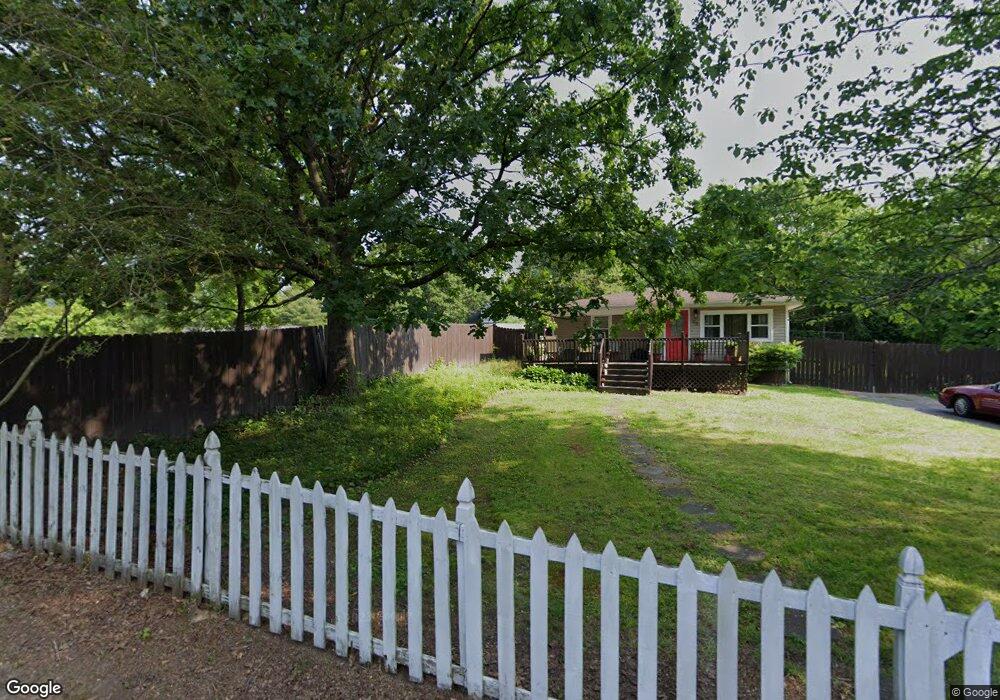
74 Crabtree Rd Rossville, GA 30741
Estimated Value: $225,333 - $256,000
3
Beds
3
Baths
1,849
Sq Ft
$132/Sq Ft
Est. Value
About This Home
This home is located at 74 Crabtree Rd, Rossville, GA 30741 and is currently estimated at $243,833, approximately $131 per square foot. 74 Crabtree Rd is a home located in Walker County with nearby schools including Stone Creek Elementary School, Rossville Middle School, and Ridgeland High School.
Ownership History
Date
Name
Owned For
Owner Type
Purchase Details
Closed on
Feb 28, 2002
Sold by
Deason Jeffrey A and Deason Belinda I
Bought by
Barber Kenneth S and Barber Tina L
Current Estimated Value
Purchase Details
Closed on
Nov 4, 1997
Sold by
Wallin R D
Bought by
Deason Jeffrey A and Deason Belinda I
Purchase Details
Closed on
May 10, 1995
Sold by
Taylor Harold L and Taylor Clara
Bought by
Wallin R D
Purchase Details
Closed on
Apr 18, 1986
Bought by
Taylor Harold L and Taylor Clara
Create a Home Valuation Report for This Property
The Home Valuation Report is an in-depth analysis detailing your home's value as well as a comparison with similar homes in the area
Home Values in the Area
Average Home Value in this Area
Purchase History
| Date | Buyer | Sale Price | Title Company |
|---|---|---|---|
| Barber Kenneth S | $122,500 | -- | |
| Deason Jeffrey A | $85,900 | -- | |
| Wallin R D | -- | -- | |
| Taylor Harold L | $9,000 | -- |
Source: Public Records
Tax History Compared to Growth
Tax History
| Year | Tax Paid | Tax Assessment Tax Assessment Total Assessment is a certain percentage of the fair market value that is determined by local assessors to be the total taxable value of land and additions on the property. | Land | Improvement |
|---|---|---|---|---|
| 2024 | $1,601 | $70,257 | $2,532 | $67,725 |
| 2023 | $1,554 | $66,616 | $2,532 | $64,084 |
| 2022 | $1,444 | $57,529 | $2,532 | $54,997 |
| 2021 | $1,354 | $48,649 | $2,532 | $46,117 |
| 2020 | $1,149 | $39,268 | $2,532 | $36,736 |
| 2019 | $1,014 | $33,636 | $2,532 | $31,104 |
| 2018 | $890 | $33,636 | $2,532 | $31,104 |
| 2017 | $1,108 | $33,636 | $2,532 | $31,104 |
| 2016 | $904 | $33,636 | $2,532 | $31,104 |
| 2015 | $1,143 | $40,908 | $4,000 | $36,908 |
| 2014 | $1,047 | $40,908 | $4,000 | $36,908 |
| 2013 | -- | $40,907 | $4,000 | $36,907 |
Source: Public Records
Map
Nearby Homes
- 408 N Jenkins Rd
- 13 Travis Rd
- 24 Newman Dr
- 4 Newman Dr
- 2 Newman Dr
- 2 & 4 Newman Dr
- 25 Carolyn Ln
- 535 E Garden Farm Rd
- 545 E Garden Farm Rd
- 353 N Jenkins Rd
- 57 Circle Dr
- 32 Kent Dr
- 323 N Jenkins Rd
- 51 Circle Dr
- 321 Jewell Ln
- 13 Circle Dr
- 3 Fisher Rd
- 633 E Garden Farm Rd
- 9 Longstreet Rd
- 0 Sunset Cir Unit 1517664