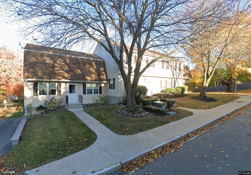
74 Cynthia Ln Amesbury, MA 01913
Estimated Value: $375,843 - $431,000
2
Beds
2
Baths
1,302
Sq Ft
$307/Sq Ft
Est. Value
About This Home
This home is located at 74 Cynthia Ln, Amesbury, MA 01913 and is currently estimated at $399,961, approximately $307 per square foot. 74 Cynthia Ln is a home located in Essex County with nearby schools including Amesbury High School and Amesbury Seventh-Day Adventist School.
Ownership History
Date
Name
Owned For
Owner Type
Purchase Details
Closed on
Oct 2, 2001
Sold by
Long Cynthia A
Bought by
Termini Joseph and Termini Joanne
Current Estimated Value
Home Financials for this Owner
Home Financials are based on the most recent Mortgage that was taken out on this home.
Original Mortgage
$133,888
Interest Rate
6.91%
Mortgage Type
Purchase Money Mortgage
Purchase Details
Closed on
Sep 1, 1998
Sold by
Andrukaitis Stephen J and Andrukaitis Luisa L
Bought by
Hoffman Cynthia A
Purchase Details
Closed on
Apr 26, 1993
Sold by
Boston 5C Sb
Bought by
Andrukaitis Stephen J and Andrukaitis Luisa
Purchase Details
Closed on
Mar 12, 1993
Sold by
Couture Steven M
Bought by
Boston 5C Sb
Purchase Details
Closed on
Jul 27, 1987
Sold by
Younger Jonathan
Bought by
Couture Steven M
Create a Home Valuation Report for This Property
The Home Valuation Report is an in-depth analysis detailing your home's value as well as a comparison with similar homes in the area
Home Values in the Area
Average Home Value in this Area
Purchase History
| Date | Buyer | Sale Price | Title Company |
|---|---|---|---|
| Termini Joseph | $153,888 | -- | |
| Hoffman Cynthia A | $89,400 | -- | |
| Andrukaitis Stephen J | $59,000 | -- | |
| Boston 5C Sb | $39,900 | -- | |
| Couture Steven M | $108,000 | -- |
Source: Public Records
Mortgage History
| Date | Status | Borrower | Loan Amount |
|---|---|---|---|
| Open | Couture Steven M | $133,615 | |
| Closed | Couture Steven M | $133,615 | |
| Closed | Couture Steven M | $133,888 |
Source: Public Records
Tax History Compared to Growth
Tax History
| Year | Tax Paid | Tax Assessment Tax Assessment Total Assessment is a certain percentage of the fair market value that is determined by local assessors to be the total taxable value of land and additions on the property. | Land | Improvement |
|---|---|---|---|---|
| 2025 | $4,980 | $325,500 | $0 | $325,500 |
| 2024 | $5,138 | $328,500 | $0 | $328,500 |
| 2023 | $4,645 | $284,300 | $0 | $284,300 |
| 2022 | $4,039 | $228,300 | $0 | $228,300 |
| 2021 | $3,853 | $211,100 | $0 | $211,100 |
| 2020 | $3,656 | $212,800 | $0 | $212,800 |
| 2019 | $3,409 | $185,600 | $0 | $185,600 |
| 2018 | $3,185 | $167,700 | $0 | $167,700 |
| 2017 | $2,941 | $147,400 | $0 | $147,400 |
| 2016 | $2,578 | $127,100 | $0 | $127,100 |
| 2015 | $1,586 | $77,200 | $0 | $77,200 |
| 2014 | $2,110 | $100,600 | $0 | $100,600 |
Source: Public Records
Map
Nearby Homes
- 28 Powderhouse Ct Unit 28
- 16 Glen Devin St
- 3 Glen Devin St
- 4 Woodsom Dr
- 2 Locke Hill Ln
- 261 Main Ave
- 25 Whittier Meadows Dr
- 48 Orchard St
- 188 Lions Mouth Rd
- 21 Woodman Rd
- 179 Lions Mouth Rd
- 81 High St Unit 27
- 5 Moncrief St Unit 1
- 3 Glenwood St
- 3 Brown Ave Unit 75
- 1 Brown Ave Unit 3-80
- 129 Friend St
- 57 Clinton St
- 31 Whitter Meadows Dr Unit 31
- 37 Millyard Unit 204