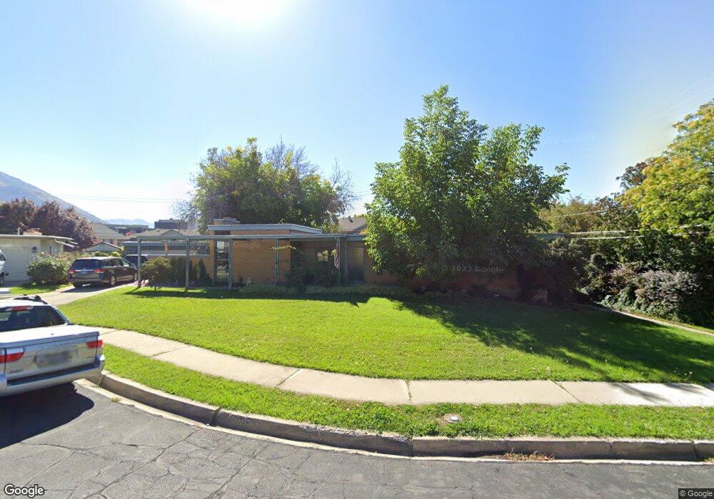
74 E 1990 N Provo, UT 84604
Rock Canyon NeighborhoodEstimated Value: $654,000 - $707,000
5
Beds
3
Baths
3,210
Sq Ft
$211/Sq Ft
Est. Value
About This Home
This home is located at 74 E 1990 N, Provo, UT 84604 and is currently estimated at $676,128, approximately $210 per square foot. 74 E 1990 N is a home located in Utah County with nearby schools including Rock Canyon Elementary School, Centennial Middle School, and Timpview High School.
Ownership History
Date
Name
Owned For
Owner Type
Purchase Details
Closed on
Apr 26, 2017
Sold by
Stiles Garrett T
Bought by
Sutton Jerome and Sutton Jane
Current Estimated Value
Home Financials for this Owner
Home Financials are based on the most recent Mortgage that was taken out on this home.
Original Mortgage
$221,501
Outstanding Balance
$185,207
Interest Rate
4.3%
Mortgage Type
New Conventional
Estimated Equity
$490,921
Purchase Details
Closed on
Jun 2, 1998
Sold by
Mildenhall Glen T and Rae N Mildenhall D
Bought by
Mildenhall Glen T and Mildenhall Rae N
Create a Home Valuation Report for This Property
The Home Valuation Report is an in-depth analysis detailing your home's value as well as a comparison with similar homes in the area
Home Values in the Area
Average Home Value in this Area
Purchase History
| Date | Buyer | Sale Price | Title Company |
|---|---|---|---|
| Sutton Jerome | -- | Old Republic Title | |
| Mildenhall Glen T | -- | -- |
Source: Public Records
Mortgage History
| Date | Status | Borrower | Loan Amount |
|---|---|---|---|
| Open | Sutton Jerome | $221,501 |
Source: Public Records
Tax History
| Year | Tax Paid | Tax Assessment Tax Assessment Total Assessment is a certain percentage of the fair market value that is determined by local assessors to be the total taxable value of land and additions on the property. | Land | Improvement |
|---|---|---|---|---|
| 2025 | $3,332 | $357,830 | -- | -- |
| 2024 | $3,332 | $327,965 | $0 | $0 |
| 2023 | $3,180 | $308,550 | $0 | $0 |
| 2022 | $3,051 | $298,485 | $0 | $0 |
| 2021 | $2,481 | $423,400 | $204,400 | $219,000 |
| 2020 | $2,364 | $378,200 | $163,500 | $214,700 |
| 2019 | $2,227 | $370,600 | $163,500 | $207,100 |
| 2018 | $2,036 | $343,600 | $163,500 | $180,100 |
| 2017 | $1,842 | $170,775 | $0 | $0 |
| 2016 | $1,727 | $149,215 | $0 | $0 |
| 2015 | $1,661 | $145,090 | $0 | $0 |
| 2014 | $1,466 | $133,485 | $0 | $0 |
Source: Public Records
Map
Nearby Homes
- 186 E 2100 N
- 1960 N Canyon Rd
- 2091 N 220 E
- 240 E 2230 N Unit 7
- 223 W 2230 N Unit 14
- 241 W 2230 N Unit 16
- 360 Sumac Ln
- 264 W 1625 N
- 2735 N Country Club Dr
- 1801 N 650 E
- 1470 N 380 W
- 2774 N 370 E
- 431 W 2310 N
- 1533 N 550 W Unit 26
- 2939 N Marrcrest Dr W
- 2999 N Marrcrest West Dr
- 788 E 2680 N
- 3013 N 100 W
- 3025 N 250 E
- 3057 N 100 W
- 54 E 1990 N
- 88 E 1990 N
- 1963 N Canyon Rd
- 2000 N 80 E
- 2019 N 80 E
- 1963 N Canyon Rd
- 1963 N Canyon Rd Unit 307
- 1963 N Canyon Rd Unit 208
- 1963 N Canyon Rd Unit 205
- 1963 N Canyon Rd Unit 108
- 1963 N Canyon Rd Unit 106
- 1963 N Canyon Rd Unit 107
- 1963 N Canyon Rd Unit 206
- 1963 N Canyon Rd Unit 207
- 1963 N Canyon Rd Unit 308
- 1963 N Canyon Rd Unit 305
- 1963 N Canyon Rd Unit 306
- 34 E 1990 N
- 53 E 1990 N
- 2020 N 80 E
Your Personal Tour Guide
Ask me questions while you tour the home.