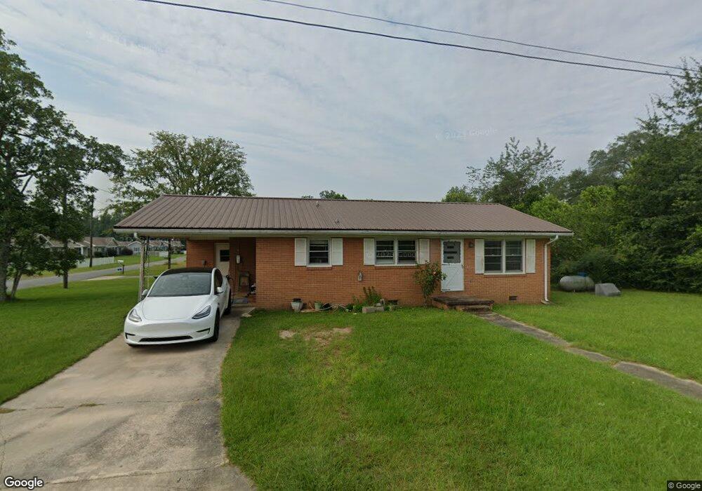
74 E Calhoun St Reynolds, GA 31076
Estimated Value: $83,000 - $123,000
3
Beds
1
Bath
1,084
Sq Ft
$94/Sq Ft
Est. Value
About This Home
This home is located at 74 E Calhoun St, Reynolds, GA 31076 and is currently estimated at $101,460, approximately $93 per square foot. 74 E Calhoun St is a home located in Taylor County with nearby schools including Taylor County Upper Elementary School, Taylor County Primary School, and Taylor County Middle School.
Ownership History
Date
Name
Owned For
Owner Type
Purchase Details
Closed on
Mar 4, 2014
Sold by
Rnt Rentals Llc
Bought by
Patel Jagdish Bhogilal
Current Estimated Value
Purchase Details
Closed on
Jul 6, 2004
Sold by
Keogh Living Trust
Bought by
Moulton James D
Purchase Details
Closed on
May 19, 1996
Bought by
Keogh Living Trust
Create a Home Valuation Report for This Property
The Home Valuation Report is an in-depth analysis detailing your home's value as well as a comparison with similar homes in the area
Purchase History
| Date | Buyer | Sale Price | Title Company |
|---|---|---|---|
| Patel Jagdish Bhogilal | $40,001 | -- | |
| Moulton James D | $44,500 | -- | |
| Keogh Living Trust | -- | -- |
Source: Public Records
Tax History
| Year | Tax Paid | Tax Assessment Tax Assessment Total Assessment is a certain percentage of the fair market value that is determined by local assessors to be the total taxable value of land and additions on the property. | Land | Improvement |
|---|---|---|---|---|
| 2025 | $1,316 | $34,960 | $1,080 | $33,880 |
| 2024 | $1,267 | $33,560 | $1,080 | $32,480 |
| 2023 | $1,024 | $26,440 | $1,080 | $25,360 |
| 2022 | $500 | $19,880 | $1,080 | $18,800 |
| 2021 | $430 | $18,680 | $1,080 | $17,600 |
| 2020 | $433 | $18,680 | $1,080 | $17,600 |
| 2019 | $440 | $18,760 | $1,080 | $17,680 |
| 2018 | $645 | $18,760 | $1,080 | $17,680 |
| 2017 | $446 | $19,411 | $2,850 | $16,561 |
| 2016 | $455 | $19,665 | $2,850 | $16,815 |
| 2015 | -- | $19,665 | $2,850 | $16,815 |
| 2014 | -- | $20,511 | $2,400 | $18,111 |
| 2013 | -- | $21,680 | $2,800 | $18,880 |
Source: Public Records
Map
Nearby Homes
- 67 N Collins St
- 25 W Marion St
- 9 Friar Tuck Rd
- 0 Suggs Mill Pond Rd Unit 26113830
- Highway 96
- 160 Underwood Rd
- 1092 Tommy Purvis Rd
- 26 Mount Olive Church Rd
- 296 Boxwood Rd
- 296 Boxwood (3061 Acres) Rd
- Cummings Rd
- 708 Tommy Purvis Junior Rd
- 1800 Cummings Rd
- 4764 River Rd
- 0 Oak Ridge Dr
- 000 Avera Rd
- Parcel 5 Carl Rogers Rd
- Parcel 8 Carl Rogers Rd
- Parcel 13 Carl Rogers Rd
- Parcel 7 Carl Rogers Rd
Your Personal Tour Guide
Ask me questions while you tour the home.