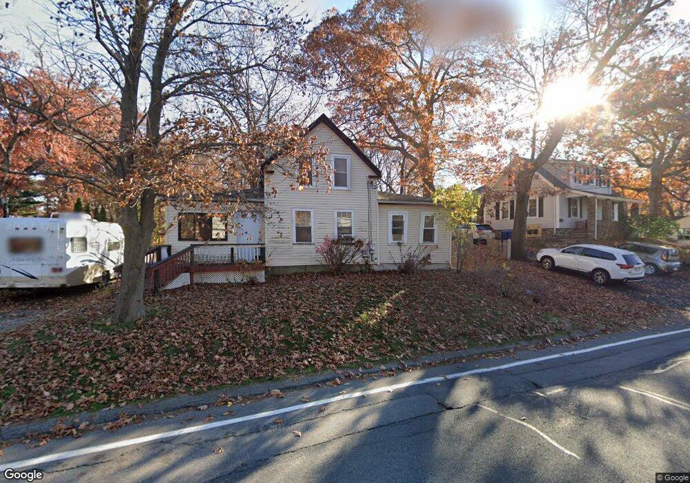
74 Forest St Wakefield, MA 01880
Greenwood NeighborhoodEstimated Value: $681,000 - $750,000
3
Beds
1
Bath
1,347
Sq Ft
$539/Sq Ft
Est. Value
About This Home
This home is located at 74 Forest St, Wakefield, MA 01880 and is currently estimated at $726,024, approximately $538 per square foot. 74 Forest St is a home located in Middlesex County with nearby schools including Wakefield Memorial High School, St. Patrick Elementary School, and St Joseph School.
Ownership History
Date
Name
Owned For
Owner Type
Purchase Details
Closed on
May 1, 2006
Sold by
Campbell Jennifer F
Bought by
74 Forest Street Rt
Current Estimated Value
Purchase Details
Closed on
Jun 30, 1999
Sold by
Oneil Mary D
Bought by
Campbell Jennifer F
Home Financials for this Owner
Home Financials are based on the most recent Mortgage that was taken out on this home.
Original Mortgage
$130,880
Interest Rate
7.19%
Mortgage Type
Purchase Money Mortgage
Create a Home Valuation Report for This Property
The Home Valuation Report is an in-depth analysis detailing your home's value as well as a comparison with similar homes in the area
Home Values in the Area
Average Home Value in this Area
Purchase History
| Date | Buyer | Sale Price | Title Company |
|---|---|---|---|
| 74 Forest Street Rt | $350,000 | -- | |
| Campbell Jennifer F | $150,000 | -- |
Source: Public Records
Mortgage History
| Date | Status | Borrower | Loan Amount |
|---|---|---|---|
| Previous Owner | Campbell Jennifer F | $130,880 | |
| Previous Owner | Campbell Jennifer F | $61,000 | |
| Previous Owner | Campbell Jennifer F | $60,150 |
Source: Public Records
Tax History Compared to Growth
Tax History
| Year | Tax Paid | Tax Assessment Tax Assessment Total Assessment is a certain percentage of the fair market value that is determined by local assessors to be the total taxable value of land and additions on the property. | Land | Improvement |
|---|---|---|---|---|
| 2025 | $7,395 | $651,500 | $414,300 | $237,200 |
| 2024 | $6,985 | $620,900 | $394,800 | $226,100 |
| 2023 | $7,000 | $596,800 | $379,500 | $217,300 |
| 2022 | $6,746 | $547,600 | $348,100 | $199,500 |
| 2021 | $6,259 | $491,700 | $305,100 | $186,600 |
| 2020 | $5,967 | $467,300 | $290,000 | $177,300 |
| 2019 | $5,788 | $451,100 | $279,900 | $171,200 |
| 2018 | $5,579 | $430,800 | $267,300 | $163,500 |
| 2017 | $5,295 | $406,400 | $252,100 | $154,300 |
| 2016 | $4,962 | $367,800 | $224,800 | $143,000 |
| 2015 | $4,864 | $360,800 | $220,500 | $140,300 |
| 2014 | $4,519 | $353,600 | $216,100 | $137,500 |
Source: Public Records
Map
Nearby Homes