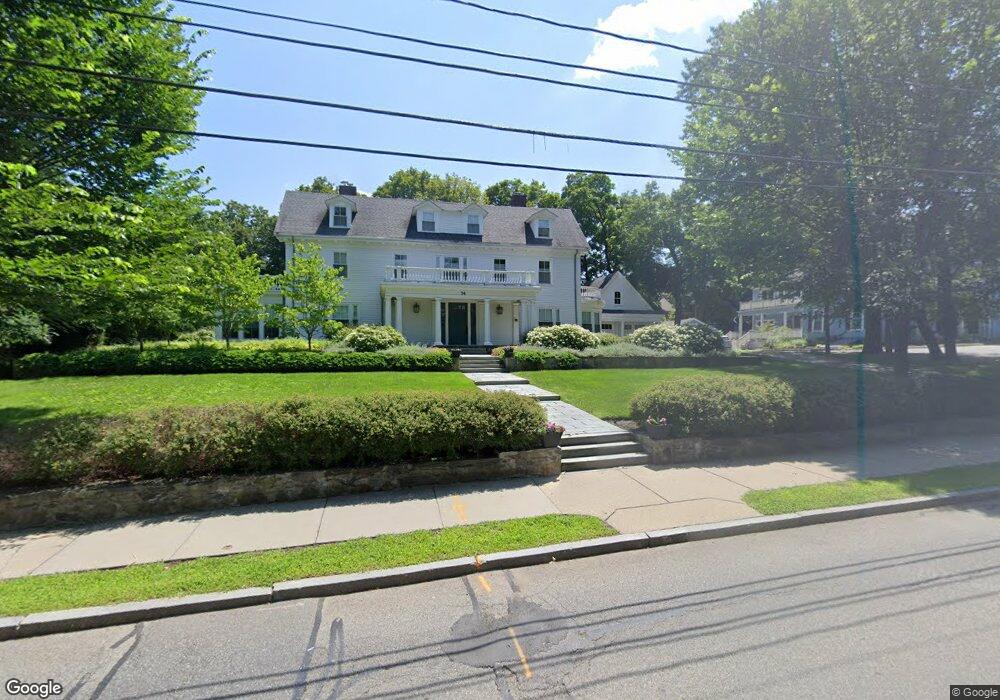
74 Grove St Auburndale, MA 02466
Auburndale NeighborhoodEstimated Value: $2,408,000 - $3,585,000
8
Beds
4
Baths
4,654
Sq Ft
$659/Sq Ft
Est. Value
About This Home
This home is located at 74 Grove St, Auburndale, MA 02466 and is currently estimated at $3,068,264, approximately $659 per square foot. 74 Grove St is a home with nearby schools including Williams Elementary School, Charles E Brown Middle School, and Newton South High School.
Ownership History
Date
Name
Owned For
Owner Type
Purchase Details
Closed on
Dec 3, 2007
Sold by
Karasek Cheryl A and Shirkhan Hamid
Bought by
Lasell College
Current Estimated Value
Purchase Details
Closed on
May 2, 2006
Sold by
Tsutsumi Jean L and Tsutsumi Patricia
Bought by
Karasek Cheryl A and Shirkhan Hamid
Home Financials for this Owner
Home Financials are based on the most recent Mortgage that was taken out on this home.
Original Mortgage
$799,000
Interest Rate
6.4%
Mortgage Type
Purchase Money Mortgage
Create a Home Valuation Report for This Property
The Home Valuation Report is an in-depth analysis detailing your home's value as well as a comparison with similar homes in the area
Home Values in the Area
Average Home Value in this Area
Purchase History
| Date | Buyer | Sale Price | Title Company |
|---|---|---|---|
| Lasell College | $1,455,000 | -- | |
| Karasek Cheryl A | $499,500 | -- | |
| Karasek Cheryl A | $499,500 | -- |
Source: Public Records
Mortgage History
| Date | Status | Borrower | Loan Amount |
|---|---|---|---|
| Previous Owner | Karasek Cheryl A | $799,000 |
Source: Public Records
Tax History Compared to Growth
Tax History
| Year | Tax Paid | Tax Assessment Tax Assessment Total Assessment is a certain percentage of the fair market value that is determined by local assessors to be the total taxable value of land and additions on the property. | Land | Improvement |
|---|---|---|---|---|
| 2025 | $32,195 | $3,285,200 | $1,196,600 | $2,088,600 |
| 2024 | $31,130 | $3,189,500 | $1,161,700 | $2,027,800 |
| 2023 | $30,146 | $2,961,300 | $918,500 | $2,042,800 |
| 2022 | $0 | $2,741,900 | $850,500 | $1,891,400 |
| 2021 | $0 | $2,586,700 | $802,400 | $1,784,300 |
| 2020 | $4,093 | $2,586,700 | $802,400 | $1,784,300 |
| 2019 | $0 | $2,511,400 | $779,000 | $1,732,400 |
| 2018 | $3,500 | $2,073,500 | $692,800 | $1,380,700 |
| 2017 | $0 | $1,349,300 | $653,600 | $695,700 |
| 2016 | -- | $1,261,000 | $610,800 | $650,200 |
| 2015 | -- | $1,178,500 | $570,800 | $607,700 |
Source: Public Records
Map
Nearby Homes
- 17 Lasell St
- 224 Auburn St Unit 224
- 224 Auburn St Unit A
- 226 Auburn St Unit 226
- 283 Melrose St
- 2202 Commonwealth Ave Unit 2
- 2202 Commonwealth Ave Unit 1
- 27 Oakwood Rd
- 283 Woodland Rd
- 13 Weir St
- 62-64 Rowe St Unit B
- 1754 Washington St
- 1639 Washington St
- 51 Bourne St
- 17 Gilbert St
- 17 Crescent St
- 160 Pine St Unit 12
- 10 Crescent St Unit 1
- 10 Crescent St Unit 2
- 0 Duncan Rd Unit 72925240
- 66 Grove St
- 86 Grove St
- 84 Grove St Unit 86
- 84 Grove St Unit 1
- 84 Grove St Unit 2
- 60 Grove St
- 123 Confidential
- 120 Woodland Rd
- 73 Grove St
- 26 Maple Terrace
- 110 Woodland Rd
- 94 Grove St
- 81 Grove St
- 50 Grove St Unit 52
- 50 Grove St Unit 52
- 50 Grove St Unit 50
- 34 Groveland St
- 40 Groveland St
- 59 Grove St
- 24 Maple Terrace