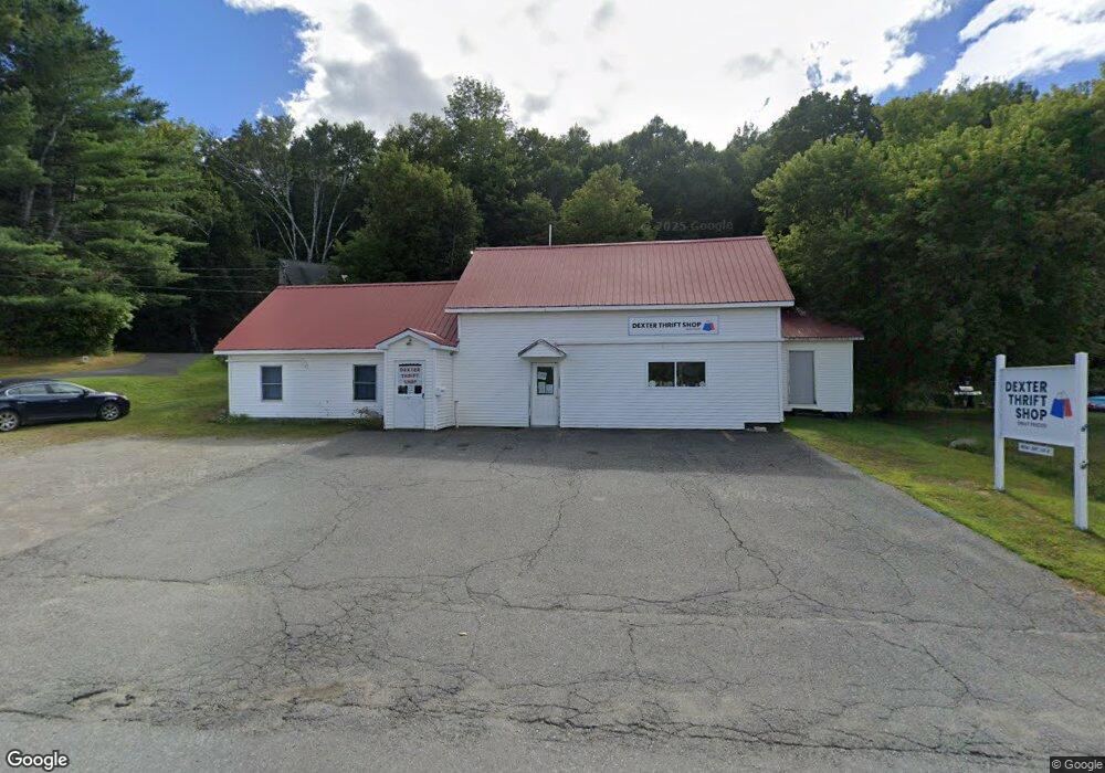
74 Grove St Dexter, ME 04930
Estimated Value: $150,063
--
Bed
--
Bath
1,120
Sq Ft
$134/Sq Ft
Est. Value
About This Home
This home is located at 74 Grove St, Dexter, ME 04930 and is currently estimated at $150,063, approximately $133 per square foot. 74 Grove St is a home located in Penobscot County with nearby schools including Ridge View Community School, Dexter Regional High School, and Dexter Christian Academy.
Ownership History
Date
Name
Owned For
Owner Type
Purchase Details
Closed on
Jun 18, 2025
Sold by
Kiwanis Clb Of Dexter-Sun
Bought by
Apel Ronald G and Debeurs Ruth
Current Estimated Value
Purchase Details
Closed on
Jul 8, 2021
Sold by
Dexter Town Of
Bought by
Kiwanis Clb Dexter Sunris
Create a Home Valuation Report for This Property
The Home Valuation Report is an in-depth analysis detailing your home's value as well as a comparison with similar homes in the area
Home Values in the Area
Average Home Value in this Area
Purchase History
| Date | Buyer | Sale Price | Title Company |
|---|---|---|---|
| Apel Ronald G | $150,000 | None Available | |
| Apel Ronald G | $150,000 | None Available | |
| Kiwanis Clb Dexter Sunris | -- | None Available | |
| Kiwanis Clb Dexter Sunris | -- | None Available |
Source: Public Records
Tax History Compared to Growth
Tax History
| Year | Tax Paid | Tax Assessment Tax Assessment Total Assessment is a certain percentage of the fair market value that is determined by local assessors to be the total taxable value of land and additions on the property. | Land | Improvement |
|---|---|---|---|---|
| 2024 | -- | $151,000 | $9,000 | $142,000 |
| 2023 | -- | $151,000 | $9,000 | $142,000 |
| 2022 | $0 | $150,200 | $8,200 | $142,000 |
| 2021 | $0 | $150,200 | $8,200 | $142,000 |
| 2020 | $0 | $150,200 | $8,200 | $142,000 |
| 2019 | $0 | $150,200 | $8,200 | $142,000 |
| 2018 | $0 | $150,200 | $8,200 | $142,000 |
| 2017 | $0 | $150,200 | $8,200 | $142,000 |
| 2016 | -- | $137,500 | $8,200 | $129,300 |
| 2015 | -- | $112,700 | $8,200 | $104,500 |
| 2014 | -- | $112,700 | $8,200 | $104,500 |
Source: Public Records
Map
Nearby Homes