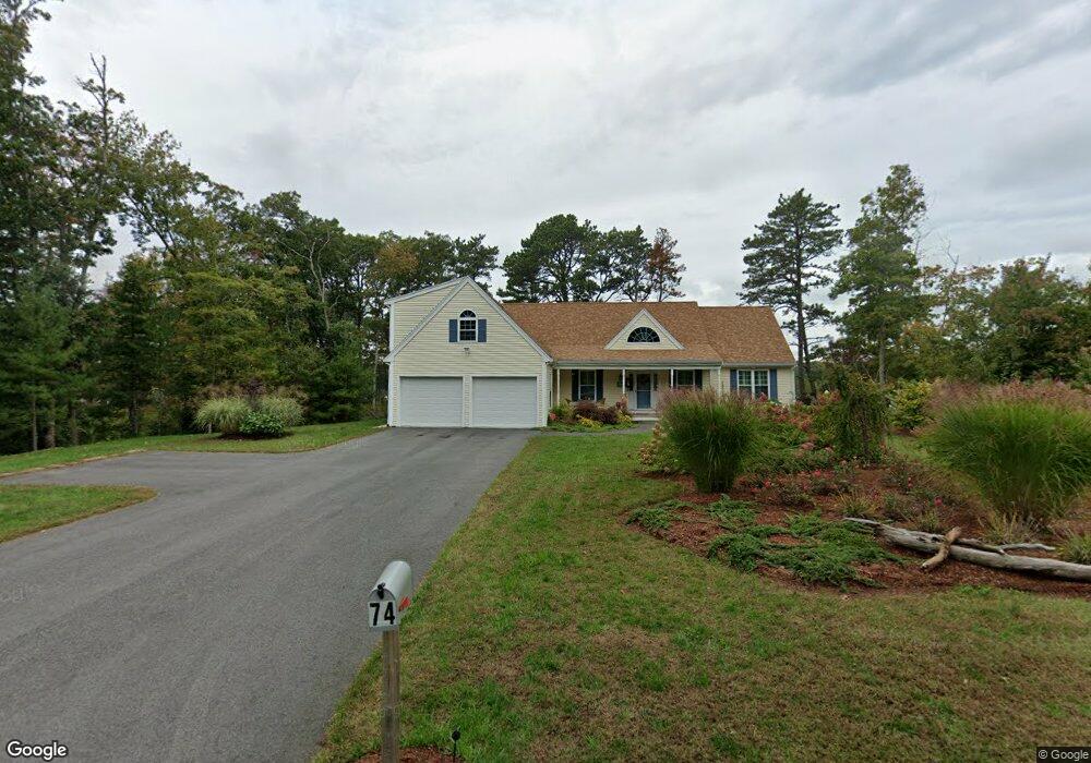
74 Gunning Point Rd Plymouth, MA 02360
Estimated Value: $756,000 - $945,000
3
Beds
4
Baths
1,994
Sq Ft
$429/Sq Ft
Est. Value
About This Home
This home is located at 74 Gunning Point Rd, Plymouth, MA 02360 and is currently estimated at $856,232, approximately $429 per square foot. 74 Gunning Point Rd is a home with nearby schools including South Elementary School, Plymouth South Middle School, and Plymouth South High School.
Ownership History
Date
Name
Owned For
Owner Type
Purchase Details
Closed on
Apr 9, 2025
Sold by
Lawrence Ginger and Lawrence Lewis K
Bought by
Ginger Lawrence Ret and Lawrence
Current Estimated Value
Purchase Details
Closed on
Jun 8, 2015
Sold by
Mulligan Family Inc
Bought by
Plymouth Town Of
Home Financials for this Owner
Home Financials are based on the most recent Mortgage that was taken out on this home.
Original Mortgage
$396,000
Interest Rate
3.65%
Mortgage Type
New Conventional
Purchase Details
Closed on
Jun 2, 2015
Sold by
Mulligan Family Inc
Bought by
Lawrence Ginger and Lawrence Lewis K
Home Financials for this Owner
Home Financials are based on the most recent Mortgage that was taken out on this home.
Original Mortgage
$396,000
Interest Rate
3.65%
Mortgage Type
New Conventional
Purchase Details
Closed on
Dec 5, 2014
Sold by
Mulligan Family Inc
Bought by
Dill B J B and Dill Colette
Create a Home Valuation Report for This Property
The Home Valuation Report is an in-depth analysis detailing your home's value as well as a comparison with similar homes in the area
Home Values in the Area
Average Home Value in this Area
Purchase History
| Date | Buyer | Sale Price | Title Company |
|---|---|---|---|
| Ginger Lawrence Ret | -- | None Available | |
| Plymouth Town Of | -- | -- | |
| Plymouth Town Of | -- | -- | |
| Lawrence Ginger | $160,000 | -- | |
| Lawrence Ginger | $160,000 | -- | |
| Dill B J B | $300,000 | -- | |
| Dill B J B | $300,000 | -- |
Source: Public Records
Mortgage History
| Date | Status | Borrower | Loan Amount |
|---|---|---|---|
| Previous Owner | Lawrence Ginger | $396,000 | |
| Previous Owner | Dill B J B | $600,000 |
Source: Public Records
Tax History Compared to Growth
Tax History
| Year | Tax Paid | Tax Assessment Tax Assessment Total Assessment is a certain percentage of the fair market value that is determined by local assessors to be the total taxable value of land and additions on the property. | Land | Improvement |
|---|---|---|---|---|
| 2025 | $10,199 | $803,700 | $309,400 | $494,300 |
| 2024 | $9,602 | $746,100 | $294,400 | $451,700 |
| 2023 | $9,445 | $688,900 | $267,400 | $421,500 |
| 2022 | $8,801 | $570,400 | $244,400 | $326,000 |
| 2021 | $8,374 | $518,200 | $244,400 | $273,800 |
| 2020 | $8,417 | $514,800 | $244,400 | $270,400 |
| 2019 | $7,999 | $483,600 | $221,900 | $261,700 |
| 2018 | $7,660 | $465,400 | $206,900 | $258,500 |
| 2017 | $7,318 | $441,400 | $206,900 | $234,500 |
| 2016 | $4,629 | $284,500 | $191,900 | $92,600 |
Source: Public Records
Map
Nearby Homes
- 7 Central Ave
- 22 Cranberry Rd
- 18 Scarlet Dr
- 35 Scarlet Dr
- 8 Joyce Dr
- 32 Lake View Blvd
- 4 Sandpiper Ln
- 72 Kirk Cir
- 756 Bourne Rd
- 119 Nathan Ln
- 455 Lunns Way
- 464 Lunns Way
- 137 Sandy Beach Rd
- 2 Wind Rose Ln
- 15 S Wind Dr
- 249 Little Sandy Pond Rd
- 19 Great Wind Dr
- 29 Pioneer Trail
- 43 Freeman Dr
- 5 Bearberry Path Unit 5
- 80 Gunning Point Rd
- Lot 1341 Gunning Point Rd ( Pondfront)
- 84 Gunning Pt Rd
- 84 Gunning Point Rd
- 84 Gunning Point Rd
- 52 Gunning Point Rd
- 46 Gunning Point Rd
- 102 Gunning Point Rd
- 8 Mallard Way
- 7 Mallard Way
- 40 Gunning Point Rd
- 106 Gunning Point Rd
- 100 Gunning Point Rd
- 110 Gunning Point Rd
- 34 Gunning Point Rd
- 37 Harmony Ln
- 41 Harmony Ln
- 25 Blueberry Rd
- 2 Blueberry Rd
- 30 Gunning Point Rd