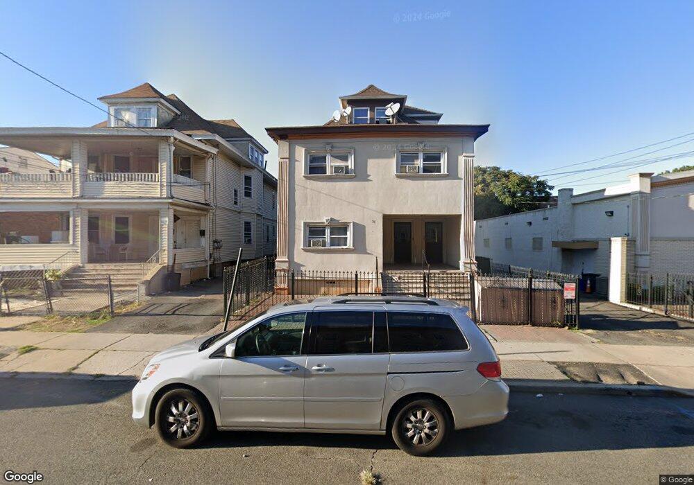
74 Howe Ave Unit 5 Passaic, NJ 07055
Estimated Value: $697,000 - $1,752,000
1
Bed
1
Bath
--
Sq Ft
4,312
Sq Ft Lot
About This Home
This home is located at 74 Howe Ave Unit 5, Passaic, NJ 07055 and is currently estimated at $1,072,449. 74 Howe Ave Unit 5 is a home located in Passaic County with nearby schools including Passaic High School # 12, Noble Leadership Academy, and Passaic Arts and Science Charter School.
Ownership History
Date
Name
Owned For
Owner Type
Purchase Details
Closed on
Jan 28, 2021
Sold by
74 Howe Ave Llc
Bought by
Jjc Holdings 74 Llc
Current Estimated Value
Purchase Details
Closed on
Jan 31, 2011
Sold by
Cena Pedro
Bought by
74 Howe Avenue Llc
Purchase Details
Closed on
Aug 18, 2003
Sold by
Ramon Ramon
Bought by
Cena Pedro
Home Financials for this Owner
Home Financials are based on the most recent Mortgage that was taken out on this home.
Original Mortgage
$244,200
Interest Rate
5.52%
Mortgage Type
Commercial
Create a Home Valuation Report for This Property
The Home Valuation Report is an in-depth analysis detailing your home's value as well as a comparison with similar homes in the area
Home Values in the Area
Average Home Value in this Area
Purchase History
Date | Buyer | Sale Price | Title Company |
---|---|---|---|
Jjc Holdings 74 Llc | -- | None Available | |
74 Howe Avenue Llc | $405,000 | -- | |
Cena Pedro | $370,000 | -- |
Source: Public Records
Mortgage History
Date | Status | Borrower | Loan Amount |
---|---|---|---|
Previous Owner | Cena Pedro | $244,200 |
Source: Public Records
Tax History Compared to Growth
Tax History
Year | Tax Paid | Tax Assessment Tax Assessment Total Assessment is a certain percentage of the fair market value that is determined by local assessors to be the total taxable value of land and additions on the property. | Land | Improvement |
---|---|---|---|---|
2024 | $16,597 | $414,500 | $71,600 | $342,900 |
2022 | $16,099 | $414,500 | $71,600 | $342,900 |
2021 | $15,585 | $414,500 | $71,600 | $342,900 |
2020 | $15,465 | $414,500 | $71,600 | $342,900 |
2019 | $15,241 | $414,500 | $71,600 | $342,900 |
2018 | $14,914 | $414,500 | $71,600 | $342,900 |
2017 | $14,454 | $414,500 | $71,600 | $342,900 |
2016 | $13,960 | $414,500 | $71,600 | $342,900 |
2015 | $13,207 | $174,400 | $42,000 | $132,400 |
2014 | $12,965 | $174,400 | $42,000 | $132,400 |
Source: Public Records
Map
Nearby Homes
- 367 Monroe St
- 52 Lincoln St
- 189 1/2 Howe Ave
- 66 Hoover Ave
- 373 Oak St Unit 2
- 108 Park Place
- 151 Van Buren St
- 269 Boulevard
- 323 Boulevard
- 112 Washington Place
- 488 Paulison Ave
- 186 Columbia Ave
- 26 Liberty St
- 285 Aycrigg Ave Unit 10E
- 285 Aycrigg Ave Unit 14F
- 285 Aycrigg Ave Unit 6E
- 285 Aycrigg Ave Unit 9A
- 285 Aycrigg Ave Unit 10H
- 74 Howe Ave Unit 3
- 74 Howe Ave Unit 5
- 74 Howe Ave
- 78 Howe Ave
- 0 Grove St
- 69 Howe Ave
- 65 Howe Ave
- 72 Grove St Unit 7
- 72 Grove St Unit 5
- 72 Grove St Unit 6
- 80 Howe Ave Unit H1
- 80 Howe Ave
- 92 Howe Ave
- 73 Howe Ave Unit 5
- 71 Henry St
- 73-89 Howe Ave Unit 5
- 73-89 Howe Ave
- 90 Howe Ave
- 105 Grove St
- 73 Henry St