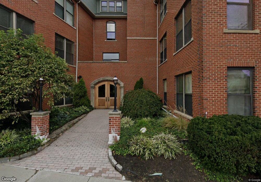
74 Kent St Unit C11 Brookline, MA 02445
Brookline Village NeighborhoodEstimated Value: $2,117,000 - $2,462,000
3
Beds
3
Baths
2,857
Sq Ft
$809/Sq Ft
Est. Value
About This Home
This home is located at 74 Kent St Unit C11, Brookline, MA 02445 and is currently estimated at $2,310,767, approximately $808 per square foot. 74 Kent St Unit C11 is a home located in Norfolk County with nearby schools including Pierce School, Brookline High School, and St. Mary of the Assumption Elementary School.
Ownership History
Date
Name
Owned For
Owner Type
Purchase Details
Closed on
Aug 1, 2007
Sold by
Sudarsky Amy
Bought by
Printz Eric R
Current Estimated Value
Home Financials for this Owner
Home Financials are based on the most recent Mortgage that was taken out on this home.
Original Mortgage
$400,000
Outstanding Balance
$254,165
Interest Rate
6.73%
Mortgage Type
Purchase Money Mortgage
Estimated Equity
$2,056,602
Create a Home Valuation Report for This Property
The Home Valuation Report is an in-depth analysis detailing your home's value as well as a comparison with similar homes in the area
Home Values in the Area
Average Home Value in this Area
Purchase History
| Date | Buyer | Sale Price | Title Company |
|---|---|---|---|
| Printz Eric R | $1,200,000 | -- |
Source: Public Records
Mortgage History
| Date | Status | Borrower | Loan Amount |
|---|---|---|---|
| Open | Printz Eric R | $400,000 |
Source: Public Records
Tax History
| Year | Tax Paid | Tax Assessment Tax Assessment Total Assessment is a certain percentage of the fair market value that is determined by local assessors to be the total taxable value of land and additions on the property. | Land | Improvement |
|---|---|---|---|---|
| 2025 | $20,399 | $2,066,800 | $0 | $2,066,800 |
| 2024 | $19,797 | $2,026,300 | $0 | $2,026,300 |
| 2023 | $18,361 | $1,841,600 | $0 | $1,841,600 |
| 2022 | $18,398 | $1,805,500 | $0 | $1,805,500 |
| 2021 | $17,519 | $1,787,700 | $0 | $1,787,700 |
| 2020 | $16,727 | $1,770,100 | $0 | $1,770,100 |
| 2019 | $15,796 | $1,685,800 | $0 | $1,685,800 |
| 2018 | $15,891 | $1,679,800 | $0 | $1,679,800 |
| 2017 | $15,366 | $1,555,300 | $0 | $1,555,300 |
| 2016 | $14,733 | $1,413,900 | $0 | $1,413,900 |
| 2015 | $13,728 | $1,285,400 | $0 | $1,285,400 |
| 2014 | $12,757 | $1,120,000 | $0 | $1,120,000 |
Source: Public Records
Map
Nearby Homes
- 58 Kent St Unit 303
- 58 Kent St Unit 301
- 58 Kent St Unit 305
- 58 Kent St Unit 402
- 58 Kent St Unit 404
- 44 Washington St Unit 505
- 216 Aspinwall Ave
- 216 Aspinwall Ave Unit 3
- 6 Juniper St Unit 16
- 69 Walnut St Unit 2
- 69 Walnut St Unit 1
- 390 Riverway Unit 24
- 378 Riverway Unit 3
- 33 Pond Ave Unit 603
- 33 Pond Ave Unit 422
- 6 Parkway Rd Unit 6
- 61 Toxteth St
- 77 Pond Ave Unit 1103
- 77 Pond Ave Unit 1506
- 77 Pond Ave Unit 401
- 74 Kent St Unit C14
- 74 Kent St Unit C13
- 74 Kent St Unit C12
- 74 Kent St Unit C9
- 74 Kent St Unit C8
- 74 Kent St Unit C7
- 74 Kent St Unit C6
- 74 Kent St Unit C5
- 74 Kent St Unit C4
- 74 Kent St Unit C3
- 74 Kent St Unit C2
- 74 Kent St Unit C1
- 74 Kent St Unit 3##
- 74 Kent St Unit 8
- 74 Kent St Unit C14,74
- 74 Kent St Unit CB
- 74 Kent St
- 74 Kent St Unit 1
- 74 Kent St
- 74 Kent St Unit 6
Your Personal Tour Guide
Ask me questions while you tour the home.