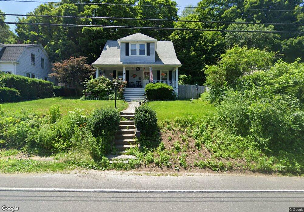
74 Maple St Seymour, CT 06483
Estimated Value: $296,000 - $339,000
3
Beds
2
Baths
1,172
Sq Ft
$277/Sq Ft
Est. Value
About This Home
This home is located at 74 Maple St, Seymour, CT 06483 and is currently estimated at $325,011, approximately $277 per square foot. 74 Maple St is a home located in New Haven County with nearby schools including Seymour Middle School, Seymour High School, and Assumption School.
Ownership History
Date
Name
Owned For
Owner Type
Purchase Details
Closed on
Mar 28, 2007
Sold by
Beauregard Sylvain and Lovegrove Andree
Bought by
Weaver John James
Current Estimated Value
Home Financials for this Owner
Home Financials are based on the most recent Mortgage that was taken out on this home.
Original Mortgage
$178,300
Interest Rate
6.33%
Purchase Details
Closed on
Apr 19, 2004
Sold by
Jones Kenneth
Bought by
Beauregard Sylvain and Lovegrove Andree
Purchase Details
Closed on
Jun 10, 2003
Sold by
Department Of Housing & Urban Dev
Bought by
Jones Kenneth B
Purchase Details
Closed on
Jul 14, 1987
Sold by
Bowen Shirley
Bought by
Blow Gary
Create a Home Valuation Report for This Property
The Home Valuation Report is an in-depth analysis detailing your home's value as well as a comparison with similar homes in the area
Home Values in the Area
Average Home Value in this Area
Purchase History
| Date | Buyer | Sale Price | Title Company |
|---|---|---|---|
| Weaver John James | $179,750 | -- | |
| Beauregard Sylvain | $170,000 | -- | |
| Jones Kenneth B | $105,000 | -- | |
| Blow Gary | $675,000 | -- |
Source: Public Records
Mortgage History
| Date | Status | Borrower | Loan Amount |
|---|---|---|---|
| Open | Blow Gary | $162,551 | |
| Closed | Blow Gary | $178,300 | |
| Closed | Blow Gary | $11,300 |
Source: Public Records
Tax History
| Year | Tax Paid | Tax Assessment Tax Assessment Total Assessment is a certain percentage of the fair market value that is determined by local assessors to be the total taxable value of land and additions on the property. | Land | Improvement |
|---|---|---|---|---|
| 2025 | $5,260 | $189,770 | $28,700 | $161,070 |
| 2024 | $4,634 | $125,790 | $22,470 | $103,320 |
| 2023 | $4,526 | $125,790 | $22,470 | $103,320 |
| 2022 | $4,477 | $125,790 | $22,470 | $103,320 |
| 2021 | $4,366 | $125,790 | $22,470 | $103,320 |
| 2020 | $3,596 | $99,890 | $26,390 | $73,500 |
| 2019 | $3,596 | $99,890 | $26,390 | $73,500 |
| 2018 | $3,596 | $99,890 | $26,390 | $73,500 |
| 2017 | $3,596 | $99,890 | $26,390 | $73,500 |
| 2016 | $3,596 | $99,890 | $26,390 | $73,500 |
| 2015 | $3,569 | $103,180 | $29,680 | $73,500 |
| 2014 | $3,512 | $103,180 | $29,680 | $73,500 |
Source: Public Records
Map
Nearby Homes
- 53 Maple St
- 122 Derby Ave
- 278 S Main St
- 29 Moss Ave Unit 23
- 50 Bissell Place
- 18 Bryson Ave
- 73 Micko Dr
- 48 Micko Dr
- 68 New St
- 17 Patton Ave
- 28 Elmwood Dr
- 32 George St
- 11 Poplar Dr
- 17 Meadow St Unit 23
- 35 Cogwheel Ln
- 93 Balance Rock Rd Unit 1
- 37-14, 49-1, 79-2, 7 Balance Rock Rd
- 24 Deer Run Dr
- 57 Bellevue Terrace
- 29 Balance Rock Rd Unit 5
Your Personal Tour Guide
Ask me questions while you tour the home.