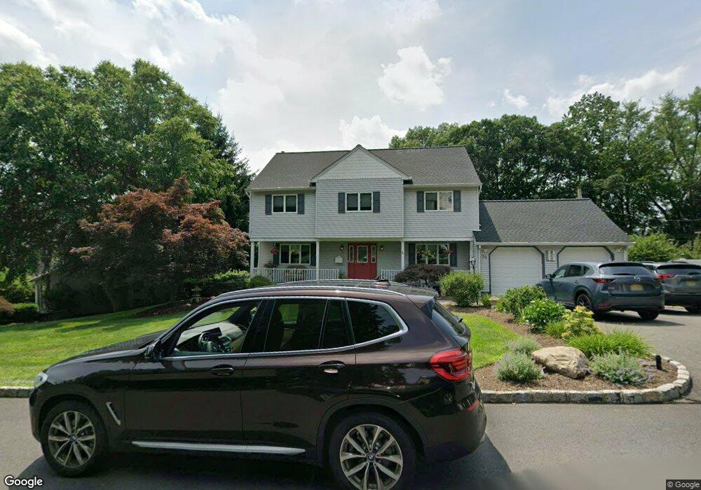
74 Maysenger Rd Mahwah, NJ 07430
Estimated Value: $924,000 - $1,189,000
--
Bed
--
Bath
2,254
Sq Ft
$457/Sq Ft
Est. Value
About This Home
This home is located at 74 Maysenger Rd, Mahwah, NJ 07430 and is currently estimated at $1,030,227, approximately $457 per square foot. 74 Maysenger Rd is a home located in Bergen County with nearby schools including Mahwah High School.
Ownership History
Date
Name
Owned For
Owner Type
Purchase Details
Closed on
Jun 8, 2016
Sold by
Pantano Richard and Germinario Carla
Bought by
Germinario Carla
Current Estimated Value
Purchase Details
Closed on
Jul 7, 2008
Sold by
Terwilliger Jack N and Terwilliger Sandra
Bought by
Pantano Richard and Germinario Carla
Home Financials for this Owner
Home Financials are based on the most recent Mortgage that was taken out on this home.
Original Mortgage
$550,000
Outstanding Balance
$356,616
Interest Rate
6.17%
Mortgage Type
New Conventional
Estimated Equity
$673,611
Create a Home Valuation Report for This Property
The Home Valuation Report is an in-depth analysis detailing your home's value as well as a comparison with similar homes in the area
Home Values in the Area
Average Home Value in this Area
Purchase History
| Date | Buyer | Sale Price | Title Company |
|---|---|---|---|
| Germinario Carla | -- | None Available | |
| Pantano Richard | $739,000 | -- |
Source: Public Records
Mortgage History
| Date | Status | Borrower | Loan Amount |
|---|---|---|---|
| Open | Pantano Richard | $550,000 |
Source: Public Records
Tax History Compared to Growth
Tax History
| Year | Tax Paid | Tax Assessment Tax Assessment Total Assessment is a certain percentage of the fair market value that is determined by local assessors to be the total taxable value of land and additions on the property. | Land | Improvement |
|---|---|---|---|---|
| 2025 | $11,903 | $576,700 | $329,800 | $246,900 |
| 2024 | $11,747 | $576,700 | $329,800 | $246,900 |
| 2023 | $11,373 | $576,700 | $329,800 | $246,900 |
| 2022 | $11,373 | $576,700 | $329,800 | $246,900 |
| 2021 | $11,251 | $576,700 | $329,800 | $246,900 |
| 2020 | $10,980 | $576,700 | $329,800 | $246,900 |
| 2019 | $10,617 | $576,700 | $329,800 | $246,900 |
| 2018 | $10,467 | $576,700 | $329,800 | $246,900 |
| 2017 | $10,300 | $576,700 | $329,800 | $246,900 |
| 2016 | $10,075 | $576,700 | $329,800 | $246,900 |
| 2015 | $9,937 | $576,700 | $329,800 | $246,900 |
| 2014 | $9,769 | $576,700 | $329,800 | $246,900 |
Source: Public Records
Map
Nearby Homes
- 324 Franklin Turnpike
- 16 Gardner St
- 18 Boulder Trail
- 163 Rutherford Rd
- 37 Hillside Ave
- 199 Island Rd
- 1248 Garrison Ct Unit E1
- 12 Alcott Rd
- 1114 Hyde Park Ct Unit 1114
- 1415 York St
- 17 Grist Mill Run
- 135 Mulberry Rd Unit 6
- 112 Moffatt Rd
- 1003 Crown Ct
- 111 Moffatt Rd
- 2214 Hilltop Rd
- 112 Magnolia Rd Unit 4
- 13 Winter Terrace
- 312 Cypress Ct Unit 2
- 66 Thunderhead Place
- 70 Maysenger Rd
- 76 Maysenger Rd
- 331 Franklin Turnpike
- 78 Maysenger Rd
- 66 Maysenger Rd
- 67 Maysenger Rd
- 75 Maysenger Rd
- 69 Maysenger Rd
- 341 Franklin Turnpike
- 325 Franklin Turnpike
- 77 Maysenger Rd
- 65 Maysenger Rd
- 60 Maysenger Rd
- 323 Franklin Turnpike
- 126 Oweno Rd
- 130 Oweno Rd
- 15 Rock Ridge Rd
- 120 Oweno Rd
- 59 Maysenger Rd
- 1 Rock Ridge Rd