Estimated Value: $897,812 - $1,158,000
3
Beds
4
Baths
2,469
Sq Ft
$414/Sq Ft
Est. Value
About This Home
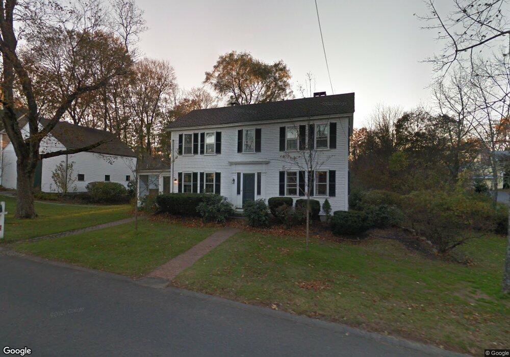
This home is located at 74 Nagog Hill Rd, Acton, MA 01720 and is currently estimated at $1,023,203, approximately $414 per square foot. 74 Nagog Hill Rd is a home located in Middlesex County with nearby schools including Acton-Boxborough Regional High School and Oak Meadow Montessori School.
Ownership History
Date
Name
Owned For
Owner Type
Purchase Details
Closed on
Aug 12, 2003
Sold by
Lucas James R and Eileen Lucas J
Bought by
Bendig Brian C and Bendig Ruth N
Current Estimated Value
Home Financials for this Owner
Home Financials are based on the most recent Mortgage that was taken out on this home.
Original Mortgage
$414,400
Outstanding Balance
$177,961
Interest Rate
5.28%
Mortgage Type
Purchase Money Mortgage
Estimated Equity
$845,242
Create a Home Valuation Report for This Property
The Home Valuation Report is an in-depth analysis detailing your home's value as well as a comparison with similar homes in the area
Home Values in the Area
Average Home Value in this Area
Purchase History
| Date | Buyer | Sale Price | Title Company |
|---|---|---|---|
| Bendig Brian C | $518,000 | -- |
Source: Public Records
Mortgage History
| Date | Status | Borrower | Loan Amount |
|---|---|---|---|
| Open | Bendig Brian C | $414,400 |
Source: Public Records
Tax History Compared to Growth
Tax History
| Year | Tax Paid | Tax Assessment Tax Assessment Total Assessment is a certain percentage of the fair market value that is determined by local assessors to be the total taxable value of land and additions on the property. | Land | Improvement |
|---|---|---|---|---|
| 2025 | $12,725 | $742,000 | $365,800 | $376,200 |
| 2024 | $12,401 | $743,900 | $365,800 | $378,100 |
| 2023 | $12,250 | $697,600 | $333,000 | $364,600 |
| 2022 | $11,820 | $607,700 | $289,500 | $318,200 |
| 2021 | $11,424 | $564,700 | $267,800 | $296,900 |
| 2020 | $10,976 | $570,500 | $267,800 | $302,700 |
| 2019 | $10,481 | $541,100 | $267,800 | $273,300 |
| 2018 | $10,372 | $535,200 | $267,800 | $267,400 |
| 2017 | $10,014 | $525,400 | $267,800 | $257,600 |
| 2016 | $10,028 | $521,500 | $267,800 | $253,700 |
| 2015 | $10,055 | $527,800 | $267,800 | $260,000 |
| 2014 | $9,873 | $507,600 | $267,800 | $239,800 |
Source: Public Records
Map
Nearby Homes
- 491 Main St
- 709 Main St
- 524 Main St
- 23 John Swift Rd
- 209 Great Rd Unit C1
- 37 Hosmer St
- 11 Horseshoe Dr
- 16 Wampus Ave Unit 32
- 10 Blue Heron Way Unit 10
- 10 Blue Heron Way
- 7 Blue Heron Way
- 1 Bayberry Rd
- 6 Bittersweet Ln
- 134 Pope Rd
- 159 Skyline Dr Unit 159
- 386 Great Rd Unit A8
- 10 Wingate Ln
- 5 Oakwood Rd
- 420 Great Rd Unit B3
- 403 Great Rd Unit 5