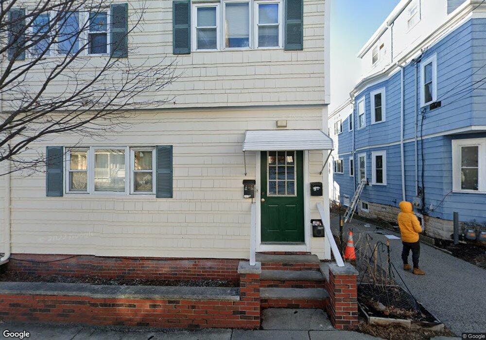
74 North St Somerville, MA 02144
West Somerville NeighborhoodEstimated Value: $1,261,000 - $1,321,948
5
Beds
2
Baths
3,151
Sq Ft
$411/Sq Ft
Est. Value
About This Home
3 Bedroom apartment in the Tufts area of Somerville within a 15 minute walk to Davis Square. Eat-in kitchen and back porch and yard. All utilities Included! (Reference #128435)
Create a Home Valuation Report for This Property
The Home Valuation Report is an in-depth analysis detailing your home's value as well as a comparison with similar homes in the area
Home Values in the Area
Average Home Value in this Area
Property History
| Date | Event | Price | List to Sale | Price per Sq Ft |
|---|---|---|---|---|
| 01/19/2025 01/19/25 | For Rent | $3,000 | 0.0% | -- |
| 01/17/2025 01/17/25 | Off Market | $3,000 | -- | -- |
| 01/14/2025 01/14/25 | Price Changed | $3,000 | -6.3% | $2 / Sq Ft |
| 01/01/2025 01/01/25 | For Rent | $3,200 | 0.0% | -- |
| 12/26/2024 12/26/24 | Off Market | $3,200 | -- | -- |
| 12/19/2024 12/19/24 | For Rent | $3,200 | 0.0% | -- |
| 12/18/2024 12/18/24 | Off Market | $3,200 | -- | -- |
| 12/13/2024 12/13/24 | For Rent | $3,200 | -- | -- |
Tax History
| Year | Tax Paid | Tax Assessment Tax Assessment Total Assessment is a certain percentage of the fair market value that is determined by local assessors to be the total taxable value of land and additions on the property. | Land | Improvement |
|---|---|---|---|---|
| 2025 | $11,693 | $1,071,800 | $564,900 | $506,900 |
| 2024 | $10,994 | $1,045,100 | $564,900 | $480,200 |
| 2023 | $10,725 | $1,037,200 | $564,900 | $472,300 |
| 2022 | $9,877 | $970,200 | $538,000 | $432,200 |
| 2021 | $9,602 | $942,300 | $534,100 | $408,200 |
| 2020 | $9,430 | $934,600 | $534,400 | $400,200 |
| 2019 | $8,823 | $820,000 | $486,500 | $333,500 |
| 2018 | $8,252 | $729,600 | $442,300 | $287,300 |
| 2017 | $7,937 | $680,100 | $417,300 | $262,800 |
| 2016 | $8,146 | $650,100 | $372,600 | $277,500 |
Source: Public Records
Map
Nearby Homes
- 233 Powder House Blvd
- 123 W Adams St Unit 1
- 202 Powder House Blvd Unit 1
- 202 Powder House Blvd Unit 2
- 142 North St
- 327 Alewife Brook Pkwy Unit A
- 327 Alewife Brook Pkwy Unit B
- 30 Clarendon Ave
- 69 Electric Ave Unit 3
- 69 Electric Ave Unit 1
- 395 Alewife Brook Pkwy Unit 2C
- 45 Teel St
- 55 Packard Ave Unit 1
- 69 Clarendon Ave Unit A
- 6 Gordon Rd
- 199 Everett St Unit 199
- 76 Orchard St
- 120 Broadway
- 157 Boston Ave Unit 1
- 58 Dearborn St
- 74 North St
- 74 North St Unit 1
- 76 North St Unit 2
- 78 North St
- 78 North St Unit 1
- 78 North St Unit 2
- 72 North St Unit 2
- 72 North St Unit 1
- 72 North St
- 80 North St
- 80 North St Unit 3
- 80 North St Unit 1
- 66 North St
- 66 North St Unit 1
- 66 North St
- 68 North St
- 68 North St Unit 1
- 68 North St
- 68 North St Unit 2
- 271 Alewife Brook Pkwy
Your Personal Tour Guide
Ask me questions while you tour the home.