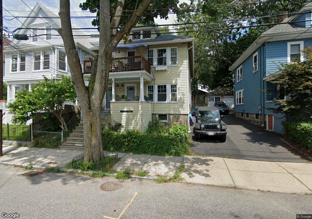
74 Patten St Jamaica Plain, MA 02130
Jamaica Plain NeighborhoodEstimated Value: $972,000 - $1,118,000
5
Beds
2
Baths
2,250
Sq Ft
$471/Sq Ft
Est. Value
About This Home
This home is located at 74 Patten St, Jamaica Plain, MA 02130 and is currently estimated at $1,058,698, approximately $470 per square foot. 74 Patten St is a home located in Suffolk County with nearby schools including Brooke Charter School Roslindale, The Croft School - Jamaica Plain, and St. Clare High School.
Ownership History
Date
Name
Owned For
Owner Type
Purchase Details
Closed on
Aug 23, 2010
Sold by
Drakes Emma P
Bought by
Drakes Rodney
Current Estimated Value
Purchase Details
Closed on
May 24, 2004
Sold by
Drakes Emma P and Drakes Rodney
Bought by
Drakes Rodney
Home Financials for this Owner
Home Financials are based on the most recent Mortgage that was taken out on this home.
Original Mortgage
$362,000
Interest Rate
5.75%
Mortgage Type
Purchase Money Mortgage
Purchase Details
Closed on
Jan 6, 1997
Sold by
Falcione Mary F
Bought by
Drakes Rodney and Drakes Emma P
Create a Home Valuation Report for This Property
The Home Valuation Report is an in-depth analysis detailing your home's value as well as a comparison with similar homes in the area
Home Values in the Area
Average Home Value in this Area
Purchase History
| Date | Buyer | Sale Price | Title Company |
|---|---|---|---|
| Drakes Rodney | $10,000 | -- | |
| Drakes Rodney | -- | -- | |
| Drakes Rodney | $158,000 | -- |
Source: Public Records
Mortgage History
| Date | Status | Borrower | Loan Amount |
|---|---|---|---|
| Open | Drakes Rodney | $5,440 | |
| Previous Owner | Drakes Rodney | $362,000 | |
| Previous Owner | Drakes Rodney | $315,000 |
Source: Public Records
Tax History Compared to Growth
Tax History
| Year | Tax Paid | Tax Assessment Tax Assessment Total Assessment is a certain percentage of the fair market value that is determined by local assessors to be the total taxable value of land and additions on the property. | Land | Improvement |
|---|---|---|---|---|
| 2025 | $10,672 | $921,600 | $291,100 | $630,500 |
| 2024 | $10,181 | $934,000 | $250,400 | $683,600 |
| 2023 | $9,554 | $889,600 | $238,500 | $651,100 |
| 2022 | $9,213 | $846,800 | $227,000 | $619,800 |
| 2021 | $8,773 | $822,200 | $220,400 | $601,800 |
| 2020 | $7,197 | $681,500 | $220,200 | $461,300 |
| 2019 | $6,838 | $648,800 | $168,800 | $480,000 |
| 2018 | $6,237 | $595,100 | $168,800 | $426,300 |
| 2017 | $6,176 | $583,200 | $168,800 | $414,400 |
| 2016 | $5,677 | $516,100 | $168,800 | $347,300 |
| 2015 | $5,245 | $433,100 | $154,000 | $279,100 |
| 2014 | $4,816 | $382,800 | $154,000 | $228,800 |
Source: Public Records
Map
Nearby Homes
- 31 Rodman St Unit 2
- 31 Rodman St Unit 1
- 140 Wachusett St
- 158 Wachusett St Unit 3
- 178 Hyde Park Ave Unit 3
- 143-171 Hyde Park Ave Unit 169A
- 18-20 Northbourne Rd Unit 18
- 50 Southbourne Rd
- 58 Weld Hill St Unit 2
- 64 Hyde Park Ave Unit 3
- 348-350 Hyde Park Ave Unit 2
- 19 Delford St
- 19 Delford St Unit 1
- 4012 Washington St
- 26 Tower St
- 24 Waterman Rd
- 71 Wyvern St
- 4031 Washington St
- 602 Canterbury St Unit 14
- 602 Canterbury St Unit 4
- 74 Patten St
- 74 Patten St Unit 1
- 76 Patten St
- 70 Patten St Unit 3
- 70 Patten St Unit 2
- 70 Patten St Unit 1
- 80 Patten St
- 80 Patten St Unit 2
- 80 Patten St Unit 3
- 80 Patten St Unit 1
- 66 Patten St
- 83 Walk Hill St Unit 85
- 64 Patten St Unit 2
- 64 Patten St Unit 1
- 9 Bourne St
- 65 Eldridge Rd
- 11 Bourne St
- 79 Walk Hill St Unit 81
- 79 Walk Hill St Unit 1
- 79 Walk Hill St