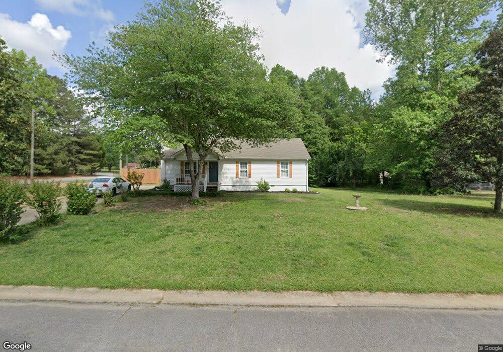
74 Poplar Point Dr Carrollton, GA 30116
Abilene NeighborhoodEstimated Value: $230,662 - $234,000
3
Beds
2
Baths
1,228
Sq Ft
$189/Sq Ft
Est. Value
About This Home
This home is located at 74 Poplar Point Dr, Carrollton, GA 30116 and is currently estimated at $232,166, approximately $189 per square foot. 74 Poplar Point Dr is a home located in Carroll County with nearby schools including Sharp Creek Elementary School, Bay Springs Middle School, and Villa Rica High School.
Ownership History
Date
Name
Owned For
Owner Type
Purchase Details
Closed on
Aug 16, 2019
Sold by
Sapp Stephen
Bought by
Scherer Shelby L and Scherer Kathleen B
Current Estimated Value
Home Financials for this Owner
Home Financials are based on the most recent Mortgage that was taken out on this home.
Original Mortgage
$116,800
Outstanding Balance
$102,505
Interest Rate
3.8%
Mortgage Type
New Conventional
Estimated Equity
$129,661
Purchase Details
Closed on
Jun 11, 2019
Sold by
Federal Home Loan Mtg Corp
Bought by
Sapp Stephen
Purchase Details
Closed on
Nov 6, 2018
Sold by
Wells Fargo Bank Na
Bought by
Federal Home Loan Mtg Corp
Purchase Details
Closed on
Oct 15, 2005
Sold by
Slazyk Judith A
Bought by
Slazyk Melvin R
Purchase Details
Closed on
Apr 13, 1994
Sold by
Richards Homes
Bought by
Slazyk Melvin R and Slazyk Judith A
Purchase Details
Closed on
Aug 1, 1991
Bought by
Richards Homes
Create a Home Valuation Report for This Property
The Home Valuation Report is an in-depth analysis detailing your home's value as well as a comparison with similar homes in the area
Home Values in the Area
Average Home Value in this Area
Purchase History
| Date | Buyer | Sale Price | Title Company |
|---|---|---|---|
| Scherer Shelby L | $146,000 | -- | |
| Sapp Stephen | $77,000 | -- | |
| Federal Home Loan Mtg Corp | $89,681 | -- | |
| Wells Fargo Bank Na | $89,681 | -- | |
| Slazyk Melvin R | -- | -- | |
| Slazyk Melvin R | $71,000 | -- | |
| Richards Homes | -- | -- |
Source: Public Records
Mortgage History
| Date | Status | Borrower | Loan Amount |
|---|---|---|---|
| Open | Scherer Shelby L | $116,800 |
Source: Public Records
Tax History Compared to Growth
Tax History
| Year | Tax Paid | Tax Assessment Tax Assessment Total Assessment is a certain percentage of the fair market value that is determined by local assessors to be the total taxable value of land and additions on the property. | Land | Improvement |
|---|---|---|---|---|
| 2024 | $1,892 | $83,642 | $4,000 | $79,642 |
| 2023 | $1,892 | $76,424 | $4,000 | $72,424 |
| 2022 | $1,557 | $62,069 | $4,000 | $58,069 |
| 2021 | $1,380 | $53,813 | $4,000 | $49,813 |
| 2020 | $1,232 | $48,002 | $4,000 | $44,002 |
| 2019 | $924 | $35,707 | $4,000 | $31,707 |
| 2018 | $143 | $29,533 | $4,000 | $25,533 |
| 2017 | $144 | $29,533 | $4,000 | $25,533 |
| 2016 | $144 | $29,533 | $4,000 | $25,533 |
| 2015 | $145 | $25,258 | $4,000 | $21,258 |
| 2014 | $146 | $25,258 | $4,000 | $21,258 |
Source: Public Records
Map
Nearby Homes
- 0 Old Airport Rd Unit 10599783
- 0 Old Airport Rd Unit 7642336
- 0 Old Airport Rd Unit 10599779
- 0 Knight Dr W
- The McGinnis Plan at Morgan Landing
- 255 Morgan Rd
- 211 Greystone Dr
- 1890 Shady Grove Rd
- 0 Shady Grove Rd Unit 10601173
- 0 Shady Grove Rd Unit 10601172
- 221 Turtle Cove
- 105 Providence Ct
- 131 Hunter Way
- 00 Old Airport Rd
- 255 Emerald Pointe Dr
- 2580 Shady Grove Rd
- 45 Sassafrass Way Unit 202
- 1711B Bankhead Hwy
- 115 N Lake Dr
- 555 McKenzie Bridge Rd
- 74 Poplar Point Dr
- 0 Poplar Point Dr Unit 8698018
- 0 Poplar Point Dr Unit 8627411
- 0 Poplar Point Dr
- 90 Poplar Point Dr
- 29 Arbor Park
- 52 Poplar Point Dr
- 87 Poplar Point Dr
- 105 Poplar Point Dr
- 20 Arbor Park
- 24 Willow Trail
- 10 Willow Trail
- 97 Poplar Point Dr
- 26 Arbor Park
- 105 Willow Trail
- 24 Arbor Park
- 34 Poplar Point Dr
- 90 E Knight Dr
- 80 E Knight Dr
- 29 Willow Trail