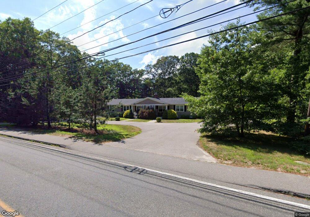
74 S Meadow Rd Carver, MA 02330
Estimated Value: $447,000 - $912,000
6
Beds
2
Baths
1,974
Sq Ft
$349/Sq Ft
Est. Value
About This Home
This home is located at 74 S Meadow Rd, Carver, MA 02330 and is currently estimated at $689,281, approximately $349 per square foot. 74 S Meadow Rd is a home located in Plymouth County with nearby schools including Carver Elementary School and Carver Middle/High School.
Ownership History
Date
Name
Owned For
Owner Type
Purchase Details
Closed on
May 23, 2013
Sold by
Brown Norman E
Bought by
Emerson Jamie P and Emerson Lisa M
Current Estimated Value
Home Financials for this Owner
Home Financials are based on the most recent Mortgage that was taken out on this home.
Original Mortgage
$200,000
Outstanding Balance
$141,530
Interest Rate
3.45%
Mortgage Type
New Conventional
Estimated Equity
$547,751
Purchase Details
Closed on
Aug 5, 2005
Sold by
Mofford Patricia A
Bought by
Brown Norman E
Purchase Details
Closed on
Feb 5, 1999
Sold by
Unlimited Holdings Inc
Bought by
Mofford Patricia A
Purchase Details
Closed on
Oct 7, 1998
Sold by
Bankers Trust Co Of Ca
Bought by
Unlimited Holdings Inc
Purchase Details
Closed on
Apr 28, 1998
Sold by
Erskine David E
Bought by
Bankers T Co Of Ca
Create a Home Valuation Report for This Property
The Home Valuation Report is an in-depth analysis detailing your home's value as well as a comparison with similar homes in the area
Home Values in the Area
Average Home Value in this Area
Purchase History
| Date | Buyer | Sale Price | Title Company |
|---|---|---|---|
| Emerson Jamie P | $158,000 | -- | |
| Emerson Jamie P | $158,000 | -- | |
| Brown Norman E | $380,000 | -- | |
| Mofford Patricia A | $155,000 | -- | |
| Unlimited Holdings Inc | $105,000 | -- | |
| Bankers T Co Of Ca | $145,409 | -- |
Source: Public Records
Mortgage History
| Date | Status | Borrower | Loan Amount |
|---|---|---|---|
| Open | Emerson Jamie P | $200,000 | |
| Closed | Emerson Jamie P | $200,000 | |
| Previous Owner | Bankers T Co Of Ca | $344,000 | |
| Previous Owner | Bankers T Co Of Ca | $86,000 |
Source: Public Records
Tax History
| Year | Tax Paid | Tax Assessment Tax Assessment Total Assessment is a certain percentage of the fair market value that is determined by local assessors to be the total taxable value of land and additions on the property. | Land | Improvement |
|---|---|---|---|---|
| 2025 | $8,397 | $605,400 | $133,300 | $472,100 |
| 2024 | $7,879 | $556,000 | $130,700 | $425,300 |
| 2023 | $7,550 | $517,500 | $130,700 | $386,800 |
| 2022 | $7,215 | $451,500 | $111,800 | $339,700 |
| 2021 | $6,656 | $392,900 | $99,800 | $293,100 |
| 2020 | $6,352 | $369,500 | $93,300 | $276,200 |
| 2019 | $6,184 | $362,700 | $90,600 | $272,100 |
| 2018 | $5,723 | $324,600 | $90,600 | $234,000 |
| 2017 | $5,479 | $309,700 | $87,100 | $222,600 |
| 2016 | $5,092 | $299,000 | $83,000 | $216,000 |
| 2015 | $4,759 | $279,800 | $83,000 | $196,800 |
| 2014 | $4,152 | $244,100 | $104,900 | $139,200 |
Source: Public Records
Map
Nearby Homes
- 43 S Meadow Rd
- 48 S Meadow Village
- 29 S Meadow Village
- 55 S Meadow Village
- 235 Main St
- 81 Center St
- 67 Crystal Lake Dr
- 7 Cedar Dr
- 35 Silva St
- 56 Bunnys Rd
- 13 Pond View Way
- 29 Wyndemere Ct
- 40 Fosdick Rd
- 6 Twin Pines Ln Unit 6
- Lot 1 Ohana Way
- Lot 2 Ohana Way
- 1 Pinehurst Dr
- 9 Lawrence Rd
- 6 Deer Hill Ln
- 114 Meadow St
- 74 S Meadow Rd Unit B
- 74 S Meadow Rd Unit A
- 74 S Meadow Rd
- 72 S Meadow Rd
- 76 S Meadow Rd
- 67 S Meadow Rd
- 68 S Meadow Rd
- 65 S Meadow Rd
- 65 S Meadow Rd
- 70 S Meadow Rd
- 69 S Meadow Rd
- 78 S Meadow Rd
- 66 S Meadow Rd
- 71 S Meadow Rd
- 63 S Meadow Rd
- 64 S Meadow Rd
- 64 S Meadow Rd
- 73 S Meadow Rd
- 27 Canterbury Dr
- 61 S Meadow Rd
Your Personal Tour Guide
Ask me questions while you tour the home.