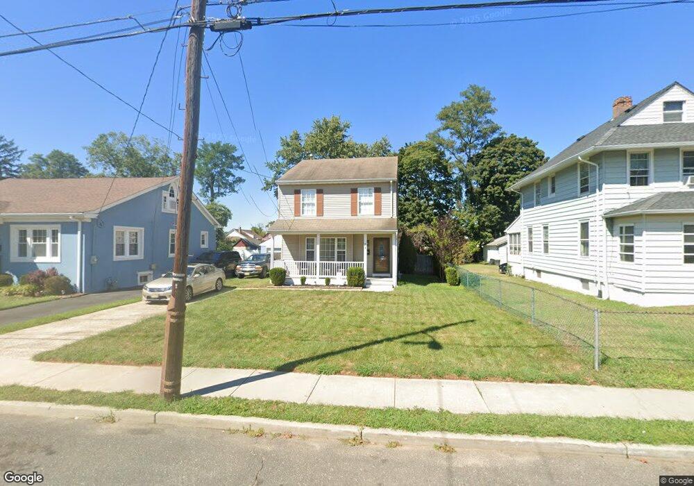
74 W Westside Ave Red Bank, NJ 07701
Estimated Value: $626,000 - $842,000
3
Beds
2
Baths
1,428
Sq Ft
$481/Sq Ft
Est. Value
About This Home
This home is located at 74 W Westside Ave, Red Bank, NJ 07701 and is currently estimated at $687,415, approximately $481 per square foot. 74 W Westside Ave is a home located in Monmouth County with nearby schools including Red Bank Primary School, Red Bank Middle School, and Red Bank Regional High School.
Ownership History
Date
Name
Owned For
Owner Type
Purchase Details
Closed on
Jun 22, 2006
Sold by
Tharrington Rickey
Bought by
Tharrington Rickey
Current Estimated Value
Home Financials for this Owner
Home Financials are based on the most recent Mortgage that was taken out on this home.
Original Mortgage
$297,648
Interest Rate
6.6%
Mortgage Type
FHA
Purchase Details
Closed on
Nov 29, 1996
Sold by
Foxworth Const
Bought by
Tharrington Rickey and Tharrington Mary
Home Financials for this Owner
Home Financials are based on the most recent Mortgage that was taken out on this home.
Original Mortgage
$109,000
Interest Rate
7.57%
Create a Home Valuation Report for This Property
The Home Valuation Report is an in-depth analysis detailing your home's value as well as a comparison with similar homes in the area
Home Values in the Area
Average Home Value in this Area
Purchase History
| Date | Buyer | Sale Price | Title Company |
|---|---|---|---|
| Tharrington Rickey | -- | -- | |
| Tharrington Rickey | $115,000 | -- |
Source: Public Records
Mortgage History
| Date | Status | Borrower | Loan Amount |
|---|---|---|---|
| Previous Owner | Tharrington Rickey | $297,648 | |
| Previous Owner | Tharrington Rickey | $109,000 |
Source: Public Records
Tax History Compared to Growth
Tax History
| Year | Tax Paid | Tax Assessment Tax Assessment Total Assessment is a certain percentage of the fair market value that is determined by local assessors to be the total taxable value of land and additions on the property. | Land | Improvement |
|---|---|---|---|---|
| 2025 | $8,183 | $463,500 | $205,300 | $258,200 |
| 2024 | $7,749 | $433,200 | $185,300 | $247,900 |
| 2023 | $7,749 | $405,500 | $164,500 | $241,000 |
| 2022 | $7,255 | $397,300 | $147,800 | $249,500 |
| 2021 | $7,255 | $324,300 | $98,500 | $225,800 |
| 2020 | $6,918 | $304,500 | $98,500 | $206,000 |
| 2019 | $6,598 | $298,400 | $98,500 | $199,900 |
| 2018 | $6,364 | $291,000 | $98,500 | $192,500 |
| 2017 | $6,113 | $289,700 | $98,500 | $191,200 |
| 2016 | $6,051 | $287,200 | $98,500 | $188,700 |
| 2015 | $6,030 | $296,600 | $134,300 | $162,300 |
| 2014 | $6,902 | $360,800 | $198,500 | $162,300 |
Source: Public Records
Map
Nearby Homes
- 5 Clifford Graves Ct
- 11 Clifford Graves Ct
- 49 Sunset Ave W
- 44 Sunset Ave W
- 19 Sunset Ave E
- 38 Bank St
- 167 River St
- 39 Sunset Ave E
- 54 Steven Ave
- 121 Catherine St
- 23 Cedar Crossing
- 56 Plum St
- 3 Cedar Crossing
- 24 Cedar Crossing
- 26 River St
- 10 Hance Ave
- 125 Springdale Ave
- 171-173 Bridge Ave
- 159 Bridge Ave
- 132 Trafford St
- 76 W Westside Ave
- 72 W Westside Ave
- 80 W Westside Ave
- 90 W Westside Ave
- 77 Sunset Ave W
- 79 Sunset Ave W
- 71 Sunset Ave W
- 75 W Westside Ave
- 77 W Westside Ave
- 83 Sunset Ave W
- 81 W Westside Ave
- 67 Sunset Ave W
- 87 Sunset Ave W
- 69 W Westside Ave
- 92 W Westside Ave
- 73 W Westside Ave
- 71 W Westside Ave
- 246 Leighton Ave
- 65 Sunset Ave W
- 91 Sunset Ave W