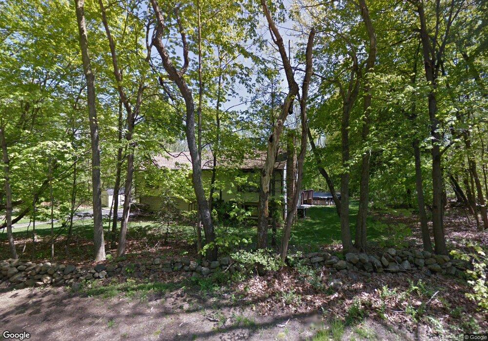
74 Walbridge Hill Rd Tolland, CT 06084
Estimated Value: $351,000 - $402,962
3
Beds
3
Baths
1,300
Sq Ft
$287/Sq Ft
Est. Value
About This Home
This home is located at 74 Walbridge Hill Rd, Tolland, CT 06084 and is currently estimated at $373,241, approximately $287 per square foot. 74 Walbridge Hill Rd is a home located in Tolland County with nearby schools including Birch Grove Primary School, Tolland Intermediate School, and Tolland Middle School.
Ownership History
Date
Name
Owned For
Owner Type
Purchase Details
Closed on
Jan 31, 2005
Sold by
Ordinas-Lewis Jose and Ordinas-Lewis Katherine
Bought by
Langlais Jill and Langlais Carl
Current Estimated Value
Home Financials for this Owner
Home Financials are based on the most recent Mortgage that was taken out on this home.
Original Mortgage
$235,200
Interest Rate
5.67%
Purchase Details
Closed on
Aug 31, 2001
Sold by
Caminiti James and Caminiti Shannon
Bought by
Ordinas-Lewis Jose and Dyer Katherine
Purchase Details
Closed on
Aug 3, 1998
Sold by
Cuffe John and Cuffe Jeanette
Bought by
Caminiti James and Caminiti Shannon
Create a Home Valuation Report for This Property
The Home Valuation Report is an in-depth analysis detailing your home's value as well as a comparison with similar homes in the area
Home Values in the Area
Average Home Value in this Area
Purchase History
| Date | Buyer | Sale Price | Title Company |
|---|---|---|---|
| Langlais Jill | $235,200 | -- | |
| Langlais Jill | $235,200 | -- | |
| Ordinas-Lewis Jose | $184,900 | -- | |
| Ordinas-Lewis Jose | $184,900 | -- | |
| Caminiti James | $145,000 | -- | |
| Caminiti James | $145,000 | -- |
Source: Public Records
Mortgage History
| Date | Status | Borrower | Loan Amount |
|---|---|---|---|
| Open | Caminiti James | $186,000 | |
| Closed | Caminiti James | $235,200 |
Source: Public Records
Tax History Compared to Growth
Tax History
| Year | Tax Paid | Tax Assessment Tax Assessment Total Assessment is a certain percentage of the fair market value that is determined by local assessors to be the total taxable value of land and additions on the property. | Land | Improvement |
|---|---|---|---|---|
| 2025 | $5,574 | $205,000 | $64,800 | $140,200 |
| 2024 | $5,488 | $145,300 | $61,700 | $83,600 |
| 2023 | $5,424 | $145,300 | $61,700 | $83,600 |
| 2022 | $5,278 | $144,300 | $61,700 | $82,600 |
| 2021 | $5,355 | $144,300 | $61,700 | $82,600 |
| 2020 | $5,202 | $144,300 | $61,700 | $82,600 |
| 2019 | $5,072 | $140,700 | $63,600 | $77,100 |
| 2018 | $4,925 | $140,700 | $63,600 | $77,100 |
| 2017 | $4,811 | $140,700 | $63,600 | $77,100 |
| 2016 | $4,811 | $140,700 | $63,600 | $77,100 |
| 2015 | $4,694 | $140,700 | $63,600 | $77,100 |
| 2014 | $4,751 | $153,000 | $70,600 | $82,400 |
Source: Public Records
Map
Nearby Homes
- 527 Merrow Rd
- 454 Merrow Rd
- 10 Summit Dr
- 88 Anthony Rd
- 312 Merrow Rd
- 10 Depot Rd Unit 25
- 284 Merrow Rd
- 97 Cassidy Hill Rd
- 226 Goose Ln
- 248 Merrow Rd
- 6 Timber Ln
- 38 Homestead Dr
- 19 Thomas Dr
- 12 Stone Pond Rd
- 18 Stone Pond Rd
- 35 Fern Dr
- 300 Geraldine Dr
- 38 Crystal Ln Unit D
- 45 Crystal Ln Unit D
- 4 Elgin Dr
- 77 Walbridge Hill Rd
- 84 Walbridge Hill Rd
- 98 Walbridge Hill Rd
- 99 Walbridge Hill Rd
- 80 Walbridge Hill Rd
- 70 Walbridge Hill Rd
- 56 Walbridge Hill Rd
- 57 Walbridge Hill Rd
- 11 Hughs Rd
- 104 Walbridge Hill Rd
- 109 Walbridge Hill Rd
- 49 Walbridge Hill Rd
- 100 Walbridge Hill Rd
- 46 Walbridge Hill Rd
- 16 Hughs Rd
- 146 Virginia Ln
- 117 Walbridge Hill Rd
- 12 Hughs Rd
- 83 Walbridge Hill Rd
- 43 Walbridge Hill Rd