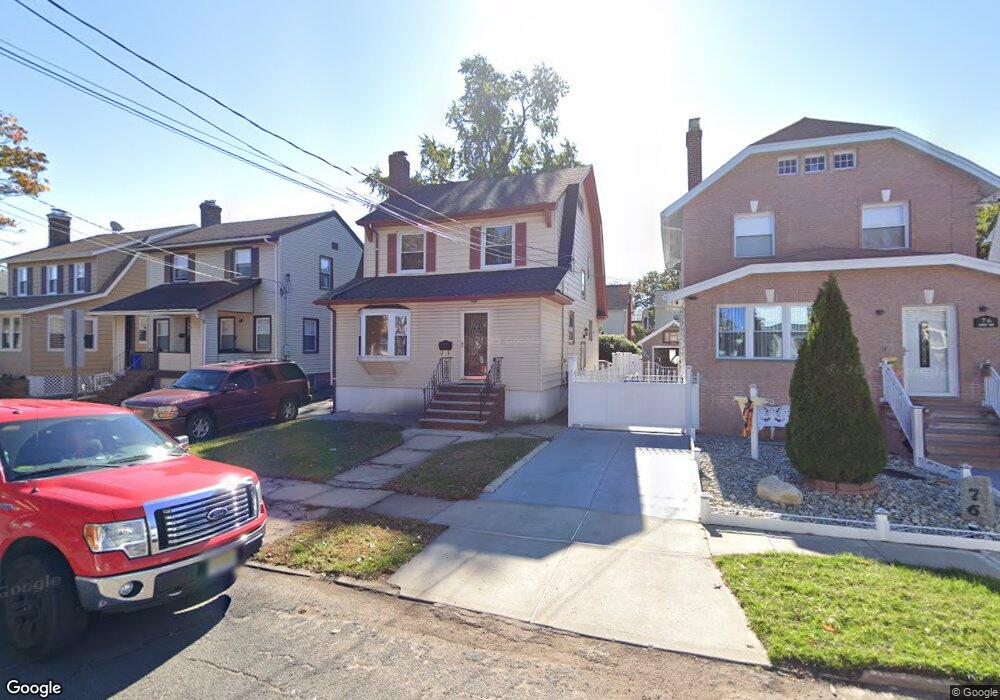
74 Waldo Ave Bloomfield, NJ 07003
Estimated Value: $451,795 - $517,000
--
Bed
--
Bath
1,402
Sq Ft
$346/Sq Ft
Est. Value
About This Home
This home is located at 74 Waldo Ave, Bloomfield, NJ 07003 and is currently estimated at $484,449, approximately $345 per square foot. 74 Waldo Ave is a home located in Essex County with nearby schools including Carteret School, Bloomfield Middle School, and Bloomfield High School.
Ownership History
Date
Name
Owned For
Owner Type
Purchase Details
Closed on
Jun 23, 2003
Current Estimated Value
Purchase Details
Closed on
Jun 30, 1998
Sold by
Grady Sheryl Ann
Bought by
Degraw Frank P and Romero Jacqueline C
Home Financials for this Owner
Home Financials are based on the most recent Mortgage that was taken out on this home.
Original Mortgage
$114,929
Interest Rate
7.02%
Purchase Details
Closed on
Aug 5, 1991
Sold by
Grady Sr Richrd T and Grady Shirley M
Bought by
Grady Richard T and Shirley Et Als
Create a Home Valuation Report for This Property
The Home Valuation Report is an in-depth analysis detailing your home's value as well as a comparison with similar homes in the area
Home Values in the Area
Average Home Value in this Area
Purchase History
| Date | Buyer | Sale Price | Title Company |
|---|---|---|---|
| -- | $210,000 | -- | |
| Degraw Frank P | $115,000 | -- | |
| Grady Richard T | -- | -- | |
| Grady Sheryl Ann | -- | -- |
Source: Public Records
Mortgage History
| Date | Status | Borrower | Loan Amount |
|---|---|---|---|
| Previous Owner | Degraw Frank P | $114,929 |
Source: Public Records
Tax History Compared to Growth
Tax History
| Year | Tax Paid | Tax Assessment Tax Assessment Total Assessment is a certain percentage of the fair market value that is determined by local assessors to be the total taxable value of land and additions on the property. | Land | Improvement |
|---|---|---|---|---|
| 2025 | $9,696 | $296,700 | $90,400 | $206,300 |
| 2024 | $9,696 | $296,700 | $90,400 | $206,300 |
| 2022 | $9,500 | $296,700 | $90,400 | $206,300 |
| 2021 | $9,325 | $296,700 | $90,400 | $206,300 |
| 2020 | $9,183 | $296,700 | $90,400 | $206,300 |
| 2019 | $8,225 | $206,600 | $89,000 | $117,600 |
| 2018 | $8,190 | $206,600 | $89,000 | $117,600 |
| 2017 | $7,890 | $206,600 | $89,000 | $117,600 |
| 2016 | $7,801 | $206,600 | $89,000 | $117,600 |
| 2015 | $7,730 | $206,600 | $89,000 | $117,600 |
| 2014 | $7,589 | $206,600 | $89,000 | $117,600 |
Source: Public Records
Map
Nearby Homes
- 107 La France Ave
- 413 Beardsley Ave Unit 3
- 413 Beardsley Ave
- 18 Whitman Ave
- 149 Leslie St
- 7 Whitman Ave
- 28 Lafayette Ave
- 12 Madison Ave
- 17 Chauncey Ave
- 220 N 17th St
- 228 N 17th St
- 42 La France Ave
- 205 N 15th St
- 141 N 16th St
- 65 Leslie St
- 527 N Grove St
- 159 N 15th St
- 200 N 15th St
- 110 N 17th St
- 509 N Grove St