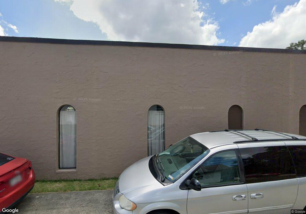
740 Bankhead Hwy Carrollton, GA 30117
Estimated Value: $167,134
--
Bed
--
Bath
1,770
Sq Ft
$94/Sq Ft
Est. Value
About This Home
This home is located at 740 Bankhead Hwy, Carrollton, GA 30117 and is currently estimated at $167,134, approximately $94 per square foot. 740 Bankhead Hwy is a home located in Carroll County with nearby schools including Carrollton Elementary School, Carrollton Upper Elementary School, and Carrollton Middle School.
Ownership History
Date
Name
Owned For
Owner Type
Purchase Details
Closed on
Oct 4, 2017
Sold by
Mcrae Beverly T
Bought by
Sbh Capital Llc
Current Estimated Value
Purchase Details
Closed on
Jun 15, 2005
Sold by
Cole Fam Partnership Lp
Bought by
Mcrae Paul H
Purchase Details
Closed on
Dec 3, 1997
Sold by
Cole Woodfin
Bought by
Cole Woodfin
Purchase Details
Closed on
Dec 1, 1997
Sold by
Ellis Tony and Ellis Ronald
Bought by
Cole Woodfin
Purchase Details
Closed on
Oct 1, 1997
Sold by
Cole Marion Etal
Bought by
Cole Family Partners
Purchase Details
Closed on
Sep 30, 1997
Sold by
Cole Woodfin Est
Bought by
Cole Marion Etal
Purchase Details
Closed on
May 1, 1980
Bought by
Cole Woodfin
Create a Home Valuation Report for This Property
The Home Valuation Report is an in-depth analysis detailing your home's value as well as a comparison with similar homes in the area
Home Values in the Area
Average Home Value in this Area
Purchase History
| Date | Buyer | Sale Price | Title Company |
|---|---|---|---|
| Sbh Capital Llc | $80,000 | -- | |
| Mcrae Beverly T | -- | -- | |
| Mcrae Paul H | $140,000 | -- | |
| Cole Woodfin | -- | -- | |
| Cole Woodfin | -- | -- | |
| Cole Family Partners | -- | -- | |
| Cole Marion Etal | -- | -- | |
| Cole Woodfin | -- | -- |
Source: Public Records
Tax History Compared to Growth
Tax History
| Year | Tax Paid | Tax Assessment Tax Assessment Total Assessment is a certain percentage of the fair market value that is determined by local assessors to be the total taxable value of land and additions on the property. | Land | Improvement |
|---|---|---|---|---|
| 2024 | $2,741 | $100,318 | $18,822 | $81,496 |
| 2023 | $2,386 | $81,738 | $18,822 | $62,916 |
| 2022 | $1,934 | $66,260 | $17,216 | $49,044 |
| 2021 | $1,814 | $62,157 | $17,216 | $44,941 |
| 2020 | $1,796 | $61,457 | $17,216 | $44,241 |
| 2019 | $1,813 | $61,457 | $17,216 | $44,241 |
| 2018 | $1,812 | $60,544 | $17,216 | $43,328 |
Source: Public Records
Map
Nearby Homes
- 0 Carroll Cir Unit LOTS 4-8 10571562
- 403 Burns Rd
- 0 Carroll Cir- Lots 4-8 Unit 148012
- 150 Cedar Park Way
- 3 Burns Rd
- 2 Burns Rd
- 204 Burns Rd
- 0 Burns Rd Unit LOT 2 10571612
- 0 Burns Rd Unit LOT 3 10571635
- 0 Burns Rd Unit LOT 1 10571595
- 0 Burns Rd Unit 148013
- 223 N Lakeshore Dr
- 231 N Lakeshore Dr
- 114 Green Point Way
- 325 Almon Rd
- 123 Autumn Glen Dr
- 119 Oxford Square
- 115 N Lake Dr
- 1711B Bankhead Hwy
- 111 Lakeview Dr
- 736 Bankhead Hwy
- 744 Bankhead Hwy Unit A/B
- 744 Bankhead Hwy
- 744 1/2 Bankhead Hwy
- 750 Bankhead Hwy
- 800 Bankhead Hwy
- 704 Bankhead Hwy
- 741 Almon Rd
- 826 Bankhead Hwy
- 117 Carroll Cir
- 635 Almon Rd
- 637 Almon Rd
- 126 Carroll Cir
- 705 Almon Rd
- 124 Carroll Cir
- 118 Shannon Dr
- 118 Shannon Dr
- 118 Shannon Dr
- 118 Shannon Dr
- 118 Shannon Dr