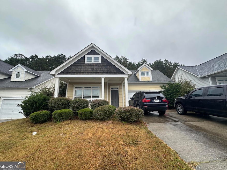
740 Ivy Brook Way Macon, GA 31210
Estimated payment $1,325/month
Highlights
- City View
- Ranch Style House
- Community Pool
- Clubhouse
- High Ceiling
- Den
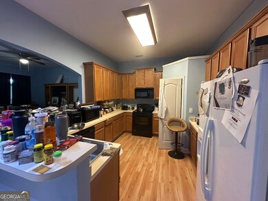
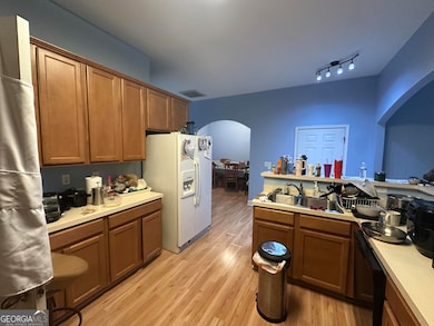
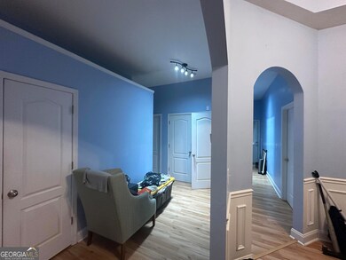
About This Home
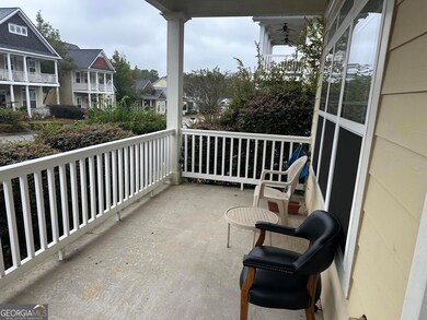
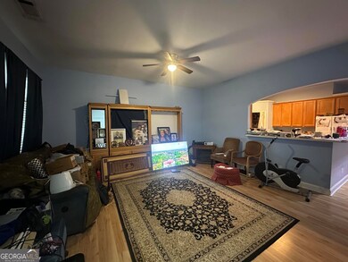
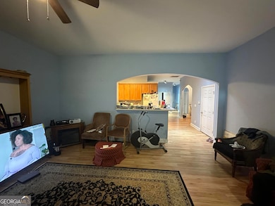
Located in The Highlands, this one level, 3BR, 2BA is ready to move into. Open floor plan concept, with 1708 square feet of living space, a high ceiling in the great room, the kitchen has a breakfast bar area, and a separate dining room. The Highlands feature an Olympic sized pool, Clubhouse, Dog park, and playground. Home is currently occupied but will be delivered vacant at closing. Home is being sold as-is.
Home Details
Home Type
- Single Family
Est. Annual Taxes
- $1,776
Year Built
- Built in 2005 | Remodeled
Lot Details
- 9,583 Sq Ft Lot
HOA Fees
- $125 Monthly HOA Fees
Parking
- 2 Car Garage
Home Design
- Ranch Style House
- Composition Roof
- Wood Siding
Interior Spaces
- 1,708 Sq Ft Home
- High Ceiling
- Den
- City Views
Kitchen
- Cooktop
- Dishwasher
Flooring
- Carpet
- Laminate
- Tile
Bedrooms and Bathrooms
- 3 Main Level Bedrooms
- 2 Full Bathrooms
- Double Vanity
Laundry
- Laundry Room
- Laundry in Hall
Schools
- Carter Elementary School
- Howard Middle School
- Howard High School
Utilities
- Central Heating and Cooling System
- High Speed Internet
- Phone Available
- Cable TV Available
Community Details
Overview
- Highlands Subdivision
Amenities
- Clubhouse
Recreation
- Community Playground
- Community Pool
Map
Home Values in the Area
Average Home Value in this Area
Tax History
| Year | Tax Paid | Tax Assessment Tax Assessment Total Assessment is a certain percentage of the fair market value that is determined by local assessors to be the total taxable value of land and additions on the property. | Land | Improvement |
|---|---|---|---|---|
| 2025 | $1,800 | $73,247 | $8,000 | $65,247 |
| 2024 | $1,702 | $67,033 | $8,000 | $59,033 |
| 2023 | $1,702 | $67,033 | $8,000 | $59,033 |
| 2022 | $2,007 | $64,968 | $12,400 | $52,568 |
| 2021 | $1,717 | $52,190 | $10,136 | $42,054 |
| 2020 | $1,719 | $51,276 | $10,136 | $41,140 |
| 2019 | $1,411 | $43,047 | $7,240 | $35,807 |
| 2018 | $2,266 | $41,798 | $7,240 | $34,558 |
| 2017 | $1,304 | $41,798 | $7,240 | $34,558 |
| 2016 | $1,204 | $41,798 | $7,240 | $34,558 |
| 2015 | $1,225 | $41,798 | $7,240 | $34,558 |
| 2014 | $2,050 | $41,798 | $7,240 | $34,558 |
Property History
| Date | Event | Price | List to Sale | Price per Sq Ft |
|---|---|---|---|---|
| 11/11/2025 11/11/25 | For Sale | $199,900 | -- | $117 / Sq Ft |
Purchase History
| Date | Type | Sale Price | Title Company |
|---|---|---|---|
| Warranty Deed | $80,000 | None Available | |
| Warranty Deed | $157,700 | Not Available | |
| Deed | $285,000 | -- |
Mortgage History
| Date | Status | Loan Amount | Loan Type |
|---|---|---|---|
| Previous Owner | $156,950 | Adjustable Rate Mortgage/ARM |
Source: Georgia MLS
MLS Number: 10641994
APN: M071-0137
Disclaimer: Certain information contained herein is derived from information provided by parties other than Homes.com. All information provided is deemed reliable, but is not guaranteed to be accurate and should be independently verified.
![]() The data relating to real estate for sale on this web site comes in part from the Broker Reciprocity Program of Georgia MLS. Real estate listings held by brokerage firms other than Redfin are marked with the Broker Reciprocity logo and detailed information about them includes the name of the listing brokers. Information deemed reliable but not guaranteed. Copyright 2025 Georgia MLS. All rights reserved.
The data relating to real estate for sale on this web site comes in part from the Broker Reciprocity Program of Georgia MLS. Real estate listings held by brokerage firms other than Redfin are marked with the Broker Reciprocity logo and detailed information about them includes the name of the listing brokers. Information deemed reliable but not guaranteed. Copyright 2025 Georgia MLS. All rights reserved.
- 715 Ivy Brook Way
- 776 Ivy Brook Way
- 631 Ivy Brook Way
- 2006 Fall Harvest Dr Unit LOT 278
- 2002 Fall Harvest Dr Unit LOT 280
- 2006 Fall Harvest Dr
- 2002 Fall Harvest Dr
- 2008 Fall Harvest Dr Unit LOT 277
- 2004 Fall Harvest Dr
- 2010 Fall Harvest Dr Unit LOT 276
- 2010 Fall Harvest Dr
- 2008 Fall Harvest Dr
- 2004 Fall Harvest Dr Unit LOT 279
- 785 Ivy Brook Way
- 621 Ivy Brook Way
- 534 Ivy Brook Way
- 4508 Bon Ayer Cir
- 644 Ivy Brook Way
- 107 Cold Creek Pkwy
- 342 Ironwood Ct
- 354 Ironwood Ct
- 360 Ironwood Ct
- 366 Ironwood Ct
- 345 Ironwood Ct
- 116 Poplar Pass
- 3620 Earl St Unit A
- 3620 Earl St
- 4582 Shadow Lawn Dr
- 3867 Log Cabin Dr
- 114 Emily St
- 4715 Pine Valley Dr
- 3778 Log Cabin Dr
- 3808 Fairmont Ave Unit A
- 4075 Meadowbrook Dr
- 4786 High Oak Dr
- 4151 Log Cabin Dr
- 1187 Edna Place
