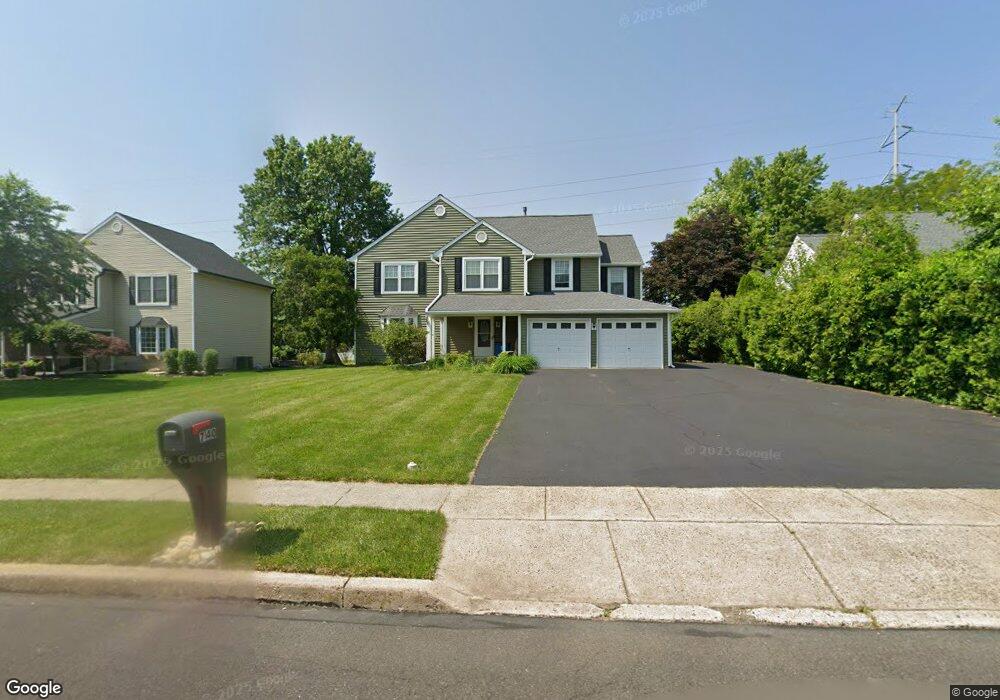
740 Jarrett Rd Horsham, PA 19044
Estimated Value: $628,000 - $788,000
4
Beds
3
Baths
2,507
Sq Ft
$275/Sq Ft
Est. Value
About This Home
This home is located at 740 Jarrett Rd, Horsham, PA 19044 and is currently estimated at $690,375, approximately $275 per square foot. 740 Jarrett Rd is a home located in Montgomery County with nearby schools including Simmons Elementary School, Keith Valley Middle School, and Hatboro-Horsham Senior High School.
Ownership History
Date
Name
Owned For
Owner Type
Purchase Details
Closed on
Dec 1, 2017
Sold by
Sawyer William C and Sawyer Margaret M
Bought by
Patel Rena
Current Estimated Value
Home Financials for this Owner
Home Financials are based on the most recent Mortgage that was taken out on this home.
Original Mortgage
$296,000
Outstanding Balance
$164,788
Interest Rate
3.94%
Mortgage Type
New Conventional
Estimated Equity
$525,587
Purchase Details
Closed on
Mar 31, 1988
Bought by
Sawyer William C and Sawyer Margaret M
Create a Home Valuation Report for This Property
The Home Valuation Report is an in-depth analysis detailing your home's value as well as a comparison with similar homes in the area
Home Values in the Area
Average Home Value in this Area
Purchase History
| Date | Buyer | Sale Price | Title Company |
|---|---|---|---|
| Patel Rena | $370,000 | -- | |
| Sawyer William C | $179,000 | -- |
Source: Public Records
Mortgage History
| Date | Status | Borrower | Loan Amount |
|---|---|---|---|
| Open | Patel Rena | $296,000 |
Source: Public Records
Tax History Compared to Growth
Tax History
| Year | Tax Paid | Tax Assessment Tax Assessment Total Assessment is a certain percentage of the fair market value that is determined by local assessors to be the total taxable value of land and additions on the property. | Land | Improvement |
|---|---|---|---|---|
| 2025 | $7,490 | $190,560 | $48,700 | $141,860 |
| 2024 | $7,490 | $190,560 | $48,700 | $141,860 |
| 2023 | $7,130 | $190,560 | $48,700 | $141,860 |
| 2022 | $6,899 | $190,560 | $48,700 | $141,860 |
| 2021 | $6,736 | $190,560 | $48,700 | $141,860 |
| 2020 | $6,577 | $190,560 | $48,700 | $141,860 |
| 2019 | $3,794 | $190,560 | $48,700 | $141,860 |
| 2018 | $5,489 | $190,560 | $48,700 | $141,860 |
| 2017 | $6,162 | $190,560 | $48,700 | $141,860 |
| 2016 | $6,088 | $190,560 | $48,700 | $141,860 |
| 2015 | $5,815 | $190,560 | $48,700 | $141,860 |
| 2014 | $5,815 | $190,560 | $48,700 | $141,860 |
Source: Public Records
Map
Nearby Homes
- 221 Winchester Dr
- 603 Norristown Rd
- 124 Sarahs Ln
- 45 Ember Ln
- 585 Colonial Dr
- 80 Whetstone Rd
- 2 Cedarbrook Dr
- 18 Hunt Dr
- 4 Beaver Hill Rd
- 45 Brookside Ct
- 44 Brookside Ct Unit 44
- 8 Barrel Stave Cir
- 15 Barrel Stave Cir
- 6 Pheasant Run
- 132 Hunt Dr
- 3 Emily Ct
- 159 Hunt Dr
- 454 1/2 Avenue A Unit A
- 43 Black Watch Ct
- Lot 46 Bryce Dr
- 742 Jarrett Rd
- 738 Jarrett Rd
- 736 Jarrett Rd
- 744 Jarrett Rd
- 101 Victoria Ln
- 737 Jarrett Rd
- 734 Jarrett Rd
- 739 Jarrett Rd
- 100 Victoria Ln
- 103 Victoria Ln
- 237 Winchester Dr
- 732 Jarrett Rd
- 741 Jarrett Rd
- 239 Winchester Dr
- 105 Victoria Ln
- 102 Victoria Ln
- 126 Victoria Ln
- 241 Winchester Dr
- 521 Norristown Rd
- 235 Winchester Dr