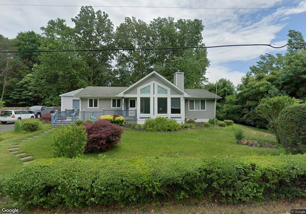
740 Kentucky Ave South Haven, MI 49090
Estimated Value: $284,000 - $457,000
--
Bed
--
Bath
1,610
Sq Ft
$244/Sq Ft
Est. Value
About This Home
This home is located at 740 Kentucky Ave, South Haven, MI 49090 and is currently estimated at $392,971, approximately $244 per square foot. 740 Kentucky Ave is a home located in Van Buren County with nearby schools including South Haven High School, St. Basil School, and St. Paul Lutheran School.
Ownership History
Date
Name
Owned For
Owner Type
Purchase Details
Closed on
Jul 17, 2015
Sold by
Wood Deanna D and Millard Deanna D
Bought by
Wood William L
Current Estimated Value
Home Financials for this Owner
Home Financials are based on the most recent Mortgage that was taken out on this home.
Original Mortgage
$167,000
Outstanding Balance
$130,896
Interest Rate
4.01%
Mortgage Type
New Conventional
Estimated Equity
$262,075
Purchase Details
Closed on
Oct 27, 1995
Sold by
Hornbrook James Leo and Hornbrook Lois L
Bought by
Wood William L and Wood Deanna D
Create a Home Valuation Report for This Property
The Home Valuation Report is an in-depth analysis detailing your home's value as well as a comparison with similar homes in the area
Home Values in the Area
Average Home Value in this Area
Purchase History
| Date | Buyer | Sale Price | Title Company |
|---|---|---|---|
| Wood William L | -- | Chicago Title Of Michigan | |
| Wood William L | $68,000 | -- |
Source: Public Records
Mortgage History
| Date | Status | Borrower | Loan Amount |
|---|---|---|---|
| Open | Wood William L | $167,000 |
Source: Public Records
Tax History Compared to Growth
Tax History
| Year | Tax Paid | Tax Assessment Tax Assessment Total Assessment is a certain percentage of the fair market value that is determined by local assessors to be the total taxable value of land and additions on the property. | Land | Improvement |
|---|---|---|---|---|
| 2025 | $4,020 | $184,600 | $0 | $0 |
| 2024 | $2,962 | $160,300 | $0 | $0 |
| 2023 | $2,836 | $135,600 | $0 | $0 |
| 2022 | $3,603 | $114,100 | $0 | $0 |
| 2021 | $3,454 | $112,500 | $44,200 | $68,300 |
| 2020 | $3,445 | $113,700 | $43,200 | $70,500 |
| 2019 | $3,307 | $79,000 | $79,000 | $0 |
| 2018 | $3,968 | $94,800 | $94,800 | $0 |
| 2017 | $3,905 | $112,100 | $0 | $0 |
| 2016 | $3,787 | $112,000 | $0 | $0 |
| 2015 | $2,737 | $112,000 | $0 | $0 |
| 2014 | $2,687 | $118,800 | $0 | $0 |
| 2013 | $3,310 | $117,200 | $117,200 | $0 |
Source: Public Records
Map
Nearby Homes
- Harbor Club 1870 Plan at Harbor Club
- Harbor Club 2390 Plan at Harbor Club
- Harbor Club 1680 Plan at Harbor Club
- Harbor Club 2100 Plan at Harbor Club
- Harbor Club 2070 Plan at Harbor Club
- Harbor Club 2700 Plan at Harbor Club
- Harbor Club 2200 Plan at Harbor Club
- Harbor Club 3100 Plan at Harbor Club
- Harbor Club K2015 Plan at Harbor Club
- 665 Meadow Dr
- 653 Preserve Dr
- 355 Preserve Dr
- 500 Virginia Ave Unit 33
- 7433 Baseline Rd
- 448 Baseline Rd
- 1 N Bailey Ave Unit 5
- 1 N Bailey Ave Unit 2
- 1 N Bailey Ave Unit 1
- 40 N Bailey Ave Unit 39
- 246 Webster Ave
- 732 Kentucky Ave
- 736 Kentucky Ave
- 722 Woodland Circle Dr Unit 70
- 722 Woodland Circle Dr
- 720 Woodland Circle Dr
- 720 Woodland Circle Dr Unit 71
- 718 Woodland Circle Dr
- 718 Woodland Circle Dr Unit 72
- 365 Woodland Circle Dr
- 721 Woodland Circle Dr
- 748 Kentucky Ave
- 363 Woodland Circle Dr
- 650 Kentucky Ave
- 394 Baseline Rd
- 719 Woodland Circle Dr
- 719 Woodland Circle Dr Unit 68
- 358 Baseline Rd
- 355 Woodland Circle Dr
- 717 Woodland Circle Dr
- 0 Woodland Circle Dr