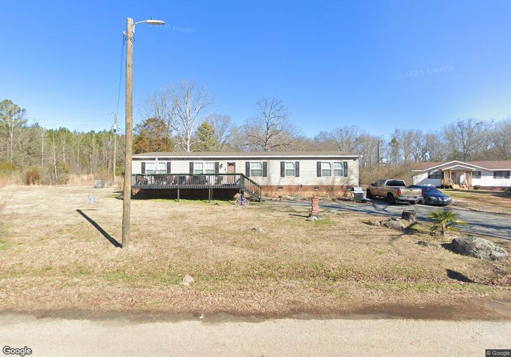
740 Kinghurst Dr Rock Hill, SC 29730
Estimated Value: $266,000 - $426,000
--
Bed
--
Bath
2,176
Sq Ft
$151/Sq Ft
Est. Value
About This Home
This home is located at 740 Kinghurst Dr, Rock Hill, SC 29730 and is currently estimated at $328,502, approximately $150 per square foot. 740 Kinghurst Dr is a home located in York County with nearby schools including Castle Heights Middle School, Rock Hill High School, and St. Anne Catholic School.
Ownership History
Date
Name
Owned For
Owner Type
Purchase Details
Closed on
Dec 21, 2020
Sold by
Mccoy Laquentus Bernard
Bought by
Armstrong Tiarra
Current Estimated Value
Home Financials for this Owner
Home Financials are based on the most recent Mortgage that was taken out on this home.
Original Mortgage
$127,632
Interest Rate
2.8%
Mortgage Type
New Conventional
Purchase Details
Closed on
Nov 5, 2020
Sold by
Annette Armstrong Macie
Bought by
Mccoy Laquentus Bernard
Home Financials for this Owner
Home Financials are based on the most recent Mortgage that was taken out on this home.
Original Mortgage
$127,632
Interest Rate
2.8%
Mortgage Type
New Conventional
Purchase Details
Closed on
Mar 28, 2007
Sold by
Whitlock Whitlock Patsy Lashawn Patsy Lashawn and Whitlock Davis Maggie
Bought by
Armstrong Macie Annette
Purchase Details
Closed on
Nov 5, 2004
Sold by
Whitlock Essie Mae S
Bought by
Armstrong Macie Annette and Whitlock Patsy Lashawn
Create a Home Valuation Report for This Property
The Home Valuation Report is an in-depth analysis detailing your home's value as well as a comparison with similar homes in the area
Home Values in the Area
Average Home Value in this Area
Purchase History
| Date | Buyer | Sale Price | Title Company |
|---|---|---|---|
| Armstrong Tiarra | -- | None Available | |
| Mccoy Laquentus Bernard | -- | None Listed On Document | |
| Armstrong Macie Annette | -- | None Available | |
| Armstrong Macie Annette | $500 | -- |
Source: Public Records
Mortgage History
| Date | Status | Borrower | Loan Amount |
|---|---|---|---|
| Previous Owner | Mccoy Laquentus Bernard | $127,632 |
Source: Public Records
Tax History Compared to Growth
Tax History
| Year | Tax Paid | Tax Assessment Tax Assessment Total Assessment is a certain percentage of the fair market value that is determined by local assessors to be the total taxable value of land and additions on the property. | Land | Improvement |
|---|---|---|---|---|
| 2024 | $858 | $6,112 | $1,120 | $4,992 |
| 2023 | $161 | $1,120 | $1,120 | $0 |
| 2022 | $162 | $1,120 | $1,120 | $0 |
| 2021 | -- | $4,315 | $1,680 | $2,635 |
| 2020 | $834 | $2,484 | $0 | $0 |
| 2019 | $748 | $2,160 | $0 | $0 |
| 2018 | $733 | $2,160 | $0 | $0 |
| 2017 | $701 | $2,160 | $0 | $0 |
| 2016 | $679 | $2,160 | $0 | $0 |
| 2014 | $659 | $2,160 | $840 | $1,320 |
| 2013 | $659 | $2,220 | $840 | $1,380 |
Source: Public Records
Map
Nearby Homes
- Tract A Porter Rd
- Tract 4 Porter Rd
- 411 Mint St
- 366 Catherine St
- 1343 Christopher Cir
- 350 Catherine St
- 348 Catherine St
- 369 S Workman St
- 2510 Firetower Rd
- 1447 Sullivan St
- 1233 Pinewood Rd
- 631 Anderson Rd S
- 234 Marshall St
- 1066 Tremont Ave
- 1033 Christopher Cir Unit 15
- 2488 Catawba Church Rd
- 210 Marshall St
- 442 Lovelace Rd
- 215 Keels Ave
- 402 Keels Ave
- 740 Kinghurst Dr
- 746 Kinghurst Dr
- 1681 Hinesdale Dr
- 1689 Hinesdale Dr
- 651 Porter Rd
- 645 Porter Rd
- 655 Porter Rd
- 401 Castlewood Cir
- 661 Porter Rd
- 411 Castlewood Cir
- 411 Castlewood Cir
- 675 Porter Rd
- 417 Castlewood Cir
- 524 Porter Rd
- 685 Porter Rd
- 701 Porter Rd
- 412 Castlewood Cir
- 429 Castlewood Cir
- 424 Castlewood Cir
- 505 Porter Rd