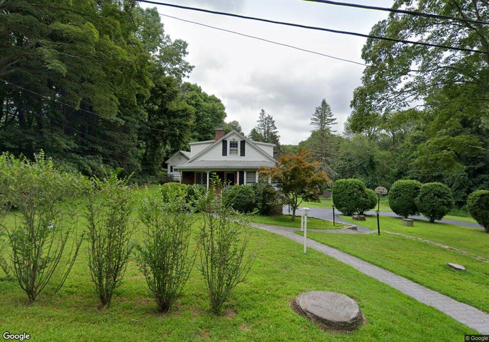
740 Morehouse Rd Unit 744 Easton, CT 06612
Estimated Value: $691,000 - $801,000
3
Beds
3
Baths
1,747
Sq Ft
$432/Sq Ft
Est. Value
About This Home
This home is located at 740 Morehouse Rd Unit 744, Easton, CT 06612 and is currently estimated at $754,797, approximately $432 per square foot. 740 Morehouse Rd Unit 744 is a home located in Fairfield County with nearby schools including Samuel Staples Elementary School, Helen Keller Middle School, and Joel Barlow High School.
Ownership History
Date
Name
Owned For
Owner Type
Purchase Details
Closed on
Dec 28, 2023
Sold by
Kovac Gloria R
Bought by
Gloria R Kovac 2019 Relt R and Gloria Kovac
Current Estimated Value
Purchase Details
Closed on
Dec 9, 2019
Sold by
Kovac Edward J and Kovac Gloria R
Bought by
Kovac Edward J and Kovac Gloria R
Create a Home Valuation Report for This Property
The Home Valuation Report is an in-depth analysis detailing your home's value as well as a comparison with similar homes in the area
Home Values in the Area
Average Home Value in this Area
Purchase History
| Date | Buyer | Sale Price | Title Company |
|---|---|---|---|
| Gloria R Kovac 2019 Relt R | -- | None Available | |
| Gloria R Kovac 2019 Relt R | -- | None Available | |
| Gloria R Kovac 2019 Relt R | -- | None Available | |
| Kovac Edward J | -- | None Available | |
| Kovac Edward J | -- | None Available | |
| Kovac Edward J | -- | None Available |
Source: Public Records
Tax History Compared to Growth
Tax History
| Year | Tax Paid | Tax Assessment Tax Assessment Total Assessment is a certain percentage of the fair market value that is determined by local assessors to be the total taxable value of land and additions on the property. | Land | Improvement |
|---|---|---|---|---|
| 2025 | $11,095 | $357,910 | $177,310 | $180,600 |
| 2024 | $10,573 | $357,910 | $177,310 | $180,600 |
| 2023 | $10,365 | $357,910 | $177,310 | $180,600 |
| 2022 | $10,179 | $357,910 | $177,310 | $180,600 |
| 2021 | $10,880 | $336,330 | $209,910 | $126,420 |
| 2020 | $10,426 | $336,330 | $209,910 | $126,420 |
| 2019 | $10,537 | $336,330 | $209,910 | $126,420 |
| 2018 | $10,554 | $336,330 | $209,910 | $126,420 |
| 2017 | $11,227 | $336,330 | $209,910 | $126,420 |
| 2016 | $11,176 | $362,750 | $247,450 | $115,300 |
| 2015 | $11,020 | $362,750 | $247,450 | $115,300 |
| 2014 | $10,846 | $362,750 | $247,450 | $115,300 |
Source: Public Records
Map
Nearby Homes
- 85 Westport Rd
- 100 Honeysuckle Hill Ln
- 101 Northwood Dr
- 897 Sport Hill Rd
- 80 Norton Rd
- 305 Sport Hill Rd
- 63 Flat Rock Dr
- 48 Sunset Rd
- 39 Sunset Rd
- 354 Black Rock Turnpike
- 16 Manor Ln
- 18 Wells Hill Rd
- 68 High Ridge Rd
- 38 Chester Rd
- 8 Messex Ln
- 35 Sturbridge Rd
- 83 Buck Hill Rd
- 132 Merrimac Dr
- 34 Merrimac Dr
- 90 Redding Rd
- 756 Morehouse Rd
- 744 Morehouse Rd
- 750 Morehouse Rd Unit 756
- 766 Morehouse Rd
- 729 Morehouse Rd
- 745 Morehouse Rd
- 225 Westport Rd
- 243 Westport Rd
- 230 Westport Rd
- 253 Westport Rd
- 210 Westport Rd
- 190 Center Rd
- 772 Morehouse Rd
- 193 Westport Rd
- 265 Westport Rd
- 250 Westport Rd
- 196 Westport Rd
- 260 Westport Rd
- 175 Westport Rd
- 1 Adams Rd