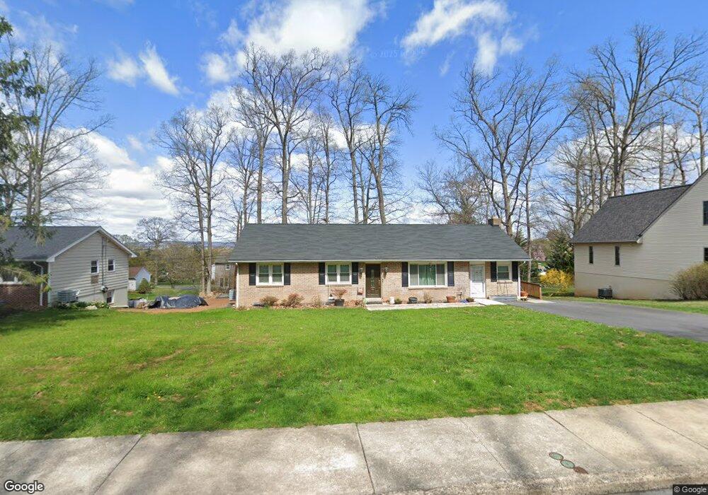
740 N Maple St Ephrata, PA 17522
Estimated Value: $256,000 - $357,171
3
Beds
2
Baths
1,470
Sq Ft
$219/Sq Ft
Est. Value
About This Home
This home is located at 740 N Maple St, Ephrata, PA 17522 and is currently estimated at $321,543, approximately $218 per square foot. 740 N Maple St is a home located in Lancaster County with nearby schools including Highland Elementary School, Ephrata Intermediate School, and Ephrata Senior High School.
Ownership History
Date
Name
Owned For
Owner Type
Purchase Details
Closed on
Sep 13, 2014
Sold by
Milburn Dorothy
Bought by
Milburn Dorothy and Milburn Dale A
Current Estimated Value
Purchase Details
Closed on
Jun 18, 2013
Sold by
Vincent Robert G
Bought by
Milburn Dorothy
Home Financials for this Owner
Home Financials are based on the most recent Mortgage that was taken out on this home.
Original Mortgage
$81,400
Outstanding Balance
$57,800
Interest Rate
3.45%
Mortgage Type
FHA
Estimated Equity
$263,743
Create a Home Valuation Report for This Property
The Home Valuation Report is an in-depth analysis detailing your home's value as well as a comparison with similar homes in the area
Home Values in the Area
Average Home Value in this Area
Purchase History
| Date | Buyer | Sale Price | Title Company |
|---|---|---|---|
| Milburn Dorothy | -- | None Available | |
| Milburn Dorothy | $82,902 | None Available |
Source: Public Records
Mortgage History
| Date | Status | Borrower | Loan Amount |
|---|---|---|---|
| Open | Milburn Dorothy | $81,400 |
Source: Public Records
Tax History Compared to Growth
Tax History
| Year | Tax Paid | Tax Assessment Tax Assessment Total Assessment is a certain percentage of the fair market value that is determined by local assessors to be the total taxable value of land and additions on the property. | Land | Improvement |
|---|---|---|---|---|
| 2025 | $4,300 | $179,300 | $56,700 | $122,600 |
| 2024 | $4,300 | $179,300 | $56,700 | $122,600 |
| 2023 | $4,194 | $179,300 | $56,700 | $122,600 |
| 2022 | $4,015 | $179,300 | $56,700 | $122,600 |
| 2021 | $3,931 | $179,300 | $56,700 | $122,600 |
| 2020 | $3,931 | $179,300 | $56,700 | $122,600 |
| 2019 | $3,877 | $179,300 | $56,700 | $122,600 |
| 2018 | $3,039 | $179,300 | $56,700 | $122,600 |
| 2017 | $3,988 | $150,700 | $32,800 | $117,900 |
| 2016 | $3,957 | $150,700 | $32,800 | $117,900 |
| 2015 | $875 | $150,700 | $32,800 | $117,900 |
| 2014 | $2,954 | $150,700 | $32,800 | $117,900 |
Source: Public Records
Map
Nearby Homes
- 221 Marion Terrace
- 210 Marion Terrace
- 214 Linda Terrace
- 704 Lincoln Ave
- 11 Carriage Ln
- 474 N Maple St
- 14 Hazelwood Cir
- 110 E Pine St
- 335 Lincoln Ave
- 67 E Mohler Church Rd
- 323 Lincoln Ave
- 623 N State St
- 18 E Pine St
- 308 Washington Ave
- 111 Ridge Ave
- 336 Ridge Ave
- 346 Duke St
- 124 Washington Ave
- 538 E Main St
- 49 N Church St
- 730 N Maple St
- 730 N Maple St
- 752 N Maple St
- 731 Timothy Ln
- 727 Timothy Ln
- 210 Tuckson Ave
- 720 N Maple St
- 723 Timothy Ln
- 741 N Maple St
- 751 N Maple St
- 806 N Maple St
- 719 Timothy Ln
- 721 N Maple St
- 209 Tuckson Ave
- 702 N Maple St
- 805 N Maple St
- 805 N Maple St
- 261 Linda Terrace
- 715 Timothy Ln
- 800 Timothy Ln