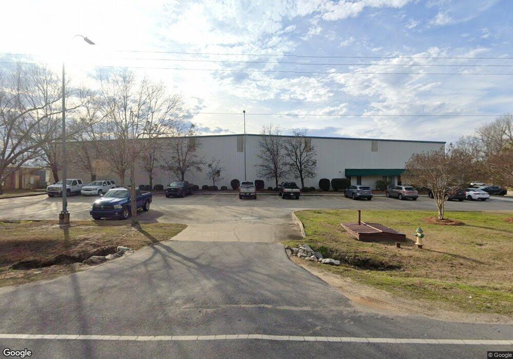
740 N Wise Dr Sumter, SC 29153
--
Bed
--
Bath
172,032
Sq Ft
10
Acres
About This Home
This home is located at 740 N Wise Dr, Sumter, SC 29153. 740 N Wise Dr is a home located in Sumter County with nearby schools including Willow Drive Elementary School, Alice Drive Middle School, and Sumter High School.
Ownership History
Date
Name
Owned For
Owner Type
Purchase Details
Closed on
Jun 5, 2015
Sold by
Redus One Llc
Bought by
Palmetto Holding Company Of Sumter Llc
Home Financials for this Owner
Home Financials are based on the most recent Mortgage that was taken out on this home.
Original Mortgage
$1,068,000
Interest Rate
3.79%
Mortgage Type
Commercial
Purchase Details
Closed on
Mar 17, 2014
Sold by
Sn Commercial Llc
Bought by
Redus One Llc
Purchase Details
Closed on
Mar 31, 2009
Sold by
Overstreet Richard A and Overstreet Esther R
Bought by
Sn Commercial Llc
Create a Home Valuation Report for This Property
The Home Valuation Report is an in-depth analysis detailing your home's value as well as a comparison with similar homes in the area
Home Values in the Area
Average Home Value in this Area
Purchase History
| Date | Buyer | Sale Price | Title Company |
|---|---|---|---|
| Palmetto Holding Company Of Sumter Llc | $1,335,000 | -- | |
| Redus One Llc | -- | -- | |
| Sn Commercial Llc | $200,000 | -- |
Source: Public Records
Mortgage History
| Date | Status | Borrower | Loan Amount |
|---|---|---|---|
| Closed | Palmetto Holding Company Of Sumter Llc | $1,068,000 |
Source: Public Records
Tax History Compared to Growth
Tax History
| Year | Tax Paid | Tax Assessment Tax Assessment Total Assessment is a certain percentage of the fair market value that is determined by local assessors to be the total taxable value of land and additions on the property. | Land | Improvement |
|---|---|---|---|---|
| 2024 | $49,005 | $144,790 | $13,537 | $131,253 |
| 2023 | $49,005 | $142,660 | $13,900 | $128,760 |
| 2022 | $48,733 | $142,660 | $13,900 | $128,760 |
| 2021 | $44,103 | $142,660 | $13,900 | $128,760 |
| 2020 | $44,103 | $125,910 | $13,900 | $112,010 |
| 2019 | $43,652 | $125,910 | $13,900 | $112,010 |
| 2018 | $43,652 | $125,910 | $13,900 | $112,010 |
| 2017 | $43,484 | $125,910 | $13,900 | $112,010 |
| 2016 | $11,497 | $31,820 | $4,340 | $27,480 |
| 2015 | -- | $31,820 | $4,340 | $27,480 |
| 2014 | -- | $37,340 | $4,340 | $33,000 |
| 2013 | -- | $37,340 | $4,340 | $33,000 |
Source: Public Records
Map
Nearby Homes
- 251 Rast St Unit D-5
- 251 Rast St Unit L1
- 251 Rast St
- 1595 Hartwell Dr
- 182 Wall St
- 0 W Wesmark Blvd
- 1919 Barnhart Dr
- 8 Andrena Dr
- 1001 Jessamine Trail
- 1022 Lacebark Dr
- 17 Shuler Dr
- 2040 Barnhart Dr
- 2026 Gion St
- 148 Carolina Ave
- 1879 Coral Way#1873
- 911 N Guignard Dr
- 144 W Moore St
- 807 N Guignard Dr
- 2115 Gion St
- 15 Walton St
- 730 Electric Dr
- 765 N Wise Dr
- 690 Dillon Trace St
- 0 Electric Dr
- 660 Dillon Trace Street Unit 24
- 620 Dillon Trace St
- 755 Electric Dr
- 538 N Wise Dr
- 530 N Wise Dr
- 725 North Pike W
- 529 N Wise Dr
- 265-289 Bultman Drive (Lots 9-13)
- 605 Archdale Dr
- 820 South Pike W
- 685 Archdale Dr
- 685 Archdale Dr
- 685 Archdale Dr
- 685 Archdale Dr Unit 685D
- 640 South Pike W
- 675 Archdale Dr Unit B