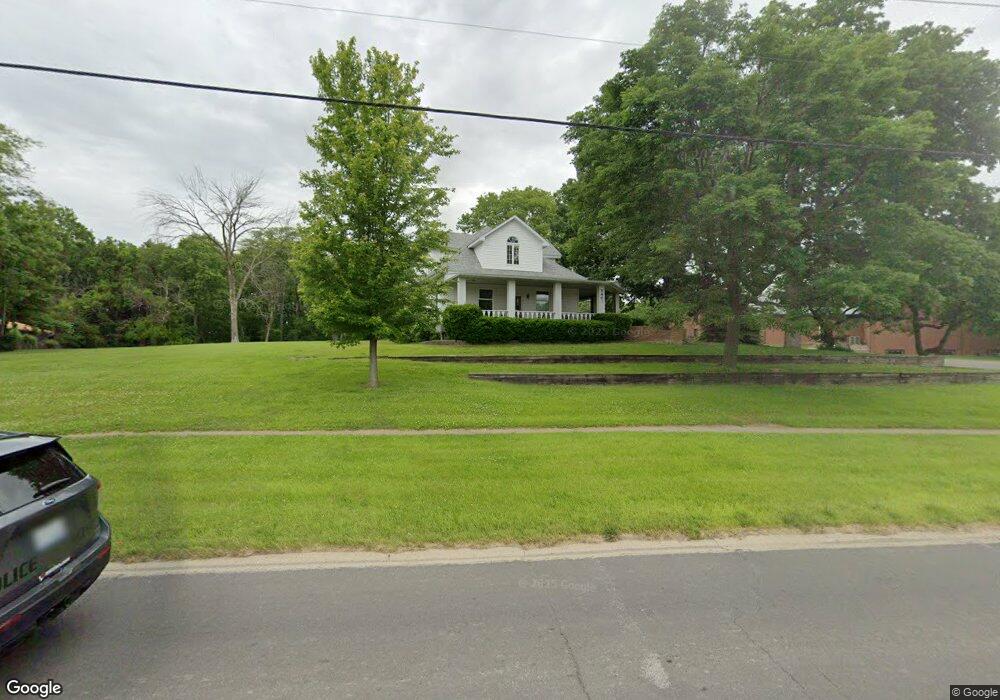
740 W Main St Mount Zion, IL 62549
--
Bed
1
Bath
1,689
Sq Ft
1.25
Acres
About This Home
This home is located at 740 W Main St, Mount Zion, IL 62549. 740 W Main St is a home located in Macon County with nearby schools including McGaughey Elementary School, Mt. Zion Elementary School, and Mt. Zion Intermediate School.
Ownership History
Date
Name
Owned For
Owner Type
Purchase Details
Closed on
Nov 2, 2011
Sold by
Farmer City State Bank
Bought by
First Baptist Church Of Mt Zion
Home Financials for this Owner
Home Financials are based on the most recent Mortgage that was taken out on this home.
Original Mortgage
$63,500
Outstanding Balance
$43,447
Interest Rate
4.09%
Mortgage Type
Future Advance Clause Open End Mortgage
Purchase Details
Closed on
Mar 1, 1986
Create a Home Valuation Report for This Property
The Home Valuation Report is an in-depth analysis detailing your home's value as well as a comparison with similar homes in the area
Home Values in the Area
Average Home Value in this Area
Purchase History
| Date | Buyer | Sale Price | Title Company |
|---|---|---|---|
| First Baptist Church Of Mt Zion | $125,000 | None Available | |
| First Baptist Church Of Mt Zion | $125,000 | Central Abs & Title | |
| -- | $28,800 | -- |
Source: Public Records
Mortgage History
| Date | Status | Borrower | Loan Amount |
|---|---|---|---|
| Open | First Baptist Church Of Mt Zion | $63,500 | |
| Closed | First Baptist Church Of Mt Zion | $63,500 |
Source: Public Records
Tax History Compared to Growth
Tax History
| Year | Tax Paid | Tax Assessment Tax Assessment Total Assessment is a certain percentage of the fair market value that is determined by local assessors to be the total taxable value of land and additions on the property. | Land | Improvement |
|---|---|---|---|---|
| 2024 | -- | $0 | $0 | $0 |
| 2023 | -- | $0 | $0 | $0 |
| 2022 | $0 | $0 | $0 | $0 |
| 2021 | $0 | $0 | $0 | $0 |
| 2020 | $0 | $0 | $0 | $0 |
| 2019 | $0 | $0 | $0 | $0 |
| 2018 | $0 | $0 | $0 | $0 |
| 2017 | $0 | $0 | $0 | $0 |
| 2016 | $0 | $0 | $0 | $0 |
| 2015 | -- | $0 | $0 | $0 |
| 2014 | -- | $0 | $0 | $0 |
| 2013 | -- | $0 | $0 | $0 |
Source: Public Records
Map
Nearby Homes
- 524 Elm St
- 125 W Walnut St
- 265 Carrington Ave
- 355 S Henderson St
- 695 Country Ct
- 1030 Country Manor
- 1610 Robin Ct
- 1625 Ridgewood Ct
- 1700 Brentwood Dr
- 1440 N Alexander Dr
- 860 W Wildwood Dr
- 50 Sundance Dr
- 3930 S Mount Zion Rd
- 9 Blakeridge Place
- 5909 Camp Warren Rd
- 1420 Noble Dr
- 2125 Buckhead Ave
- 1935 Buckhead Ct
- 2110 Buckhead Ln
- 2035 Buckhead Blvd