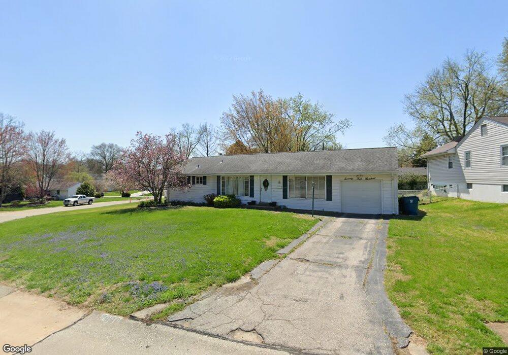
7400 Dalgren Dr Saint Louis, MO 63123
Estimated Value: $272,121 - $292,000
3
Beds
2
Baths
1,200
Sq Ft
$234/Sq Ft
Est. Value
About This Home
This home is located at 7400 Dalgren Dr, Saint Louis, MO 63123 and is currently estimated at $281,280, approximately $234 per square foot. 7400 Dalgren Dr is a home located in St. Louis County with nearby schools including Mesnier Primary School, Gotsch Intermediate School, and Rogers Middle School.
Ownership History
Date
Name
Owned For
Owner Type
Purchase Details
Closed on
Dec 30, 1998
Sold by
Wamser Jerry B
Bought by
Talley Mark A and Talley Jennifer L
Current Estimated Value
Home Financials for this Owner
Home Financials are based on the most recent Mortgage that was taken out on this home.
Original Mortgage
$82,650
Outstanding Balance
$18,321
Interest Rate
6.5%
Mortgage Type
Assumption
Estimated Equity
$262,959
Create a Home Valuation Report for This Property
The Home Valuation Report is an in-depth analysis detailing your home's value as well as a comparison with similar homes in the area
Home Values in the Area
Average Home Value in this Area
Purchase History
| Date | Buyer | Sale Price | Title Company |
|---|---|---|---|
| Talley Mark A | $87,000 | -- |
Source: Public Records
Mortgage History
| Date | Status | Borrower | Loan Amount |
|---|---|---|---|
| Open | Talley Mark A | $82,650 |
Source: Public Records
Tax History Compared to Growth
Tax History
| Year | Tax Paid | Tax Assessment Tax Assessment Total Assessment is a certain percentage of the fair market value that is determined by local assessors to be the total taxable value of land and additions on the property. | Land | Improvement |
|---|---|---|---|---|
| 2025 | $3,416 | $50,730 | $16,020 | $34,710 |
| 2024 | $3,416 | $42,140 | $10,680 | $31,460 |
| 2023 | $3,303 | $42,140 | $10,680 | $31,460 |
| 2022 | $2,835 | $32,910 | $11,740 | $21,170 |
| 2021 | $2,770 | $32,910 | $11,740 | $21,170 |
| 2020 | $2,625 | $29,090 | $10,090 | $19,000 |
| 2019 | $2,603 | $29,090 | $10,090 | $19,000 |
| 2018 | $2,590 | $25,590 | $7,010 | $18,580 |
| 2017 | $2,574 | $25,590 | $7,010 | $18,580 |
| 2016 | $2,255 | $23,810 | $6,060 | $17,750 |
| 2015 | $2,262 | $23,810 | $6,060 | $17,750 |
| 2014 | $2,314 | $24,250 | $7,700 | $16,550 |
Source: Public Records
Map
Nearby Homes
- 7243 General Sherman Ln
- 7452 Rockwood Dr
- 7101 Fernbrook Dr
- 8215 General Sheridan Ln
- 7123 Craighill Dr
- 8405 Rockhaven Ln
- 8415 Rockhaven Ln
- 7625 General Meade Ln
- 1405 Culverhill Dr
- 8261 Watson Rd
- 8853 Raleigh Dr
- 7936 Radnor Dr
- 739 Hurstgreen Rd
- 8875 Rock Forest Dr
- 7424 Granbury Cir
- 8613 Carriage Way Dr
- 8509 Grantshire Ln
- 7369 Whitehaven Dr
- 8400 New Hampshire Ave
- 6540 Lawnside Dr
- 8135 Rockwood Dr
- 7408 Dalgren Dr
- 7325 General Sherman Ln
- 7335 General Sherman Ln
- 8111 Rockwood Dr
- 7414 Dalgren Dr
- 7401 General Sherman Ln
- 7407 Dalgren Dr
- 8134 Rockwood Dr
- 8128 Rockwood Dr
- 8112 Rockwood Dr
- 7311 General Sherman Ln
- 7407 General Sherman Ln
- 7420 Dalgren Dr
- 7413 Dalgren Dr
- 7322 General Sherman Ln
- 7328 General Sherman Ln
- 8101 Rockwood Dr
- 7316 General Sherman Ln
- 8108 Rockwood Dr