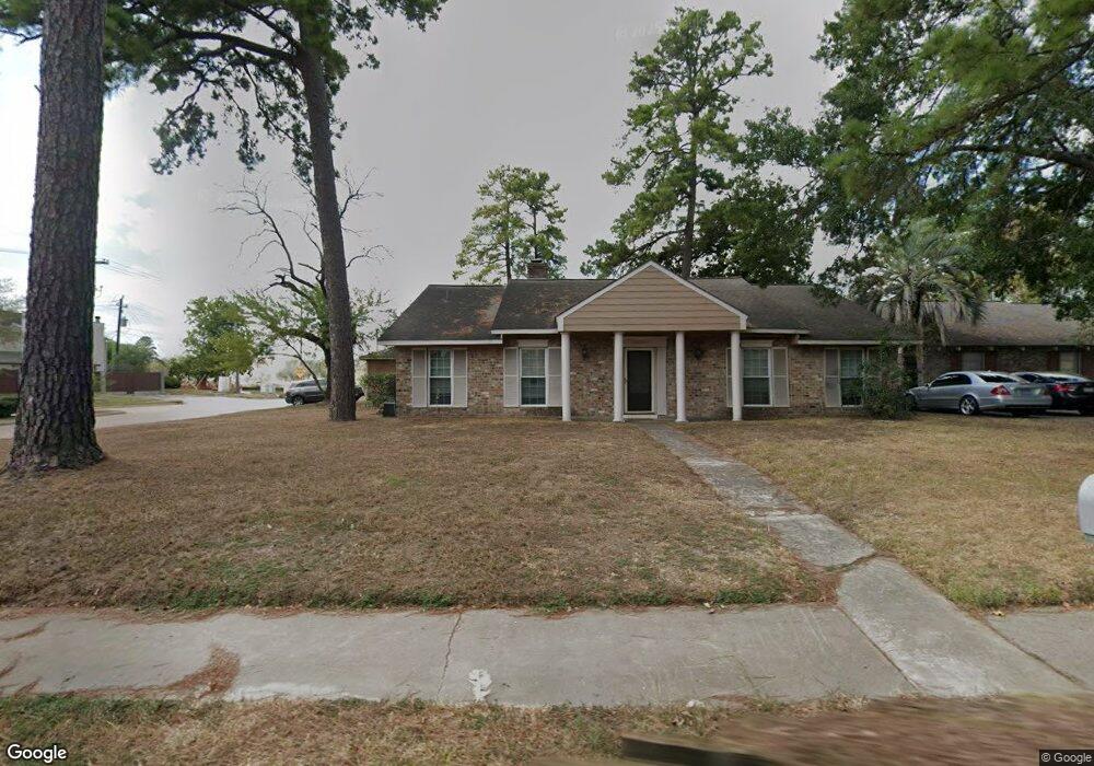
7403 Antoine Dr Houston, TX 77088
Greater Inwood NeighborhoodEstimated Value: $219,481 - $247,000
4
Beds
2
Baths
2,060
Sq Ft
$112/Sq Ft
Est. Value
About This Home
This home is located at 7403 Antoine Dr, Houston, TX 77088 and is currently estimated at $230,870, approximately $112 per square foot. 7403 Antoine Dr is a home located in Harris County with nearby schools including Edward a Vines EC/Pre-K/K School, J. Ruth Smith Elementary, and Hoffman Middle School.
Ownership History
Date
Name
Owned For
Owner Type
Purchase Details
Closed on
Oct 30, 2000
Sold by
Brader Betty
Bought by
Ramos Paul A and Ramos Nora S
Current Estimated Value
Home Financials for this Owner
Home Financials are based on the most recent Mortgage that was taken out on this home.
Original Mortgage
$68,000
Outstanding Balance
$25,092
Interest Rate
7.9%
Estimated Equity
$205,778
Purchase Details
Closed on
Jul 19, 1995
Sold by
Constantin Serban D
Bought by
Brader Betty
Create a Home Valuation Report for This Property
The Home Valuation Report is an in-depth analysis detailing your home's value as well as a comparison with similar homes in the area
Home Values in the Area
Average Home Value in this Area
Purchase History
| Date | Buyer | Sale Price | Title Company |
|---|---|---|---|
| Ramos Paul A | -- | Charter Title Company | |
| Brader Betty | -- | -- |
Source: Public Records
Mortgage History
| Date | Status | Borrower | Loan Amount |
|---|---|---|---|
| Open | Ramos Paul A | $68,000 | |
| Closed | Ramos Paul A | $17,000 |
Source: Public Records
Tax History Compared to Growth
Tax History
| Year | Tax Paid | Tax Assessment Tax Assessment Total Assessment is a certain percentage of the fair market value that is determined by local assessors to be the total taxable value of land and additions on the property. | Land | Improvement |
|---|---|---|---|---|
| 2025 | $3,172 | $200,113 | $34,182 | $165,931 |
| 2024 | $3,172 | $206,666 | $34,182 | $172,484 |
| 2023 | $3,172 | $206,666 | $34,182 | $172,484 |
| 2022 | $4,492 | $197,465 | $34,182 | $163,283 |
| 2021 | $4,276 | $173,836 | $17,946 | $155,890 |
| 2020 | $4,085 | $158,719 | $17,946 | $140,773 |
| 2019 | $3,893 | $151,137 | $17,946 | $133,191 |
| 2018 | $1,478 | $138,915 | $17,946 | $120,969 |
| 2017 | $3,085 | $138,915 | $17,946 | $120,969 |
| 2016 | $2,804 | $119,220 | $17,946 | $101,274 |
| 2015 | $1,905 | $119,220 | $17,946 | $101,274 |
| 2014 | $1,905 | $99,980 | $17,946 | $82,034 |
Source: Public Records
Map
Nearby Homes
- 5907 Darkwood Dr
- 0 Maple Hill Dr
- 7211 Deep Forest Dr
- 4444 Victory Dr Unit 1311
- 4444 Victory Dr Unit 1108
- 7526 Antoine Dr
- 5906 Lawn Ln
- 7606 Victory Dr
- 5914 Lawn Ln
- 5710 Council Grove Ln
- 6918 Bent Branch Dr
- 7014 Bent Branch Dr
- 6202 Wagonwheel Cir
- 5606 Water Leaf Ln
- 5639 Council Grove Ln
- 6931 Wagonwheel Ln
- 5514 Long Creek Ln
- 4306 Saratoga Dr
- 4206 Saratoga Dr
- 6430 Antoine Dr
- 7407 Antoine Dr
- 7411 Antoine Dr
- 7341 Antoine Dr
- 7339 Antoine Dr
- 7337 Antoine Dr
- 7335 Antoine Dr
- 7415 Antoine Dr
- 5799 Maple Hill Dr
- 7357 Antoine Dr
- 7353 Antoine Dr
- 7351 Antoine Dr
- 7355 Antoine Dr
- 7359 Antoine Dr
- 7410 Antoine Dr
- 7361 Antoine Dr
- 7363 Antoine Dr
- 7402 Deep Forest Dr
- 5791 Maple Hill Dr
- 5793 Maple Hill Dr
- 5795 Maple Hill Dr