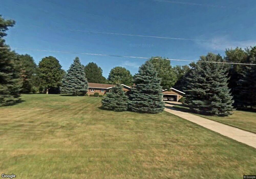
7409 Maple Rd Frankenmuth, MI 48734
Estimated Value: $512,000 - $555,000
3
Beds
3
Baths
1,912
Sq Ft
$282/Sq Ft
Est. Value
About This Home
This home is located at 7409 Maple Rd, Frankenmuth, MI 48734 and is currently estimated at $538,951, approximately $281 per square foot. 7409 Maple Rd is a home located in Saginaw County with nearby schools including List Elementary, E.F. Rittmueller Middle School, and Frankenmuth High School.
Ownership History
Date
Name
Owned For
Owner Type
Purchase Details
Closed on
Dec 31, 2020
Sold by
Scharrer Richard E and Scharrer Trish C
Bought by
Scharrer Richard E and Scharrer Trish C
Current Estimated Value
Purchase Details
Closed on
Oct 1, 2014
Sold by
Scharrer Richard E and Scharrer Trish C
Bought by
Scharrer Richard E and Scharrer Trish C
Purchase Details
Closed on
Dec 15, 2010
Sold by
Howard G Peters And Ruth J Peters Trus
Bought by
Scharrer Richard E and Scharrer Trish C
Home Financials for this Owner
Home Financials are based on the most recent Mortgage that was taken out on this home.
Original Mortgage
$199,200
Interest Rate
4.16%
Mortgage Type
Purchase Money Mortgage
Purchase Details
Closed on
Aug 4, 2006
Sold by
Peters H Gary
Bought by
Peters, Howard G & Ruth J Trust
Create a Home Valuation Report for This Property
The Home Valuation Report is an in-depth analysis detailing your home's value as well as a comparison with similar homes in the area
Home Values in the Area
Average Home Value in this Area
Purchase History
| Date | Buyer | Sale Price | Title Company |
|---|---|---|---|
| Scharrer Richard E | -- | None Available | |
| Scharrer Richard E | -- | -- | |
| Scharrer Richard E | $260,000 | -- | |
| Peters, Howard G & Ruth J Trust | -- | -- |
Source: Public Records
Mortgage History
| Date | Status | Borrower | Loan Amount |
|---|---|---|---|
| Previous Owner | Scharrer Richard E | $199,200 |
Source: Public Records
Tax History Compared to Growth
Tax History
| Year | Tax Paid | Tax Assessment Tax Assessment Total Assessment is a certain percentage of the fair market value that is determined by local assessors to be the total taxable value of land and additions on the property. | Land | Improvement |
|---|---|---|---|---|
| 2025 | $5,157 | $246,600 | $0 | $0 |
| 2024 | $1,500 | $233,800 | $0 | $0 |
| 2023 | $1,428 | $215,000 | $0 | $0 |
| 2022 | $4,502 | $183,700 | $0 | $0 |
| 2021 | $4,107 | $169,100 | $0 | $0 |
| 2020 | $3,998 | $156,100 | $0 | $0 |
| 2019 | $3,824 | $141,200 | $0 | $0 |
| 2018 | $1,246 | $134,700 | $0 | $0 |
| 2017 | $3,446 | $135,100 | $0 | $0 |
| 2016 | $3,356 | $117,300 | $0 | $0 |
| 2014 | -- | $115,300 | $0 | $77,700 |
| 2013 | -- | $107,800 | $0 | $0 |
Source: Public Records
Map
Nearby Homes
- 7965 Dixie Hwy
- 7110 Townline Rd
- 0 W Tuscola Rd Unit 50182343
- 8780 Dixie Hwy
- 5400 Maple Rd
- V/L S Dehmel Rd
- 5 Mission Ridge
- 2 Wilshire Dr Unit A4
- 10 Harlan Ct
- 000 W Tuscola St
- 7720 Rookway Rd
- Parcel E W Rolling Hills Dr
- Parcel B W Rolling Hills Dr
- Parcel D W Rolling Hills Dr
- Parcel F W Rolling Hills Dr
- Parcel C W Rolling Hills Dr
- 640 Heine St
- 6977 Rathbun Rd
- 4705 Weiss Rd
- 53 Pine Grove Dr