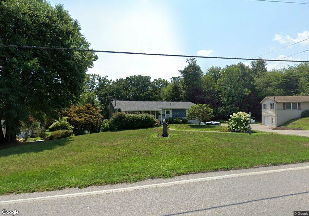
741 Black Rock Rd Hanover, PA 17331
Estimated Value: $248,000 - $288,000
3
Beds
2
Baths
1,296
Sq Ft
$205/Sq Ft
Est. Value
About This Home
This home is located at 741 Black Rock Rd, Hanover, PA 17331 and is currently estimated at $266,023, approximately $205 per square foot. 741 Black Rock Rd is a home located in York County with nearby schools including South Western Senior High School, St Joseph Catholic School, and Hope Christian School Of Hanover.
Ownership History
Date
Name
Owned For
Owner Type
Purchase Details
Closed on
Jul 19, 2011
Sold by
Walton Deanna L
Bought by
Bair Harold and Werner Katie
Current Estimated Value
Home Financials for this Owner
Home Financials are based on the most recent Mortgage that was taken out on this home.
Original Mortgage
$144,248
Outstanding Balance
$103,745
Interest Rate
5.5%
Mortgage Type
FHA
Estimated Equity
$162,278
Purchase Details
Closed on
Aug 28, 2003
Sold by
Rodgers Mary M and Stein Howard
Bought by
Walton Deanna L
Home Financials for this Owner
Home Financials are based on the most recent Mortgage that was taken out on this home.
Original Mortgage
$40,000
Interest Rate
5.29%
Mortgage Type
Purchase Money Mortgage
Create a Home Valuation Report for This Property
The Home Valuation Report is an in-depth analysis detailing your home's value as well as a comparison with similar homes in the area
Home Values in the Area
Average Home Value in this Area
Purchase History
| Date | Buyer | Sale Price | Title Company |
|---|---|---|---|
| Bair Harold | $148,000 | None Available | |
| Walton Deanna L | $105,000 | -- |
Source: Public Records
Mortgage History
| Date | Status | Borrower | Loan Amount |
|---|---|---|---|
| Open | Bair Harold | $144,248 | |
| Previous Owner | Walton Deanna L | $40,000 |
Source: Public Records
Tax History Compared to Growth
Tax History
| Year | Tax Paid | Tax Assessment Tax Assessment Total Assessment is a certain percentage of the fair market value that is determined by local assessors to be the total taxable value of land and additions on the property. | Land | Improvement |
|---|---|---|---|---|
| 2025 | $4,129 | $122,510 | $43,190 | $79,320 |
| 2024 | $4,129 | $122,510 | $43,190 | $79,320 |
| 2023 | $4,055 | $122,510 | $43,190 | $79,320 |
| 2022 | $3,968 | $122,510 | $43,190 | $79,320 |
| 2021 | $3,751 | $122,510 | $43,190 | $79,320 |
| 2020 | $3,751 | $122,510 | $43,190 | $79,320 |
| 2019 | $3,679 | $122,510 | $43,190 | $79,320 |
| 2018 | $3,630 | $122,510 | $43,190 | $79,320 |
| 2017 | $3,547 | $122,510 | $43,190 | $79,320 |
| 2016 | $0 | $122,510 | $43,190 | $79,320 |
| 2015 | -- | $122,510 | $43,190 | $79,320 |
| 2014 | -- | $122,510 | $43,190 | $79,320 |
Source: Public Records
Map
Nearby Homes
- 62 Allen Dr
- 18 Quail Ridge Rd
- 110 Sara Ln
- 1270 Wanda Dr
- 3021 Grandview Rd
- 40 Allen Dr
- 8 Lakeview Terrace
- 15 Gladys Ct
- 381 Sonny St
- 2287 Grandview Rd
- 27 Arlene Ct
- 30 Allen Dr
- 276 Ridgeview Ln Unit 46
- 279 Ridgeview Ln Unit 49
- 113 Timber Ln
- 271 Ridge View Ln Unit 51
- 260 Ridge View Ln Unit 42
- Homesite 312 Homestead Dr
- 256 Ridge View Ln Unit 41
- 3229 Grandview Rd
- 751 Black Rock Rd
- 725 Black Rock Rd
- 761 Black Rock Rd
- 230 Bragg Cir
- 235 Bragg Cir
- 10 Bankert Rd
- 750 Black Rock Rd
- 720 Black Rock Rd
- 35 Penn Cir
- 760 Black Rock Rd
- 771 Black Rock Rd
- 225 Bragg Cir
- 240 Bragg Cir
- 20 Bankert Rd
- 30 Penn Cir
- 770 Black Rock Rd
- 220 Bragg Cir
- 701 Black Rock Rd
- 245 Bragg Cir
- 785 Black Rock Rd