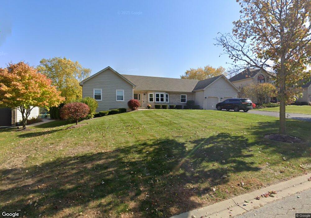
741 Foxglove Dr Algonquin, IL 60102
Far West Algonquin NeighborhoodEstimated Value: $527,729 - $669,000
About This Home
This home is located at 741 Foxglove Dr, Algonquin, IL 60102 and is currently estimated at $596,932, approximately $306 per square foot. 741 Foxglove Dr is a home located in McHenry County with nearby schools including Mackeben Elementary School, Conley Elementary School, and Heineman Middle School.
Ownership History
We collect this data history from publicly available records. To have your information removed, we recommend requesting removal directly through your county’s website.
Purchase Details
Purchase Details
Home Values in the Area
Average Home Value in this Area
Purchase History
We collect this data history from publicly available records. To have your information removed, we recommend requesting removal directly through your county’s website.
| Date | Buyer | Sale Price | Title Company |
|---|---|---|---|
| -- | -- | ||
| $293,500 | -- |
Tax History
We collect this data history from publicly available records. To have your information removed, we recommend requesting removal directly through your county’s website.
| Year | Tax Paid | Tax Assessment Tax Assessment Total Assessment is a certain percentage of the fair market value that is determined by local assessors to be the total taxable value of land and additions on the property. | Land | Improvement |
|---|---|---|---|---|
| 2024 | $10,617 | $160,308 | $17,702 | $142,606 |
| 2023 | $10,247 | $144,007 | $15,902 | $128,105 |
| 2022 | $9,934 | $131,130 | $14,480 | $116,650 |
| 2021 | $9,578 | $123,498 | $13,637 | $109,861 |
| 2020 | $9,425 | $120,204 | $13,273 | $106,931 |
| 2019 | $9,167 | $117,135 | $12,934 | $104,201 |
| 2018 | $8,569 | $107,890 | $14,556 | $93,334 |
| 2017 | $8,444 | $101,678 | $13,718 | $87,960 |
| 2016 | $8,494 | $96,670 | $13,042 | $83,628 |
| 2013 | -- | $91,317 | $20,338 | $70,979 |
Map
- 3630 White Deer Dr Unit II
- 3761 Wintergreen Terrace
- 4131 Wanderlust Dr
- 3960 Georgetown Cir
- 280 Prestwicke Blvd
- 1128 Kingsmill Dr
- 260 Summerdale Ln
- 12 Covington Ct
- 1154 Kingsmill Dr
- 10 Covington Ct
- 4001 Whitehall Ln
- 2 Tiverton Ct
- 4 Stillwater Ct
- 4041 Whitehall Ln
- 16 Springbrook Ln
- 5 Covington Ct
- 8 Liam Ct
- 7 Springbrook Ln
- 1 Springbrook Ln
- 3250 Covington Ln
- 731 Foxglove Dr
- 751 Foxglove Dr
- 761 Foxglove Dr
- 721 Foxglove Dr
- 740 Foxglove Dr
- 750 Foxglove Dr
- 730 Foxglove Dr
- 760 Foxglove Dr
- 740 Par Dr
- 750 Par Dr
- 730 Par Dr
- 771 Foxglove Dr
- 3641 Persimmon Dr
- 760 Par Dr
- 720 Foxglove Dr
- 770 Foxglove Dr
- 720 Par Dr
- 3651 Persimmon Dr
- 3631 Persimmon Dr
- 3621 Persimmon Dr
Ask me questions while you tour the home.