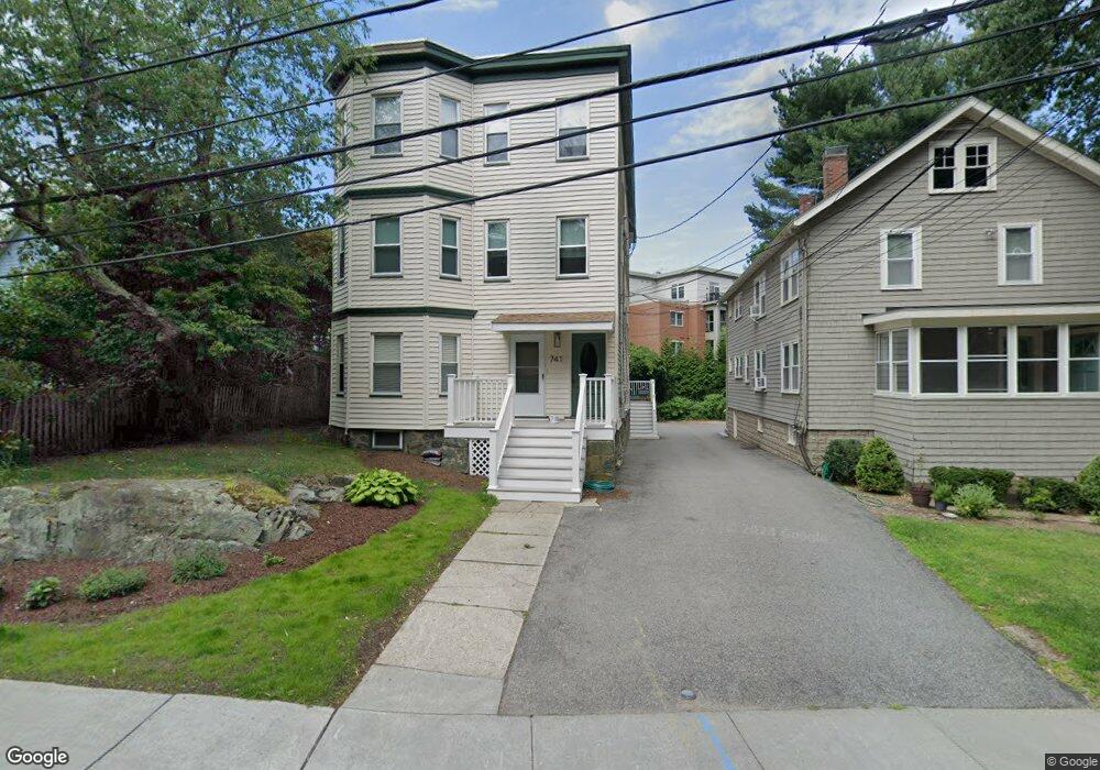
741 Heath St Unit 2 Chestnut Hill, MA 02467
Chestnut Hill NeighborhoodEstimated Value: $846,579 - $1,066,000
3
Beds
2
Baths
1,129
Sq Ft
$827/Sq Ft
Est. Value
About This Home
This home is located at 741 Heath St Unit 2, Chestnut Hill, MA 02467 and is currently estimated at $933,395, approximately $826 per square foot. 741 Heath St Unit 2 is a home located in Norfolk County with nearby schools including Baker School, Mount Alvernia Academy, and Brimmer & May School.
Ownership History
Date
Name
Owned For
Owner Type
Purchase Details
Closed on
May 12, 2009
Sold by
Morrissey John N
Bought by
Bloom Leslie A
Current Estimated Value
Home Financials for this Owner
Home Financials are based on the most recent Mortgage that was taken out on this home.
Original Mortgage
$247,500
Outstanding Balance
$156,797
Interest Rate
4.9%
Mortgage Type
Purchase Money Mortgage
Estimated Equity
$776,598
Create a Home Valuation Report for This Property
The Home Valuation Report is an in-depth analysis detailing your home's value as well as a comparison with similar homes in the area
Home Values in the Area
Average Home Value in this Area
Purchase History
| Date | Buyer | Sale Price | Title Company |
|---|---|---|---|
| Bloom Leslie A | $397,500 | -- |
Source: Public Records
Mortgage History
| Date | Status | Borrower | Loan Amount |
|---|---|---|---|
| Open | Bloom Leslie A | $247,500 |
Source: Public Records
Tax History Compared to Growth
Tax History
| Year | Tax Paid | Tax Assessment Tax Assessment Total Assessment is a certain percentage of the fair market value that is determined by local assessors to be the total taxable value of land and additions on the property. | Land | Improvement |
|---|---|---|---|---|
| 2025 | $7,606 | $770,600 | $0 | $770,600 |
| 2024 | $7,381 | $755,500 | $0 | $755,500 |
| 2023 | $6,911 | $693,200 | $0 | $693,200 |
| 2022 | $6,858 | $673,000 | $0 | $673,000 |
| 2021 | $6,187 | $631,300 | $0 | $631,300 |
| 2020 | $5,907 | $625,100 | $0 | $625,100 |
| 2019 | $5,578 | $595,300 | $0 | $595,300 |
| 2018 | $5,364 | $567,000 | $0 | $567,000 |
| 2017 | $5,187 | $525,000 | $0 | $525,000 |
| 2016 | $4,916 | $471,800 | $0 | $471,800 |
| 2015 | $4,581 | $428,900 | $0 | $428,900 |
| 2014 | $4,545 | $399,000 | $0 | $399,000 |
Source: Public Records
Map
Nearby Homes
- 321 Hammond Pond Pkwy Unit 103
- 321 Hammond Pond Pkwy Unit 301
- 771 Heath St Unit 771
- 15 Glenland Rd
- 809-811 Heath St Unit 811
- 11 Hammond Pond Pkwy Unit 3
- 33 Hammond Pond Pkwy Unit 2
- 799 Heath St Unit 2
- 811 Heath St
- 5 Heathwood Ln
- 3 Glenoe Rd
- 280 Boylston St Unit 203
- 280 Boylston St Unit 905
- 280 Boylston St Unit 710
- 280 Boylston St Unit 908
- 280 Boylston St Unit 415
- 280 Boylston St Unit 511
- 80 Louise Rd Unit 82
- 0 Glenoe Rd
- 250 Hammond Pond Pkwy Unit 1604N
- 741 Heath St
- 741 Heath St Unit 3
- 741 Heath St Unit 1
- 739 Heath St
- 739 Heath St Unit 1
- 739 Heath St Unit 2
- 749 Heath St
- 745 Heath St
- 751 Heath St
- 311 Hammond Pond Pkwy
- 755 Heath St
- 731 Heath St
- 317 Hammond Pond Pkwy
- 382 Woodland Rd
- 727 Heath St
- 321 Hammond Pond Pkwy Unit 205
- 321 Hammond Pond Pkwy
- 321 Hammond Pond Pkwy Unit 307
- 321 Hammond Pond Pkwy Unit 201
- 321 Hammond Pond Pkwy