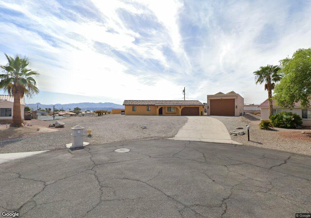
741 Satellite Ct Lake Havasu City, AZ 86404
Estimated Value: $441,000 - $692,000
3
Beds
1
Bath
1,348
Sq Ft
$422/Sq Ft
Est. Value
About This Home
This home is located at 741 Satellite Ct, Lake Havasu City, AZ 86404 and is currently estimated at $569,065, approximately $422 per square foot. 741 Satellite Ct is a home located in Mohave County with nearby schools including Havasupai Elementary School, Thunderbolt Middle School, and Lake Havasu High School.
Ownership History
Date
Name
Owned For
Owner Type
Purchase Details
Closed on
Aug 19, 2009
Sold by
Fannie Mae
Bought by
Beith Torben and Beith Teresa
Current Estimated Value
Home Financials for this Owner
Home Financials are based on the most recent Mortgage that was taken out on this home.
Original Mortgage
$120,000
Interest Rate
5.08%
Mortgage Type
New Conventional
Purchase Details
Closed on
Aug 10, 2005
Sold by
Welty Timothy L
Bought by
Gregg Joshua A
Home Financials for this Owner
Home Financials are based on the most recent Mortgage that was taken out on this home.
Original Mortgage
$258,300
Interest Rate
5.85%
Mortgage Type
New Conventional
Purchase Details
Closed on
Oct 29, 2001
Sold by
Nack Roy A
Bought by
Welty Timothy L
Home Financials for this Owner
Home Financials are based on the most recent Mortgage that was taken out on this home.
Original Mortgage
$74,200
Interest Rate
6.67%
Mortgage Type
New Conventional
Create a Home Valuation Report for This Property
The Home Valuation Report is an in-depth analysis detailing your home's value as well as a comparison with similar homes in the area
Home Values in the Area
Average Home Value in this Area
Purchase History
| Date | Buyer | Sale Price | Title Company |
|---|---|---|---|
| Beith Torben | $150,000 | Stewart Title & Trust Lake H | |
| Gregg Joshua A | $287,000 | First American Title Insuran | |
| Welty Timothy L | $76,500 | Transnation Title Insurance |
Source: Public Records
Mortgage History
| Date | Status | Borrower | Loan Amount |
|---|---|---|---|
| Previous Owner | Beith Torben | $120,000 | |
| Previous Owner | Gregg Joshua A | $258,300 | |
| Previous Owner | Welty Timothy L | $74,200 |
Source: Public Records
Tax History Compared to Growth
Tax History
| Year | Tax Paid | Tax Assessment Tax Assessment Total Assessment is a certain percentage of the fair market value that is determined by local assessors to be the total taxable value of land and additions on the property. | Land | Improvement |
|---|---|---|---|---|
| 2026 | -- | -- | -- | -- |
| 2025 | $1,816 | $54,658 | $0 | $0 |
| 2024 | $1,816 | $57,338 | $0 | $0 |
| 2023 | $1,816 | $46,989 | $0 | $0 |
| 2022 | $1,738 | $34,600 | $0 | $0 |
| 2021 | $2,046 | $32,560 | $0 | $0 |
| 2019 | $1,951 | $26,783 | $0 | $0 |
| 2018 | $1,889 | $25,527 | $0 | $0 |
| 2017 | $1,872 | $21,941 | $0 | $0 |
| 2016 | $1,708 | $19,313 | $0 | $0 |
| 2015 | $1,642 | $15,864 | $0 | $0 |
Source: Public Records
Map
Nearby Homes
- 2735 Poseidon Dr
- 2875 Swirl Dr
- 2880 Sombrero Dr
- 2699 Poseidon Dr
- 710 Meadows Dr
- 2825 Pepperwood Dr
- 2815 Pepperwood Dr
- 2528 Tanglewood Dr
- 2775 Briarcrest Dr
- 2740 Arcadia Dr
- 2575 Ascot Dr
- 3000 Applewood Dr
- 600 Stone Acre Dr
- 2820 Briarcrest Dr
- 2795 Barbara
- 3030 Green Acres Dr
- 2774 Hidden Valley Dr
- 2570 Havasupai Blvd
- 2765 Arcadia Dr
- 2850 Kiowa Blvd N
- 2770 Empress Ln
- 743 Satellite Ct
- 739 Satellite Ct
- 2765 Empress Ln
- 2805 Papeete Dr
- 737 Satellite Ct
- 2795 Papeete Dr
- 745 Satellite Dr
- 2760 Empress Ln
- 745 Satellite Ct
- 2815 Papeete Dr
- 749 Satellite Dr
- 745 Satellite Dr
- 2759 Empress Ln
- 2759 Empress Ln
- 735 Satellite Ct
- 2785 Papeete Dr
- 755 Satellite Dr
- 2825 Papeete Dr
- 2756 Empress Ln