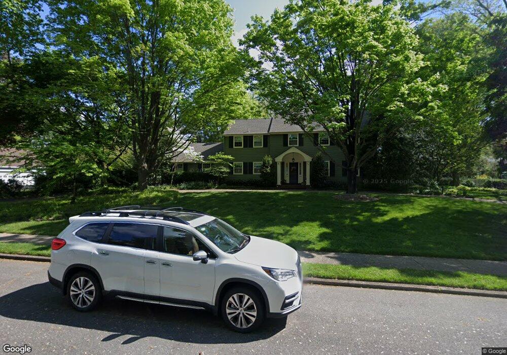
741 Signal Light Rd Moorestown, NJ 08057
Estimated Value: $913,973 - $1,178,000
--
Bed
--
Bath
2,988
Sq Ft
$359/Sq Ft
Est. Value
About This Home
This home is located at 741 Signal Light Rd, Moorestown, NJ 08057 and is currently estimated at $1,073,991, approximately $359 per square foot. 741 Signal Light Rd is a home located in Burlington County with nearby schools including George C. Baker Elementary School, Moorestown Upper Elementary School, and William Allen Middle School.
Ownership History
Date
Name
Owned For
Owner Type
Purchase Details
Closed on
Dec 19, 1986
Bought by
Mannion Thomas J and Mannion Susan R
Current Estimated Value
Create a Home Valuation Report for This Property
The Home Valuation Report is an in-depth analysis detailing your home's value as well as a comparison with similar homes in the area
Home Values in the Area
Average Home Value in this Area
Purchase History
| Date | Buyer | Sale Price | Title Company |
|---|---|---|---|
| Mannion Thomas J | $271,500 | -- |
Source: Public Records
Tax History Compared to Growth
Tax History
| Year | Tax Paid | Tax Assessment Tax Assessment Total Assessment is a certain percentage of the fair market value that is determined by local assessors to be the total taxable value of land and additions on the property. | Land | Improvement |
|---|---|---|---|---|
| 2025 | $16,230 | $572,100 | $311,200 | $260,900 |
| 2024 | $15,738 | $572,100 | $311,200 | $260,900 |
| 2023 | $15,738 | $572,100 | $311,200 | $260,900 |
| 2021 | $15,372 | $572,100 | $311,200 | $260,900 |
| 2020 | $15,275 | $572,100 | $311,200 | $260,900 |
| 2019 | $15,006 | $572,100 | $311,200 | $260,900 |
| 2018 | $14,600 | $572,100 | $311,200 | $260,900 |
| 2017 | $14,726 | $572,100 | $311,200 | $260,900 |
| 2016 | $14,674 | $572,100 | $311,200 | $260,900 |
| 2015 | $14,497 | $572,100 | $311,200 | $260,900 |
| 2014 | $13,765 | $572,100 | $311,200 | $260,900 |
Source: Public Records
Map
Nearby Homes
- 744 Signal Light Rd
- 863 Golf View Rd
- 7 Whitetail Ct
- 628 Windsock Way
- 205 E Central Ave
- 308 Elm St
- 408 E 2nd St
- 415 Bridgeboro Rd
- 133 Plum St Unit 6
- 693 Garwood Rd
- 343 Tom Brown Rd
- 347 Tom Brown Rd
- 514 E Main St
- 80 E 3rd St
- 57 Brooks Rd
- 82 E 3rd St
- 66 E 3rd St
- 526 E Main St
- 50 E 3rd St
- 633 E Main St Unit B7
- 745 Signal Light Rd
- 737 Signal Light Rd
- 748 Stonehouse Rd
- 744 Stonehouse Rd
- 740 Signal Light Rd
- 752 Stonehouse Rd
- 740 Stonehouse Rd
- 736 Signal Light Rd
- 733 Signal Light Rd
- 736 Stonehouse Rd
- 745 Stonehouse Rd
- 741 N Stanwick Rd
- 732 Signal Light Rd
- 749 Stonehouse Rd
- 741 Stonehouse Rd
- 745 N Stanwick Rd
- 737 N Stanwick Rd
- 753 Stonehouse Rd
- 732 Stonehouse Rd
- 737 Stonehouse Rd