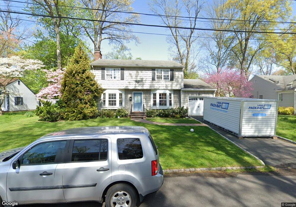
741 Stevens Ave Westfield, NJ 07090
Estimated Value: $1,062,000 - $1,199,000
4
Beds
3
Baths
1,678
Sq Ft
$656/Sq Ft
Est. Value
About This Home
This home is located at 741 Stevens Ave, Westfield, NJ 07090 and is currently estimated at $1,100,153, approximately $655 per square foot. 741 Stevens Ave is a home located in Union County with nearby schools including Washington Elementary School, Edison Intermediate School, and Westfield Senior High School.
Ownership History
Date
Name
Owned For
Owner Type
Purchase Details
Closed on
Mar 16, 2010
Sold by
Wiehl Lois
Bought by
Cho Yun Won and Lyons Peter
Current Estimated Value
Home Financials for this Owner
Home Financials are based on the most recent Mortgage that was taken out on this home.
Original Mortgage
$464,000
Outstanding Balance
$308,144
Interest Rate
5.02%
Mortgage Type
New Conventional
Estimated Equity
$792,009
Purchase Details
Closed on
Oct 8, 1998
Sold by
Wiehl Lois
Bought by
Wiehl Lois and Wiehl Paul G
Create a Home Valuation Report for This Property
The Home Valuation Report is an in-depth analysis detailing your home's value as well as a comparison with similar homes in the area
Home Values in the Area
Average Home Value in this Area
Purchase History
| Date | Buyer | Sale Price | Title Company |
|---|---|---|---|
| Cho Yun Won | $580,000 | None Available | |
| Wiehl Lois | -- | -- |
Source: Public Records
Mortgage History
| Date | Status | Borrower | Loan Amount |
|---|---|---|---|
| Open | Cho Yun Won | $464,000 |
Source: Public Records
Tax History
| Year | Tax Paid | Tax Assessment Tax Assessment Total Assessment is a certain percentage of the fair market value that is determined by local assessors to be the total taxable value of land and additions on the property. | Land | Improvement |
|---|---|---|---|---|
| 2025 | $14,996 | $665,900 | $478,300 | $187,600 |
| 2024 | $14,690 | $665,900 | $478,300 | $187,600 |
| 2023 | $14,690 | $665,900 | $478,300 | $187,600 |
| 2022 | $14,383 | $665,900 | $478,300 | $187,600 |
| 2021 | $14,403 | $665,900 | $478,300 | $187,600 |
| 2020 | $14,370 | $665,900 | $478,300 | $187,600 |
| 2019 | $14,317 | $665,900 | $478,300 | $187,600 |
| 2018 | $14,206 | $152,800 | $73,100 | $79,700 |
| 2017 | $14,128 | $152,800 | $73,100 | $79,700 |
| 2016 | $13,796 | $152,800 | $73,100 | $79,700 |
| 2015 | $13,521 | $152,800 | $73,100 | $79,700 |
| 2014 | $13,075 | $152,800 | $73,100 | $79,700 |
Source: Public Records
Map
Nearby Homes
- 529 Benson Place
- 615 Maple Ct Unit 615
- 765 Marcellus Dr
- 484 4th Ave Unit 9
- 941 Harding St
- 1008 Cranford Ave
- 401 Brookside Place
- 629 Tremont Ave
- 312 3rd Ave
- 820 E Broad St
- 684 Gallows Hill Rd
- 318 S Euclid Ave
- 208 Jefferson Ave
- 564 Spruce Ave
- 314 South Ave E Unit 2
- 424 Saint Marks Ave
- 435 Spruce Ave
- 556 Locust Ave
- 756 Kimball Ave
- 122 Livingston St
- 530 Wells St
- 731 Stevens Ave
- 751 Stevens Ave
- 740 Stevens Ave
- 746 Stevens Ave
- 736 Coolidge St
- 742 Coolidge St
- 726 Stevens Ave
- 746 Coolidge St
- 721 Stevens Ave
- 801 Stevens Ave
- 732 Coolidge St
- 800 Stevens Ave
- 529 Wells St
- 720 Stevens Ave
- 728 Coolidge St
- 781 Cranford Ave
- 501 Wells St
- 771 Cranford Ave
- 791 Cranford Ave
Your Personal Tour Guide
Ask me questions while you tour the home.