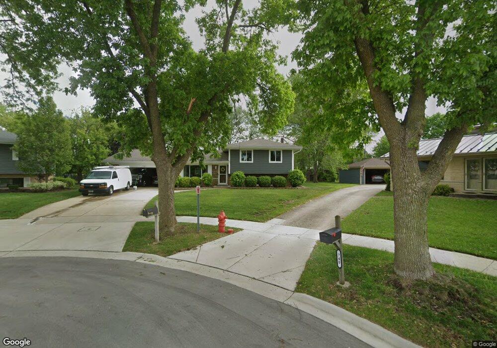
741 Terrace Ct Schaumburg, IL 60193
East Schaumburg NeighborhoodEstimated Value: $421,000 - $501,000
3
Beds
2
Baths
1,137
Sq Ft
$412/Sq Ft
Est. Value
About This Home
This home is located at 741 Terrace Ct, Schaumburg, IL 60193 and is currently estimated at $468,397, approximately $411 per square foot. 741 Terrace Ct is a home located in Cook County with nearby schools including Michael Collins Elementary School, Robert Frost Junior High School, and J B Conant High School.
Ownership History
Date
Name
Owned For
Owner Type
Purchase Details
Closed on
Nov 2, 2020
Sold by
Reichold Mark W
Bought by
Reichold Mark W and Biwer Kathleen M
Current Estimated Value
Home Financials for this Owner
Home Financials are based on the most recent Mortgage that was taken out on this home.
Original Mortgage
$150,000
Interest Rate
2.75%
Mortgage Type
Purchase Money Mortgage
Create a Home Valuation Report for This Property
The Home Valuation Report is an in-depth analysis detailing your home's value as well as a comparison with similar homes in the area
Home Values in the Area
Average Home Value in this Area
Purchase History
| Date | Buyer | Sale Price | Title Company |
|---|---|---|---|
| Reichold Mark W | -- | Attorney |
Source: Public Records
Mortgage History
| Date | Status | Borrower | Loan Amount |
|---|---|---|---|
| Previous Owner | Reichold Mark W | $150,000 |
Source: Public Records
Tax History Compared to Growth
Tax History
| Year | Tax Paid | Tax Assessment Tax Assessment Total Assessment is a certain percentage of the fair market value that is determined by local assessors to be the total taxable value of land and additions on the property. | Land | Improvement |
|---|---|---|---|---|
| 2024 | $9,436 | $37,000 | $8,235 | $28,765 |
| 2023 | $9,122 | $37,000 | $8,235 | $28,765 |
| 2022 | $9,122 | $37,000 | $8,235 | $28,765 |
| 2021 | $7,849 | $29,226 | $6,176 | $23,050 |
| 2020 | $7,782 | $29,226 | $6,176 | $23,050 |
| 2019 | $7,785 | $32,474 | $6,176 | $26,298 |
| 2018 | $7,969 | $29,988 | $5,261 | $24,727 |
| 2017 | $7,861 | $29,988 | $5,261 | $24,727 |
| 2016 | $7,594 | $29,988 | $5,261 | $24,727 |
| 2015 | $7,243 | $26,835 | $4,575 | $22,260 |
| 2014 | $7,180 | $26,835 | $4,575 | $22,260 |
| 2013 | $6,979 | $26,835 | $4,575 | $22,260 |
Source: Public Records
Map
Nearby Homes
- 718 N Point Dr
- 722 Merlin Dr Unit 16
- 916 Manchester Cir Unit 91A
- 126 Manchester Ct Unit 61B
- 421 Summit Dr
- 1100 Boston Harbor Unit 7004
- 421 E Wise Rd
- 36 Shore Dr
- 1871 Fox Run Dr Unit A
- 426 E Niagara Ave
- 205 Nantucket Harbor Unit 104
- 251 University Ln
- 263 Doral Ct Unit 1
- 711 Tipperary Ct Unit 2D
- 712 Tipperary Ct Unit 1C
- 1910 Baltimore Dr
- 733 Limerick Ln Unit 7333D
- 307 University Ln Unit A
- 620 S Point Dr
- 826 Thornton Ct Unit 2AL
- 740 Terrace Ct
- 737 Terrace Ct
- 736 Terrace Ct
- 733 Terrace Ct
- 500 Scholten Dr
- 450 Scholten Dr
- 736 Fennel Ct
- 739 Highpoint Ct
- 446 Scholten Dr
- 732 Terrace Ct
- 729 Terrace Ct
- 504 Scholten Dr
- 735 Highpoint Ct
- 442 Scholten Dr
- 508 Scholten Dr
- 732 Fennel Ct
- 740 Fennel Ct Unit 9
- 438 Scholten Dr
- 731 Highpoint Ct
- 728 Fennel Ct