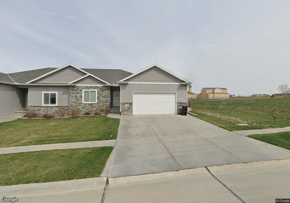
7410 Aero Lincoln, NE 68516
The Woodlands NeighborhoodEstimated Value: $416,000 - $462,000
2
Beds
3
Baths
1,419
Sq Ft
$304/Sq Ft
Est. Value
About This Home
This home is located at 7410 Aero, Lincoln, NE 68516 and is currently estimated at $431,188, approximately $303 per square foot. 7410 Aero is a home with nearby schools including Wysong Elementary School, Moore Middle School, and Lincoln East High School.
Ownership History
Date
Name
Owned For
Owner Type
Purchase Details
Closed on
May 27, 2020
Sold by
Sands Heidi and Buescher Ross
Bought by
Buescher Heidi
Current Estimated Value
Home Financials for this Owner
Home Financials are based on the most recent Mortgage that was taken out on this home.
Original Mortgage
$207,352
Outstanding Balance
$183,743
Interest Rate
3.3%
Mortgage Type
Credit Line Revolving
Estimated Equity
$247,445
Purchase Details
Closed on
Apr 23, 2017
Sold by
Rc Krueger Development Comopany
Bought by
A & P Rpoperties Llc
Create a Home Valuation Report for This Property
The Home Valuation Report is an in-depth analysis detailing your home's value as well as a comparison with similar homes in the area
Home Values in the Area
Average Home Value in this Area
Purchase History
| Date | Buyer | Sale Price | Title Company |
|---|---|---|---|
| Buescher Heidi | -- | Homeservices Title | |
| A & P Rpoperties Llc | $41,000 | Union Title Co Llc |
Source: Public Records
Mortgage History
| Date | Status | Borrower | Loan Amount |
|---|---|---|---|
| Open | Buescher Heidi | $207,352 |
Source: Public Records
Tax History Compared to Growth
Tax History
| Year | Tax Paid | Tax Assessment Tax Assessment Total Assessment is a certain percentage of the fair market value that is determined by local assessors to be the total taxable value of land and additions on the property. | Land | Improvement |
|---|---|---|---|---|
| 2025 | $5,016 | $382,600 | $80,000 | $302,600 |
| 2024 | $5,016 | $360,100 | $55,000 | $305,100 |
| 2023 | $5,438 | $329,700 | $55,000 | $274,700 |
| 2022 | $5,455 | $273,300 | $45,000 | $228,300 |
| 2021 | $5,161 | $273,300 | $45,000 | $228,300 |
| 2020 | $4,904 | $253,500 | $40,000 | $213,500 |
| 2019 | $4,809 | $253,500 | $40,000 | $213,500 |
| 2018 | $4,696 | $251,500 | $35,000 | $216,500 |
| 2017 | $968 | $52,000 | $52,000 | $0 |
| 2016 | $217 | $11,400 | $11,400 | $0 |
Source: Public Records
Map
Nearby Homes
- 7531 Aero Dr
- 7600 Ponce Dr
- 9448 Friedman St
- 7511 Kallum Dr
- 7521 Kallum Dr
- 9421 Dalton Dr
- 7377 Yankee Woods Dr
- 7918 Ponce Dr
- 7743 Aero Cir
- 8915 S 75th St
- 7320 Irene Ct
- 9435 Breashears St
- 7939 Ponce Dr
- 7510 Maxine Dr
- 9434 Breashears St
- 7600 Maxine Dr
- 7349 Yankee Woods Dr
- 7619 Jimmie Ave
- 7509 Jimmie Ave
- 7901 Maxine Dr