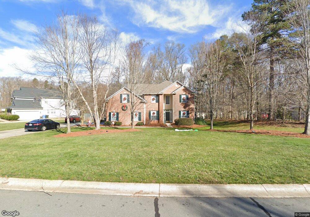
7410 Forrest Rader Dr Mint Hill, NC 28227
Estimated Value: $566,540 - $627,000
5
Beds
3
Baths
3,080
Sq Ft
$196/Sq Ft
Est. Value
About This Home
This home is located at 7410 Forrest Rader Dr, Mint Hill, NC 28227 and is currently estimated at $604,635, approximately $196 per square foot. 7410 Forrest Rader Dr is a home located in Mecklenburg County with nearby schools including Bain Elementary, Mint Hill Middle School, and Independence High.
Ownership History
Date
Name
Owned For
Owner Type
Purchase Details
Closed on
Aug 14, 2000
Sold by
Cambridge Homes Of Nc Ltd Partnership
Bought by
Krumbine Robert L and Krumbine Joanna R
Current Estimated Value
Home Financials for this Owner
Home Financials are based on the most recent Mortgage that was taken out on this home.
Original Mortgage
$180,000
Outstanding Balance
$65,036
Interest Rate
8.17%
Estimated Equity
$539,599
Create a Home Valuation Report for This Property
The Home Valuation Report is an in-depth analysis detailing your home's value as well as a comparison with similar homes in the area
Home Values in the Area
Average Home Value in this Area
Purchase History
| Date | Buyer | Sale Price | Title Company |
|---|---|---|---|
| Krumbine Robert L | $233,500 | -- |
Source: Public Records
Mortgage History
| Date | Status | Borrower | Loan Amount |
|---|---|---|---|
| Open | Krumbine Robert L | $180,000 |
Source: Public Records
Tax History
| Year | Tax Paid | Tax Assessment Tax Assessment Total Assessment is a certain percentage of the fair market value that is determined by local assessors to be the total taxable value of land and additions on the property. | Land | Improvement |
|---|---|---|---|---|
| 2025 | $3,602 | $501,800 | $110,000 | $391,800 |
| 2024 | $3,602 | $501,700 | $110,000 | $391,700 |
| 2023 | $3,547 | $501,700 | $110,000 | $391,700 |
| 2022 | $2,814 | $318,200 | $80,000 | $238,200 |
| 2021 | $2,814 | $318,200 | $80,000 | $238,200 |
| 2020 | $2,814 | $318,200 | $80,000 | $238,200 |
| 2019 | $2,808 | $318,200 | $80,000 | $238,200 |
| 2018 | $2,569 | $232,500 | $42,800 | $189,700 |
| 2017 | $2,548 | $232,500 | $42,800 | $189,700 |
| 2016 | $2,545 | $232,500 | $42,800 | $189,700 |
| 2015 | $2,541 | $232,500 | $42,800 | $189,700 |
| 2014 | $2,539 | $232,500 | $42,800 | $189,700 |
Source: Public Records
Map
Nearby Homes
- 5502 Chicopee Dr
- 5244 Kinsbridge Dr
- 7200 Box Car Ct
- 10319 Topeka Dr
- 5024 Hillshire Ln
- 1221 Colgher St
- 5108 Kinsbridge Dr
- 10200 Atchinson Dr
- 10830 Kempton Square N
- 6270 Hove Rd
- 7701 Matthews-Mint Hill Rd
- 8847 Driftwood Commons Ct
- 4317 Wilgrove Mint Hill Rd
- 4309 Wilgrove Mint Hill Rd
- 6705 Old Magnolia Ln
- 10116 Mountain Apple Dr
- 7719 Kuck Rd
- 7731 Orrview Dr
- 6521 Old Magnolia Ln
- 6525 Thamesmead Ln
- 7348 Forrest Rader Dr
- 7426 Forrest Rader Dr
- 7403 Forrest Rader Dr
- 7415 Forrest Rader Dr
- 7436 Forrest Rader Dr
- 7338 Forrest Rader Dr
- 7423 Forrest Rader Dr
- 7341 Forrest Rader Dr
- 7433 Forrest Rader Dr
- 7328 Forrest Rader Dr
- 7442 Forrest Rader Dr
- 5214 Harris Trace Ct
- 7434 Hannah Alexander Ln
- 7424 Hannah Alexander Ln
- 7441 Forrest Rader Dr
- 7504 Hannah Alexander Ln
- 7414 Hannah Alexander Ln
- 7514 Hannah Alexander Ln
- 5211 Harris Trace Ct
- 7318 Forrest Rader Dr
Your Personal Tour Guide
Ask me questions while you tour the home.