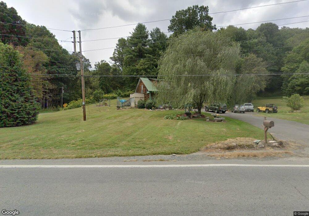
7411 Nc Highway 194 N Lansing, NC 28643
Estimated Value: $142,136 - $278,000
--
Bed
--
Bath
1,534
Sq Ft
$134/Sq Ft
Est. Value
About This Home
This home is located at 7411 Nc Highway 194 N, Lansing, NC 28643 and is currently estimated at $205,784, approximately $134 per square foot. 7411 Nc Highway 194 N is a home with nearby schools including Ashe County High School.
Ownership History
Date
Name
Owned For
Owner Type
Purchase Details
Closed on
Feb 13, 2015
Sold by
Younger Allyn Dale
Bought by
Howell Kristin D
Current Estimated Value
Purchase Details
Closed on
Dec 14, 2007
Sold by
Miller E Sue and The Estate Of Hattie Rosetta C
Bought by
Howell Kristin Deanna and Younger Allyn Dale
Home Financials for this Owner
Home Financials are based on the most recent Mortgage that was taken out on this home.
Original Mortgage
$64,000
Interest Rate
6.22%
Mortgage Type
New Conventional
Create a Home Valuation Report for This Property
The Home Valuation Report is an in-depth analysis detailing your home's value as well as a comparison with similar homes in the area
Home Values in the Area
Average Home Value in this Area
Purchase History
| Date | Buyer | Sale Price | Title Company |
|---|---|---|---|
| Howell Kristin D | -- | None Available | |
| Howell Kristin Deanna | $80,000 | -- |
Source: Public Records
Mortgage History
| Date | Status | Borrower | Loan Amount |
|---|---|---|---|
| Previous Owner | Howell Kristin Deanna | $64,000 |
Source: Public Records
Tax History Compared to Growth
Tax History
| Year | Tax Paid | Tax Assessment Tax Assessment Total Assessment is a certain percentage of the fair market value that is determined by local assessors to be the total taxable value of land and additions on the property. | Land | Improvement |
|---|---|---|---|---|
| 2025 | $564 | $96,600 | $9,700 | $86,900 |
| 2024 | $545 | $96,600 | $9,700 | $86,900 |
| 2023 | $545 | $96,600 | $9,700 | $86,900 |
| 2022 | $540 | $61,900 | $10,000 | $51,900 |
| 2021 | $515 | $61,900 | $10,000 | $51,900 |
| 2020 | $474 | $61,900 | $10,000 | $51,900 |
| 2019 | $464 | $61,900 | $10,000 | $51,900 |
| 2018 | $446 | $63,700 | $10,000 | $53,700 |
| 2016 | $449 | $63,700 | $10,000 | $53,700 |
| 2015 | $435 | $63,700 | $10,000 | $53,700 |
| 2014 | $435 | $68,100 | $10,000 | $58,100 |
Source: Public Records
Map
Nearby Homes
- TBD Charlie King Rd
- 9.5 +/- Acres Charlie King Rd
- 410 River Dr
- 3500 Teaberry Rd
- 234 Pioneer Trails Rd SE
- 116 River Dr
- 253 Bobby Rash Rd
- Lot 30 River Rock Way
- 972 W Deep Ford Rd
- 237 A St
- TBD N Carolina 194
- 18103 N Carolina 194
- 9211 N Carolina 194
- 2507 Parker Eller Rd
- 0 Sugar Tree Rd
- TBD Long Branch Rd
- tbd Teaberry Rd
- 2013 Deep Ford Rd
- 174 Bass Pond Rd
- 979 Wagon Rd Unit 6-8
- 7421 Nc Highway 194 N
- 7329 Nc Hwy 194 N
- 7327 Nc Highway 194 N
- 196 Pounding Mill Rd
- 271 Pounding Mill Rd
- 7597 Nc Highway 194 N
- 7637 Nc Highway 194 N
- 7602 Nc Highway 194 N
- 120 Twin Bridges Cir
- 7653 Nc Highway 194 N
- 7607 Nc Highway 194 N
- 7651 Nc Highway 194 N
- 7712 Nc Highway 194 N
- 766 Denny Hollow Rd
- Tba Charlie King Rd
- 7736 Nc Hwy 194 N
- 7723 Nc Highway 194 N
- 7744 Nc Highway 194 N
- 459 Pounding Mill Rd
- 603 Charlie King Rd